Clarinbridge
Appearance
This article needs additional citations for verification. (June 2020) |
Clarinbridge
Droichead an Chláirín | |
|---|---|
Town | |
 | |
| Coordinates: 53°13′46″N 8°52′42″W / 53.2295°N 8.8782°W | |
| Country | Ireland |
| Province | Connacht |
| County | County Galway |
| Elevation | 5 m (16 ft) |
| Population (2016)[1] | 384 |
| Time zone | UTC+0 (WET) |
| • Summer (DST) | UTC-1 (IST (WEST)) |
| Irish Grid Reference | M409203 |
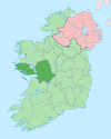
Clarinbridge (Irish: Droichead an Chláirín, meaning 'Small Board Bridge') is a small village, approximately 15 minutes drive south of Galway, Ireland in the Diocese of Kilmacduagh. It is on the mouth of the Clarin River at the end of Dunbulcaun Bay, which is the easternmost part of Galway Bay.
Notable people
- Alexander Young, recipient of the Victoria Cross
References
- ^ "Sapmap Area - Settlements - Clarinbridge". Census 2016. Central Statistics Office. April 2016. Retrieved 21 December 2019.
External links


