Minamiashigara, Kanagawa
Minamiashigara
南足柄市 | |
|---|---|
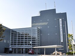
 Minamiashigara City Hall | |
 Location of Minamiashigara in Kanagawa Prefecture | |
| Coordinates: 35°19′N 139°06′E / 35.317°N 139.100°E | |
| Country | Japan |
| Region | Kantō |
| Prefecture | Kanagawa Prefecture |
| Area | |
• Total | 77.12 km2 (29.78 sq mi) |
| Population (April 1, 2017) | |
• Total | 42,641 |
| • Density | 550/km2 (1,400/sq mi) |
| Time zone | UTC+9 (Japan Standard Time) |
| - Tree | Camellia sasanqua |
| - Flower | Japanese gentian |
| Address | Sekimoto 440-banchi, Minamiashigara-shi, Kanagawa-ken 250-0192 |
| Website | http://www.city.minamiashigara.kanagawa.jp/ |
Minamiashigara (南足柄市, Minamiashigara-shi) is a city located in Kanagawa Prefecture, Japan.
As of April 1, 2017, the city has an estimated population of 42,641, and population density of 550 persons per km².[1] The total area is 77.12 km².[2]
Geography
Minamiashigara is located in the mountainous west of Kanagawa Prefecture, with most of the city located within either the Tanzawa-Ōyama Quasi-National Park or the Fuji-Hakone-Izu National Park.
Surrounding Municipalities
Kanagawa Prefecture
Shizuoka Prefecture
History
The area that is now known as Minamiashigara was under control of the later Hōjō clan in the Sengoku period, and part of Odawara Domain during the Edo period.
After the Meiji Restoration, cadastral reforms created Minamiashigara, Fukusawa, Okamoto and Kitaashigara villages within Ashigarakami District, Kanagawa Prefecture. The development of the area was spurred by the opening of the Oyama Mountain Railway (present-day Izuhakone Railway Daiyūzan Line) on October 15, 1925. Minamiashigara was elevated in status to that of a town on April 1, 1940, and annexed neighboring Fukusawa, Okamoto and Kitaashigara villages in 1955. It was elevated to city status on April 1, 1972.
Economy
The economy of Minamiashigara is based on forestry and agriculture (primarily green tea and mikan). Fujifilm and Asahi Breweries have factories in Minamiashigara to make use of its abundant fresh water.
Transportation
Railway
- Izuhakone Railway - Daiyūzan Line
- (Odawara) - Sagami-Numata - Iwahara - Tsukahara - Wadagahara - Fujifilm-Mae - Daiyūzan
Bus
- Hakone Tozan Bus
- (Shin-Matsuda Station) - Sekimoto (Daiyūzan Station) - Jizodo
Road
- Kanagawa Prefectural Route 74
- from Odawara
- Kanagawa Prefectural Route 78
- from Ōi-Matsuda Interchange on the Tōmei Expressway
Sister City relations
 - Tilburg, Netherlands, since June 4, 1989.
Local attractions
- Saijoji Temple, many temples and shrines located in an old growth cedar forest.
- Maruta no Mori: a park with hiking trails and camp grounds.
- Niju Isseki no Mori (21st Century Forest), a park with hiking trails throughout.
- Yuhi no Taki (Fall), located in Jizodo.
- Ashigara Pass
Noted people from Minamiashigara
- Rina Uchiyama - actress
References
- ^ "Statistics of Minamiashigara City" (in Japanese). Japan: Minamiashigara City. Archived from the original on 21 July 2017. Retrieved 6 May 2017.
- ^ "Profile of Minamiashigara City" (in Japanese). Japan: Minamiashigara City. Retrieved 6 May 2017.
External links
- Official Website (in Japanese)


