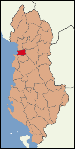
Kurbin District
Appearance
Kurbin District
Rrethi i Kurbinit | |
|---|---|
 | |
| Coordinates: 41°37′N 19°42′E / 41.617°N 19.700°E | |
| Country | |
| Dissolved | 2000 |
| Seat | Laç |
| Area | |
• Total | 235 km2 (91 sq mi) |
| Population (2001) | |
• Total | 54,519 |
| • Density | 230/km2 (600/sq mi) |
| Time zone | UTC+1 (CET) |
| • Summer (DST) | UTC+2 (CEST) |
Kurbin District (Template:Lang-sq) was one of the thirty-six districts of Albania (which were dissolved in 2000). It had a population of 54,519 in 2001, and an area of 235 km².[1] It is in the west of the country, and its capital was Laç. Its territory is now part of Lezhë County, and is coterminous with the present municipality of Kurbin.
Administrative divisions
The district consisted of the following municipalities:[2]
Note: - urban municipalities in bold
References
- ^ Districts of Albania, statoids.com
- ^ "Portraits of poverty and inequality in Albania" (PDF). World Bank Group. 2016. pp. 33–40.
