Qaarsut
Appearance
Qaarsut | |
|---|---|
 Aerial panorama of Qaarsut | |
| Coordinates: 70°43′55″N 52°38′15″W / 70.73194°N 52.63750°W | |
| State | |
| Constituent country | |
| Municipality | |
| Government | |
| • Mayor | Ole Dorph |
| Population (2020) | |
| • Total | 174 |
| Time zone | UTC-03 |
| Postal code | 3964 Qaarsut |
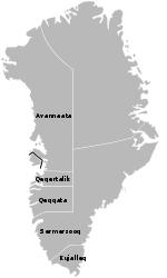
Qaarsut (old spelling: Kaersut) is a settlement in the Avannaata municipality, in northwestern Greenland. It is situated on the northeastern shore of the Nuussuaq Peninsula. It had 174 inhabitants in 2020.[2]
History

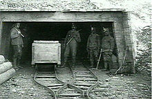
The first coal mine in Greenland operated between 1778 and 1924 in Qaarsuarsuit.
Transport
Qaarsut Airport, located to the northwest of the settlement, serves both Qaarsut and Uummannaq, the latter accessible only by helicopter.
Population
The population of Qaarsut has dropped by over 18 percent relative to the 2000 levels, reflecting a general trend in the region.[3]
Photos
-
Qaarsut's chapel
-
Qaarsut and Uummannaq's mountain in the background
-
Overview of Qaarsut
-
Colourful houses
-
School
-
Qaarsut at midnight sun
References
Wikimedia Commons has media related to Qaarsut.
- ^ Kalaallit Nunaata Radioa (Greenlandic Broadcasting Corporation) (in Danish)
- ^ "Population by Localities". Statistical Greenland.
- ^ a b Statistics Greenland Archived July 21, 2011, at the Wayback Machine


