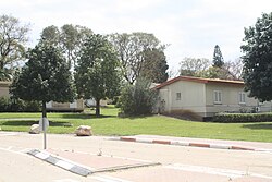
Lehavot Haviva
Appearance
Lehavot Haviva
לְהֲבוֹת חֲבִיבָה | |
|---|---|
 | |
| Etymology: Haviva's Flames | |
| Coordinates: 32°23′37″N 35°0′36″E / 32.39361°N 35.01000°E | |
| Country | Israel |
| District | Haifa |
| Council | Menashe |
| Affiliation | Kibbutz Movement |
| Founded | 1949 |
| Founded by | Czechoslovakian Hashomer Hatzair members |
| Population (2022)[1] | 1,061 |
| Website | lehavot-haviva.org.il |
Lehavot Haviva (Template:Lang-he, lit. Haviva's Flames) is a kibbutz in northern Israel. Located in the eastern Sharon plain near the Green Line, it falls under the jurisdiction of Menashe Regional Council. In 2022 it had a population of 1,061.[1]
History
The village was established in 1949 by Hashomer Hatzair, who had immigrated from Czechoslovakia, and was named after Haviva Reik. In 1951, it moved three kilometres east to its present location onto land that had belonged to the depopulated Palestinian Arab village of al-Jalama.[2] Sde Yitzhak was founded on the former site the following year.
References
- ^ a b "Regional Statistics". Israel Central Bureau of Statistics. Retrieved 21 March 2024.
- ^ Khalidi, Walid (1992). All That Remains: The Palestinian Villages Occupied and Depopulated by Israel in 1948. Washington D.C.: Institute for Palestine Studies. p. 554. ISBN 0-88728-224-5.
External links
- Official website (in Hebrew)

