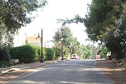
Gizo, Israel
Appearance
Gizo
גיזו جيزو | |
|---|---|
 | |
| Coordinates: 31°48′15″N 34°56′17″E / 31.80417°N 34.93806°E | |
| Country | Israel |
| District | Jerusalem |
| Council | Mateh Yehuda |
| Founded | 1960 |
| Founded by | Jewish Agency |
| Population (2022)[1] | 207 |
Gizo (Hebrew: גִּיזוֹ) is a community settlement in central Israel, northwest of Beit Shemesh, under the jurisdiction of the Mateh Yehuda Regional Council. In 2022 it had a population of 207.[1]
History
The village was established in 1960 by the Jewish Agency as a place of residence for teachers of the Gizo Regional Council school, and was named after the nearby biblical city of Gizo (1 Chronicles 11:34).[2] It is on the former site of the depopulated Palestinian village of Bayt Jiz,[3] whose name also possibly referred to Gizo.[2]
References
- ^ a b "Regional Statistics". Israel Central Bureau of Statistics. Retrieved 21 March 2024.
- ^ a b Yoav Regev (2001) New Israel Guide, Vol. 10: The Shephelah, Keter, Yedioth Ahronoth and the Ministry of Defense
- ^ Khalidi, Walid (1992). All That Remains:The Palestinian Villages Occupied and Depopulated by Israel in 1948. Washington D.C.: Institute for Palestine Studies. p. 365. ISBN 0-88728-224-5.

