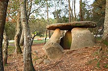
Dolmen de Axeitos


Dolmen de Axeitos is a prehistoric megalithic dolmen just to the northwest of the village Axeitos, in the parish of Oleiros, in the municipality of Ribeira, on the Barbanza Peninsula in the estuary of the Ría de Arousa in the Province of A Coruña, Galicia, in northern Spain. It is dated to 3600-4000 BC. Because of its historical and archaeological value, on March 11, 1978 it became a registered Bien de Interés Cultural landmark.
