
Karuvanthuruthy
This article needs additional citations for verification. (May 2018) |
Karuvanthuruthy | |
|---|---|
city | |
 Karuvanthuruthy Kadavu | |
 Karuvanthuruthy Location in Kerala, India  Karuvanthuruthy Karuvanthuruthy (India) | |
| Coordinates: 11°19′59″N 75°49′00″E / 11.33317°N 75.8166°E | |
| Country | |
| State | Kerala |
| District | Kozhikode |
| Population (2001) | |
| • Total | 20,767 |
| Languages | |
| • Official | Malayalam, English |
| Time zone | UTC+5:30 (IST) |
Karuvanthuruthy is a census town in Kozhikode district in the Indian state of Kerala.
Location
Karuvanthuruthy is located on the western side of Feroke railway station. The underbridge from Feroke town goes to Karuvanthuruthy town and the Karuvanthuruthy bridge connects the town to Chaliyam beach and seawalk.
Demographics
As of 2001[update] India census,[1] Karuvanthuruthy had a population of 20,767. Males constitute 49% of the population and females 51%. Karuvanthuruthy has an average literacy rate of 81%, higher than the national average of 59.5%: male literacy is 84%, and female literacy is 79%. In Karuvanthuruthy, 12% of the population is under 6 years of age.
Landmarks
- Pallithara Temple, Karuvanthuruthy
- Kadavu Masjidh, Karuvanthuruthy
- Karuvanthuruthy Bridge
- Kadavu Jetty, Karuvanthuruthy
- Bafaki Thangal School, Karuvanthuruthy
See also
Image Gallery
-
 Bafaki Thangal School
 -
 Kadavath Masjidh
 -
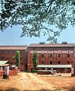 Commonwealth factory


References
- ^ "Census of India 2001: Data from the 2001 Census, including cities, villages and towns (Provisional)". Census Commission of India. Archived from the original on 16 June 2004. Retrieved 1 November 2008.
This article related to a location in Kozhikode district, Kerala, India is a stub. You can help Wikipedia by expanding it. |