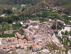
Sot de Chera
Sot de Chera | |
|---|---|
 | |
| Coordinates: 39°37′18″N 0°54′43″W / 39.62167°N 0.91194°W | |
| Country | |
| Autonomous community | |
| Province | Valencia |
| Comarca | Los Serranos |
| Judicial district | Liria |
| Government | |
| • Alcalde | José Rafael Rodrigo Boronat |
| Area | |
| • Total | 38.8 km2 (15.0 sq mi) |
| Elevation | 240 m (790 ft) |
| Population (2018)[1] | |
| • Total | 352 |
| • Density | 9.1/km2 (23/sq mi) |
| Demonym | Sotero/a |
| Time zone | UTC+1 (CET) |
| • Summer (DST) | UTC+2 (CEST) |
| Postal code | 46168 |
| Official language(s) | Spanish |
| Website | Official website |
Sot de Chera is a municipality in the comarca of Los Serranos in the Valencian Community, Spain.
- ^ Municipal Register of Spain 2018. National Statistics Institute.


