
Arnett, Oklahoma
Arnett, Oklahoma | |
|---|---|
 Location of Arnett, Oklahoma | |
| Country | United States |
| State | Oklahoma |
| County | Ellis |
| Area | |
| • Total | 0.4 sq mi (1.1 km2) |
| • Land | 0.4 sq mi (1.1 km2) |
| • Water | 0.0 sq mi (0.0 km2) |
| Elevation | 2,448 ft (746 m) |
| Population (2000) | |
| • Total | 520 |
| • Density | 1,233.1/sq mi (476.1/km2) |
| Time zone | UTC-6 (Central (CST)) |
| • Summer (DST) | UTC-5 (CDT) |
| ZIP code | 73832 |
| Area code | 580 |
| FIPS code | 40-02800 Template:GR |
| GNIS feature ID | 1089707 Template:GR |
Arnett is a town in Ellis County, Oklahoma, United States. The population was 520 at the 2000 census. It is the county seat of Ellis County.Template:GR
History
The townsite came about at the junction of local trading routes. A post office was established at the townsite in 1902, with William G. Brown as the postmaster. Brown is said to have named the post office Arnett after A. S. Arnett, Brown's minister from Fayetteville, West Virginia.[1][2][3]
Geography
Arnett is located at 36°8′4″N 99°46′15″W / 36.13444°N 99.77083°WInvalid arguments have been passed to the {{#coordinates:}} function (36.134368, -99.770826).Template:GR
According to the United States Census Bureau, the town has a total area of 0.4 square miles (1.1 km²), all of it land.
Demographics
As of the census of 2000,Template:GR there were 520 people, 238 households, and 140 families residing in the town. The population density was 1,233.1 people per square mile (478.0/km²). There were 281 housing units at an average density of 666.4/sq mi (258.3/km²). The racial makeup of the town was 96.35% White, 0.38% African American, 0.96% Native American, 1.15% from other races, and 1.15% from two or more races. Hispanic or Latino of any race were 1.35% of the population.
There were 238 households out of which 23.1% had children under the age of 18 living with them, 51.3% were married couples living together, 5.9% had a female householder with no husband present, and 40.8% were non-families. 39.1% of all households were made up of individuals and 19.3% had someone living alone who was 65 years of age or older. The average household size was 2.13 and the average family size was 2.81.
In the town the population was spread out with 21.3% under the age of 18, 6.3% from 18 to 24, 23.3% from 25 to 44, 25.8% from 45 to 64, and 23.3% who were 65 years of age or older. The median age was 44 years. For every 100 females there were 97.0 males. For every 100 females age 18 and over, there were 94.8 males.
The median income for a household in the town was $26,618, and the median income for a family was $29,861. Males had a median income of $24,250 versus $13,438 for females. The per capita income for the town was $14,512. About 12.8% of families and 18.9% of the population were below the poverty line, including 27.4% of those under age 18 and 20.0% of those age 65 or over.
References
- ^ "Ellis County" Towns. - USGenNet
- ^ Arnett. - Encyclopedia of Oklahoma History and Culture. - Oklahoma Historical Society
- ^ Shirk, George H., (1987). - Oklahoma Place Names. - Norman: University of Oklahoma Press. - p.12. - ISBN 9780806120287
External links
Municipalities and communities of Ellis County, Oklahoma, United States | ||
|---|---|---|
| Towns | 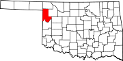 | |
| Unincorporated communities | ||
| Ghost town | ||