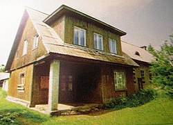
Aruküla
Appearance
You can help expand this article with text translated from the corresponding article in Estonian. (July 2010) Click [show] for important translation instructions.
|
Aruküla | |
|---|---|
 Aruküla old culture centre | |
| Coordinates: 59°21′55″N 25°04′48″E / 59.36528°N 25.08000°E | |
| Country | |
| County | |
| Municipality | |
| First appeared on map | 1291 |
| Area | |
| • Total | 3.56 km2 (1.37 sq mi) |
| Population (01.01.2020[1]) | |
| • Total | 2,113 |
| • Density | 590/km2 (1,500/sq mi) |
| Time zone | UTC+2 (EET) |
| • Summer (DST) | UTC+3 (EEST) |
Aruküla is a small borough (Estonian: alevik) in Harju County, northern Estonia. It is the administrative centre of Raasiku Parish. Aruküla had a population of 2,113 on 1 January 2020.[1] Aruküla has a station on the Elron's eastern route.
Gallery
[edit]-
Aruküla old culture house
-
Aruküla song festival grounds in the 1960s.
-
Aruküla glacial erratic
-
Former centre of Aruküla kolkhoz.
-
View to Aruküla
-
Aruküla song court
-
Stone, indicating Aruküla first mention
See also
[edit]References
[edit]- ^ a b "Raasiku vallast" (in Estonian). Raasiku vald. Retrieved 24 January 2013.
External links
[edit]Wikivoyage has a travel guide for Aruküla.
- Raasiku Parish (in Estonian)
- Aruküla Basic School (in Estonian)
- Aruküla Cultural company (in Estonian)
- Aruküla SK Handball Club (in Estonian)


