Exuma International Airport
Exuma International Airport | |||||||||||
|---|---|---|---|---|---|---|---|---|---|---|---|
| Summary | |||||||||||
| Airport type | Public | ||||||||||
| Serves | Great Exuma, Bahamas | ||||||||||
| Location | Moss Town | ||||||||||
| Elevation AMSL | 9 ft / 3 m | ||||||||||
| Coordinates | 23°33′48″N 075°52′23″W / 23.56333°N 75.87306°W | ||||||||||
| Map | |||||||||||
| Runways | |||||||||||
| |||||||||||
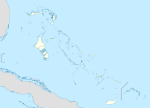
Exuma International Airport (IATA: GGT, ICAO: MYEF) is a public airport serving the island of Great Exuma in the Bahamas. It is located near Moss Town, northwest of George Town. The airport services mainly light aircraft and regional jets from the United States and The Bahamas.
Facilities
The airport resides at an elevation of 9 ft (2.7 m) above mean sea level. It has one runway designated 12/30 with an asphalt surface measuring 2,149 m × 46 m (7,051 ft × 151 ft).[1]
Airlines and destinations
Passenger
| Airlines | Destinations |
|---|---|
| Air Canada | Seasonal: Toronto–Pearson |
| American Eagle | Miami |
| Bahamasair | Nassau |
| IBC Airways | Cap–Haitien |
| Delta Air Lines | Atlanta |
| Delta Connection | Atlanta |
| Silver Airways | Seasonal: Fort Lauderdale |
| SkyBahamas Airlines | Nassau |
See also
- George Town Airport (ICAO: MYEG), located near George Town.
References
- ^ a b Template:WAD
- ^ Airport information for GGT at Great Circle Mapper. Source: DAFIF (effective October 2006).
External links

