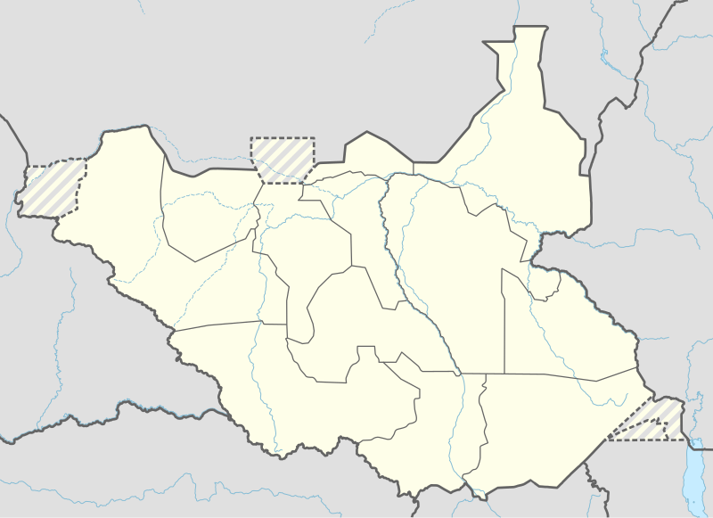
File:South Sudan adm location map.svg
Appearance

Size of this PNG preview of this SVG file: 800 × 581 pixels. Other resolutions: 320 × 232 pixels | 640 × 465 pixels | 1,024 × 743 pixels | 1,280 × 929 pixels | 2,560 × 1,858 pixels | 1,561 × 1,133 pixels.
Original file (SVG file, nominally 1,561 × 1,133 pixels, file size: 201 KB)
File history
Click on a date/time to view the file as it appeared at that time.
| Date/Time | Thumbnail | Dimensions | User | Comment | |
|---|---|---|---|---|---|
| current | 18:25, 23 April 2020 |  | 1,561 × 1,133 (201 KB) | Leviavery | Added Pibor and Ruweng Administrative Areas |
| 16:16, 25 February 2020 |  | 1,561 × 1,133 (199 KB) | Myrabert01 | Reverted to version as of 13:47, 25 February 2020 (UTC) South Sudan revert back to 10 States. https://www.aljazeera.com/news/2020/02/6-years-war-peace-finally-south-sudan-200223114919537.html | |
| 14:39, 25 February 2020 |  | 1,561 × 1,133 (213 KB) | NordNordWest | Reverted to version as of 14:39, 13 August 2016 (UTC); no reason for this revert | |
| 13:47, 25 February 2020 |  | 1,561 × 1,133 (199 KB) | Myrabert01 | Reverted to version as of 18:18, 12 November 2014 (UTC). South Sudan revert back to 10 States. | |
| 14:39, 13 August 2016 |  | 1,561 × 1,133 (213 KB) | NordNordWest | corr | |
| 12:31, 12 August 2016 |  | 1,561 × 1,133 (214 KB) | NordNordWest | upd, new states | |
| 18:18, 12 November 2014 |  | 1,561 × 1,133 (199 KB) | NordNordWest | == {{int:filedesc}} == {{Information |Description= {{de|1=Positionskarte von Südsudan}} {{en|1=Location map of South Sudan}} {{Location map series N |stretching=101 |top=12.7 |bottom=3.2 |left=23.15 |right=36.4 }} |Source={{Own using}} * United States... |
File usage
More than 100 pages use this file. The following list shows the first 100 pages that use this file only. A full list is available.
- 2009 Sobat River ambush
- Abyei (town)
- Acongeong
- Akobo, South Sudan
- Akobo Airport
- Akobo County
- Aweil, South Sudan
- Aweil Airport
- Bentiu
- Bentiu Airport
- Biem, South Sudan
- Bor, South Sudan
- Bor Airport (South Sudan)
- Budi County
- Chukudum
- Daga Post
- Deim Zubeir
- Dimo, South Sudan
- Doleib Hill
- Ezo, South Sudan
- Faddoi
- Gogrial
- Gogrial Airport
- Gondokoro
- Ikotos
- Ikotos County
- Juba
- Kajo Keji
- Kajo Keji Airstrip
- Kapoeta
- Kapoeta Airport
- Kapoeta East County
- Kapoeta North County
- Kapoeta South County
- Kaya, South Sudan
- Kiro
- Kodok
- Kuajok
- Lado, South Sudan
- Lafon, South Sudan
- Lafon County
- Leer, South Sudan
- Leer County
- Lolim
- Lopit people
- Loyoro, South Sudan
- Magwi
- Malakal
- Malakal Airport
- Malualkon
- Marial Bai
- Maridi
- Maridi Airport
- Nadapal
- Nanyangachor
- Narus, South Sudan
- Nasir, South Sudan
- Natinga
- Nimule
- Nimule Airport
- Nymlal
- Owiny Ki-Bul
- Palotaka
- Parjok
- Pibor
- Pibor Airport
- Pochalla
- Pochalla Airport
- Raga, South Sudan
- Raga Airport
- Ramciel
- Rejaf
- Renk, South Sudan
- Renk Airport
- Riwoto
- Rokon, South Sudan
- Rumbek
- Rumbek Airport
- Sudanese nomadic conflicts
- Terekeka
- Tirangore
- Tonj
- Tonj Airport
- Torit
- Torit Airport
- Torit County
- Tumbura
- Tumbura Airport
- Turalei
- Waat
- Warrap, South Sudan
- Wau, South Sudan
- Wau Airport
- Wernyol City
- Yambio
- Yambio Airport
- Yei Airport
- Yirol
- Yirol Airport
- Talk:Ramciel
View more links to this file.
Global file usage
The following other wikis use this file:
- Usage on ab.wikipedia.org
- Usage on af.wikipedia.org
- Usage on an.wikipedia.org
- Usage on ast.wikipedia.org
- Usage on av.wikipedia.org
- Usage on azb.wikipedia.org
- Usage on az.wikipedia.org
- Usage on be.wikipedia.org
- Usage on bg.wikipedia.org
- Usage on bn.wikipedia.org
- Usage on bs.wikipedia.org
- Usage on ceb.wikipedia.org
View more global usage of this file.


