
Forrest City, Arkansas
Forrest City, Arkansas | |
|---|---|
 Location in St. Francis County and the state of Arkansas | |
| Country | United States |
| State | Arkansas |
| County | St. Francis |
| Government | |
| • Mayor | Gordon McCoy |
| Area | |
| • Total | 16.4 sq mi (42.2 km2) |
| • Land | 16.3 sq mi (42.1 km2) |
| • Water | 0.1 sq mi (0.1 km2) |
| Elevation | 253 ft (77 m) |
| Population (2000) | |
| • Total | 14,774 |
| • Density | 900.9/sq mi (350.1/km2) |
| Time zone | UTC-6 (Central (CST)) |
| • Summer (DST) | UTC-5 (CDT) |
| FIPS code | 05-24430 |
| GNIS feature ID | 0083152 |
Forrest City is a city in St. Francis County, Arkansas, United States. It was named as a result of General Nathan Bedford Forrest using the location as a campsite for a construction crew soon after the Civil War. The railroad construction crew was completing the railroad that connects Memphis, TN with Little Rock, AR. According to 2006 Census Bureau estimates, the population of the city is 14,078.[1] The city is the county seat of St. Francis CountyTemplate:GR.
Geography
Forrest City is located at 35°0′36″N 90°47′19″W / 35.01000°N 90.78861°WInvalid arguments have been passed to the {{#coordinates:}} function (35.010131, -90.788716)Template:GR.
According to the United States Census Bureau, the city has a total area of 16.3 square miles (42.2 km²), of which, 16.3 square miles (42.1 km²) of it is land and 0.1 square miles (0.2 km²) of it (0.37%) is water.
Demographics
As of the censusTemplate:GR of 2000, there were 14,774 people, 4,581 households, and 3,165 families residing in the city. The population density was 908.7 people per square mile (350.8/km²). There were 5,164 housing units at an average density of 317.6/sq mi (122.6/km²). The racial makeup of the city was 35.52% White, 60.93% Black or African American, 0.19% Native American, 0.74% Asian, 0.30% from other races, and 2.31% from two or more races. 8.26% of the population were Hispanic or Latino of any race.
There were 4,581 households out of which 37.5% had children under the age of 18 living with them, 37.2% were married couples living together, 28.0% had a female householder with no husband present, and 30.9% were non-families. 27.9% of all households were made up of individuals and 11.9% had someone living alone who was 65 years of age or older. The average household size was 2.65 and the average family size was 3.23.
In the city the population was spread out with 27.5% under the age of 18, 10.5% from 18 to 24, 32.3% from 25 to 44, 18.5% from 45 to 64, and 11.1% who were 65 years of age or older. The median age was 32 years. For every 100 females there were 116.1 males. For every 100 females age 18 and over, there were 121.6 males.
The median income for a household in the city was $23,111, and the median income for a family was $27,432. Males had a median income of $29,313 versus $21,295 for females. The per capita income for the city was $11,716. About 29.0% of families and 33.4% of the population were below the poverty line, including 45.9% of those under age 18 and 22.3% of those age 65 or over.
Heritage
Nathan Bedford Forrest, famous Confederate general, became interested in the area around Crowley's Ridge during the American Civil War. After the war, he contracted with railroad companies in Memphis and Little Rock to cut through the rough ridge and succeeded in linking the two cities by rail. The first trains came through in 1868.
General Forrest later built a commissary located on Front St. and Colonel V.B. Izard began the task of designing the town. Most citizens were calling the area "Forrest's Town," thus the evolution of the name Forrest City.
General Forrest's camp was incorporated May 11, 1870.
On October 13, 1827, St. Francis County was officially recognized by the Arkansas Territorial Legislature in Little Rock. It is located in the east central part of Arkansas. Although the county seat was the now defunct town of Franklin, later moved to the once thriving St. Francis River town. The county seat was permanently moved to Forrest City in 1874.
Forrest City History
The Forrest City Chamber of Commerce is located in the 100-year-old Becker House. This house has served a variety of functions since being sold by the Becker family. It has been an antique store and later a home furnishings boutique before being occupied by the Chamber.
Forrest City is located on Crowley's Ridge, a geological phenomenon that rises above the flat delta terrain that surrounds it. This north-south running highland is some three miles wide and 300 feet above sea level. Several species of trees not indigenous to Arkansas are found here, including Beech, Butternut, Sugar Maple, and Cucumber tree trees.
Forrest City is the county seat of St. Francis County,Arkansas, which was officially recognized and approved by the Arkansas legislature on May 11, 1876.
Proof that giant mastodons roamed the slope was revealed in 1949 when workmen excavating for sewer improvements found fossils of the massive beasts within the city-limits of Forrest City.
Famous Forrest Citians
- Al Green, singer and minister
- John W. Henry, principal owner of Boston Red Sox
- Don Kessinger, born in Forest City, major league baseball player[2]
- Charlie Rich see Colt, Arkansas
- Cal Slayton, comic book artist
- Dennis Winston, NFL player
- Lawrence E. Rea Jr., Lieutenant Colonel, United States Air Force
- Andre Jackson, Actor
Marcus Britt ( Arkansas Razorbacks)
Frank Fowler (UnderGround Music LeGend) Ryan Hawkins (Leader Of Group SMFC)
External links
- History of Forrest City's Jewish community (from the Institute of Southern Jewish Life)
- Forrest City, Arkansas
Municipalities and communities of St. Francis County, Arkansas, United States | ||
|---|---|---|
| Cities | 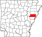 | |
| Towns | ||
| CDP | ||
| Other unincorporated communities | ||
| Footnotes | ‡This populated place also has portions in an adjacent county or counties | |
- ^ "Annual Estimates of the Population for All Incorporated Places in Arkansas" (CSV). 2005 Population Estimates. U.S. Census Bureau, Population Division. June 21 2006.
{{cite web}}: Check date values in:|year=(help); Unknown parameter|accessmonthday=ignored (help); Unknown parameter|accessyear=ignored (|access-date=suggested) (help)CS1 maint: year (link) - ^ Reichler, Joseph L., ed. (1979) [1969]. The Baseball Encyclopedia (4th edition ed.). New York: Macmillan Publishing. ISBN 0-02-578970-8.
{{cite book}}:|edition=has extra text (help)