Herne Hill, Victoria
Appearance
| Herne Hill Geelong, Victoria | |||||||||||||||
|---|---|---|---|---|---|---|---|---|---|---|---|---|---|---|---|
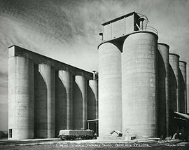
 Cement storage silos | |||||||||||||||
| Coordinates | 38°07′58″S 144°19′50″E / 38.1329°S 144.3305°E | ||||||||||||||
| Population | 3,413 (2016 census)[1] | ||||||||||||||
| Postcode(s) | 3218 | ||||||||||||||
| LGA(s) | City of Greater Geelong | ||||||||||||||
| State electorate(s) | Geelong | ||||||||||||||
| Federal division(s) | Corio | ||||||||||||||
| |||||||||||||||
Herne Hill is a residential suburb of Geelong, Victoria, Australia. It is in the federal Division of Corio, and its postcode is 3218.
References
- ^ Australian Bureau of Statistics (27 June 2017). "Herne Hill (State Suburb)". 2016 Census QuickStats. Retrieved 16 November 2017.


