Interstate 490 (Ohio)
| Troy Lee James Highway | |||||||
 | |||||||
| Route information | |||||||
| Maintained by ODOT | |||||||
| Length | 2.43 mi[1] (3.91 km) | ||||||
| Existed | Designated on November 10, 1973[citation needed] Completed on September 12, 1990[2]–present | ||||||
| NHS | Entire route | ||||||
| Major junctions | |||||||
| West end | |||||||
| East end | East 55th Street, Bower Avenue in Cleveland | ||||||
| Location | |||||||
| Country | United States | ||||||
| State | Ohio | ||||||
| Highway system | |||||||
| |||||||
| |||||||
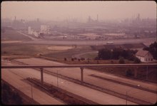
Interstate 490 (I-490) is a 2.43-mile (3.91 km) Interstate Highway in Cleveland, Ohio. The western terminus is a junction with I-90 and I-71 on Cleveland's west side. After spanning the Cuyahoga River, I-490 reaches its eastern terminus at a junction with East 55th Street, just east of I-77.
History

The original plans of the Cleveland and other city and federal highway authorities called for the highway – also known as the Clark Freeway[3] and, at various times and in various sections, as Interstate 80N[4] and Interstate 290 – to bisect the east side of the city and the eastern suburbs; the I-290 designation would then have continued north along I-271.[5] I-71 was to have continued along the Innerbelt to Dead Man's Curve, while I-290 was to have used the portion of present I-90 westward to the Parma Freeway near West 65th Street.[4] Freeway revolts in the late 1960s prevented the Clark Freeway east of East 55th Street and the Parma Freeway from being built; specifically, a referendum in Shaker Heights barred the city from allowing the Clark Freeway to pass through the city and its Shaker Lakes.[6][7] The Interstate 490 designation was applied to the Clark Freeway's altered proposed path in 1973,[8] but this alignment was also not built east of East 55th Street. Ultimately I-90 was realigned to follow the Clark Freeway routing west of I-71 and the Innerbelt, and the middle segment of the Clark Freeway between I-71 and I-77 opened in 1990.[2] The Opportunity Corridor expressway is being constructed to follow the path of the cancelled portion of I-490/Clark Freeway eastward from the end of the completed portion until it veers north toward the University Circle neighborhood.
In 2003, I-490 was dedicated to Troy Lee James, former member of the Ohio House of Representatives.[9]
In April 2011, the ramps between I-77 and I-90 to the west were removed, making I-490 the official route between those highways and between I-77 and I-71.[10]

Exit list
This section is missing mileposts for junctions. |
The entire route is in Cleveland, Cuyahoga County.
| mi[11] | km | Exit | Destinations | Notes | ||
|---|---|---|---|---|---|---|
| 0.00 | 0.00 | — | Western terminus; I-90 exit 170C | |||
| 0.06 | 0.097 | 1A | Westbound exit and eastbound entrance; I-71 exit 247B | |||
| 0.92 | 1.48 | 1B | West 7th Street / Houston Avenue | Westbound exit and eastbound entrance | ||
| 1.65 | 2.66 | 2A | Eastbound exit and westbound entrance | |||
| 1.72 | 2.77 | — | Exit 161 on I-77; proposed rerouting of SR 10[12] | |||
| 2.43 | 3.91 | — | To East 55th Street (unnamed street) | Eastern terminus at an at-grade intersection | ||
| — | Road continues east as SR 10[12] | |||||
1.000 mi = 1.609 km; 1.000 km = 0.621 mi
| ||||||
References
- ^ "Route Log and Finder List - Interstate System: Table 2". FHWA. Retrieved 2007-09-24.
- ^ a b Thoma, Pauline (1990-09-12). "Ceremony gets I-490 on road; Long-awaited bridge opens for business". The Plain Dealer. Retrieved 2008-02-25.
{{cite news}}: Cite has empty unknown parameter:|coauthors=(help) - ^ Cuyahoga County, Ohio (August 1966). "Route Location Studies: Clark Freeway, East 55th Street to Outer Belt East Freeway (Report Number 8)". Howard, Needles, Tammen & Bergendoff. Retrieved 2016-03-25.
- ^ a b Ohio Department of Highways. "1957-1958 Biennial Report excerpt". Retrieved 2007-09-24.
- ^ Example: Map of Ohio Showing State Highway System (MrSID) (Map). Cartography by ODOH. Ohio Department of Highways. 1964. Retrieved 2014-07-12.
- ^ O'Malley, Michael (2006-09-25). "Women saved Shaker Lakes from freeways". The Plain Dealer.
{{cite news}}: Cite has empty unknown parameter:|coauthors=(help) - ^ Cleveland Heights Historical Society. "Feature Stories: When Bad Ideas Happen to Good Suburbs: The Clark, Lee and Heights Freeways". Retrieved 2008-02-26.
- ^ U.S. Route Numbering Subcommittee (November 10, 1973). "U.S. Route Numbering Subcommittee Agenda Showing Action Taken by the Executive Committee" (PDF) (Report). Washington, DC: American Association of State Highway and Transportation Officials. p. 1. Retrieved 2014-08-04 – via Wikisource.
- ^ "§5516.05: Troy Lee James highway". Ohio Revised Code. 2003-03-19. Retrieved 2013-08-01.
- ^ "Two Interstate 77/90 Ramps to Close Permanently as Part of Innerbelt Work" (press release). Ohio Department of Transportation District 12, 2011-04-05. Retrieved on 2011-07-19.
- ^ "State of Ohio - Department of Transportation - IR 490 Straight Line Diagram" (PDF). Ohio Department of Transportation. January 2003. Retrieved September 20, 2013.
- ^ a b "Opportunity Corridor Public Hearing" (PDF). City of Cleveland. 2013-10-01. Retrieved 2013-12-12.
Further reading
- Breckenridge, Tom (2010-09-18). "Homes, businesses in Cleveland neighborhoods would be leveled to make way for Opportunity Corridor". The Plain Dealer. Retrieved 2010-09-22.
{{cite news}}: Cite has empty unknown parameter:|coauthors=(help)
External links
- Opportunity Corridor project page (Ohio Department of Transportation)

