Island Barn Reservoir
| Island Barn Reservoir | |
|---|---|
 Sailing Club at Island Barn | |
| Location | Elmbridge, Surrey |
| Coordinates | 51°23′26″N 0°21′48″W / 51.39056°N 0.36333°W |
| Type | reservoir |
| Basin countries | United Kingdom |
| Surface area | 122 acres (0.49 km2) |
| Water volume | 4.5 Gl (0.99×10⁹ imp gal)* |
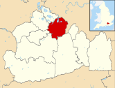
The Island Barn Reservoir lies south of the River Thames in England at West Molesey.[1] The reservoir is 122 acres (0.49 km2) large with a capacity of 992 million gallons and is managed by Thames Water. It is within the borough of Elmbridge and is surrounded by the River Mole to the west and the River Ember to the east. Queen Elizabeth II Reservoir is a larger reservoir to the West.
Island Barn Reservoir was authorized by the Lambeth Water Act of 1900. It was built by Sir Robert McAlpine[2] for the Metropolitan Water Board, and opened in 1911.[3]
Island Barn Reservoir Sailing Club hosts dinghy sailing races and training at the reservoir. Among many successful current and past members has been Fireball world champion and ISO designer John Caig.
The reservoir is a bird watching site[4] and Black-necked grebes have been sighted here.[5]
Gallery
-
Outlet towers at Island Barn Reservoir
-
Interior from the Sailing Club
See also
References
- ^ Island Barn Reservoir Sailing Club
- ^ "Opening Ceremony, 4 November 1911". Island Barn Reservoir Sailing Club. Retrieved 25 October 2016.
- ^ A Guide to the Industrial Archaeology of the Borough of Elmbridge
- ^ Surrey Bird Club Recent Sightings, including IB Reservoir
- ^ Thames Water official website - Birdwatching


