List of islands of the United States by area
Appearance

This is a list of islands of the United States, as ordered by area. It includes most islands with an area greater than 20 square miles (approximately 52 km2.) Mainland areas cut by man-made canals are not considered islands.
Islands over 250 square miles (650 km2)
| Rank | Island's Name | Area (sq mi) | Area (km2) | Location | Population (2000) |
|---|---|---|---|---|---|
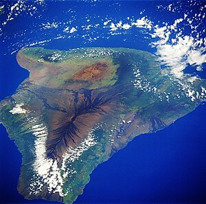
| 1 | Hawaiʻi (Big Island) | 4,028[1] | 10,433[1] | 148,677 | |
| 2 | Kodiak Island | 3,588[2] | 9,293[2] | 13,913[2] | |
| 3 | Puerto Rico | 3,515 | 9,104[3] | 3,808,610[3] | |
| 4 | Prince of Wales Island | 2,577 | 6,675[4][5] | 6,000 ≈ | |
| 5 | Chichagof Island | 2,080 | 5,388 | 1,342 | |
| 6 | St. Lawrence Island | 1,983 | 5,135 | 1,292 | |
| 7 | Admiralty Island | 1,684 | 4,362 | 650 | |
| 8 | Nunivak Island | 1,625 | 4,209 | 210 | |
| 9 | Unimak Island | 1,590 | 4,119 | 64 | |
| 10 | Baranof Island | 1,570 | 4,065[4] | 8,532 | |
| 11 | Long Island | 1,401[6] | 3,629[6] | 7,448,618[6] | |
| 12 | Revillagigedo Island | 1,145 | 2,965[5] | 13,950 | |
| 13 | Kupreanof Island | 1,086 | 2,813[5] | 785 | |
| 14 | Unalaska Island | 1,051 | 2,722 | 1,759 | |
| 15 | Nelson Island | 843 | 2,183 | 1,065 | |
| 16 | Kuiu Island | 758 | 1,962[5] | 10 | |
| 17 | Maui | 727[1] | 1,883[1] | 117,644 | |
| 18 | Afognak | 698 | 1,809 | 169 | |
| 19 | Umnak | 692 | 1,793 | 39 | |
| 20 | Oʻahu | 597[1] | 1,545[1] | 876,151 | |
| 21 | Kauaʻi | 552[1] | 1,430[1] | 58,303 | |
| 22 | Atka Island | 410 | 1,061 | 95 | |
| 23 | Attu Island | 346 | 896 | 20 | |
| 24 | Etolin Island | 336 | 870 | 15 | |
| 25 | Adak Island | 280 | 725 | 316 | |
| 26 | Montague Island | 279 | 722 | 0 | |
| 27 | Molokaʻi | 260[1] | 673[1] | 7,404 | |
| 28 | Dall Island | 253 | 655[4] | 20 |
Islands 250–75 square miles (647–194 km2)
This section of the list might not be complete, but covers almost all of the islands in the United States over 75 square miles (190 km2).
Islands under 75 square miles (190 km2)
This section of the list is not complete, although it should cover most of the islands in the United States over 20 square miles (52 km2).
References
- ^ a b c d e f g h i j k l m n o p
"Table 5.08 - Land Area of Islands: 2000" (Portable Document Format). The State of Hawaii Data Book 2004. State of Hawaii. 2004. Retrieved 2007-10-25.
{{cite web}}: External link in|work= - ^ a b c "Kodiak Island". Encyclopædia Britannica (Britannica Concise ed.). Encyclopædia Britannica, Inc. 2007. 9369330. Retrieved 2007-10-28.
- ^ a b c d "PUERTO RICO FACTS and HISTORY". The Office of the Government of the Commonwealth of Puerto Rico. Archived from the original on 2007-12-12. Retrieved 2007-10-28. Cite error: The named reference "TOOTGOTCOPR" was defined multiple times with different content (see the help page).
- ^ a b c d e
Carrara, Paul E.; Ager, Thomas A.; Baichtal, James F.; VanSistine, D. Paco (2003). "Miscellaneous Field Studies Map MF–2424" (Portable Document Format). Denver, Colorado: United States Geological Survey. Retrieved 2007-10-24.
{{cite journal}}:|contribution=ignored (help); Cite journal requires|journal=(help) - ^ a b c d e
Peacock, Elizabeth (2004-12-13). "Kuiu" (Portable Document Format). Reno, Nevada: Alaska Department of Fish and Game. Retrieved 2007-10-29.
{{cite journal}}:|contribution=ignored (help); Cite journal requires|journal=(help) - ^ a b c "Long Island". Encyclopædia Britannica (Britannica Concise ed.). Encyclopædia Britannica, Inc. 2007. 9370515. Retrieved 2007-10-29.
- ^
"Handbook of Texas Online". Padre Island. University of Texas. Retrieved 2007-11-12.
Padre Island comprises a total of 133,918 acres (541.95 km2) in Nueces, Kleberg, Willacy, Cameron, and Kenedy County, Texas.
{{cite web}}: External link in|work= - ^ a b
"Isle Royale National Park - Nature & Science". Isle Royale National Park. National Park Service. 2006-07-25. Retrieved 2007-10-29.
Isle Royale National Park preserves 132,018 acres (534.26 km2) of land-based wilderness
{{cite web}}: External link in|work= - ^ Drummond Island comprises the bulk of Drummond Township, Chippewa County, Michigan. According to the U.S. Census Bureau, the land area of Drummond Township is 334.3 km2, or 129.1 mi2, and its population was 992 in the year 2000. The township includes a number of apparently uninhabited smaller islands in Potagannissing Bay, and their estimated combined area is not more than four mi2.
- ^ a b c "Mount Desert Island". Encyclopædia Britannica. Encyclopædia Britannica, Inc. 2007. 9054016. Retrieved 2007-10-29.
- ^ a b "Channel Islands". Encyclopædia Britannica (Britannica Concise ed.). Encyclopædia Britannica, Inc. 2007. 9360314. Retrieved 2007-10-29.
- ^ a b c "Nantucket". Encyclopædia Britannica. Encyclopædia Britannica, Inc. 2007. 9054798. Retrieved 2007-10-29.
See also
