Milford, Queensland
Appearance
| Milford Queensland | |||||||||||||||
|---|---|---|---|---|---|---|---|---|---|---|---|---|---|---|---|
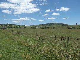
 Fields, 2016 | |||||||||||||||
| Coordinates | 28°01′S 152°43′E / 28.017°S 152.717°E | ||||||||||||||
| Population | 190 (SAL 2021)[1] | ||||||||||||||
| Postcode(s) | 4310 | ||||||||||||||
| LGA(s) | Scenic Rim Region | ||||||||||||||
| State electorate(s) | Scenic Rim | ||||||||||||||
| Federal division(s) | Blair | ||||||||||||||
| |||||||||||||||
Milford is a locality in the Scenic Rim Region of south-east Queensland, Australia.
Geography
The area is undeveloped with a low population. Rural residential properties predominate in mostly open fields and hilly paddocks with no major roads or geographical features. It is located south of Boonah and is included within the Boonah census data collection area as a gazetted locality.[2]
References
- ^ Australian Bureau of Statistics (28 June 2022). "Milford (suburb and locality)". Australian Census 2021 QuickStats. Retrieved 28 June 2022.
- ^ "Milford (Bounded locality)". Queensland Place Names. The State of Queensland. Retrieved 31 December 2016.
External links
![]() Media related to Milford, Queensland at Wikimedia Commons
Media related to Milford, Queensland at Wikimedia Commons

