Neudorf, Saskatchewan
Appearance
Neudorf, Saskatchewan | |
|---|---|
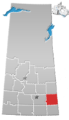
Location of Neudorf in Saskatchewan | |
| Coordinates: 50°42′35″N 103°00′51″W / 50.709722°N 103.014167°W | |
| Country | Canada |
| Province | Saskatchewan |
| Region | Southwest Saskatchewan |
| Rural Municipality | McLeod No. 185 |
| Post Office Established | July 1, 1895 |
| Postal code | S0A 2T0 |
| Area code | 306 |
| Highways | Highway 22 |
| Website | Village of Neudorf |
| [1] | |
Neudorf[2] is a village located in the south east corner of the Canadian province of Saskatchewan. Situated on Highway 22 east of Lemberg, and Abernethy, and west of Killaly.
The town was established prior to the arrival of the Canadian Pacific Railway; when it arrived the town was designated a divisional point, leading to a population boom.[3]
Statistics
Canada census – Neudorf, Saskatchewan community profile
| Population |
|---|
| Land area |
| Population density |
| Median age |
| Private dwellings |
| Median household income |
Notables
- Dick Assman - Petro-Canada employee, known for appearing on the Late Show with David Letterman
- Doreen Kimura - Professor Simon Fraser University, winner of the Kistler Prize
- Ed Litzenberger - NHL hockey player
- Brian Propp - NHL hockey player
- Percy Saltzman - First English-speaking Weatherman in Canada
- Jarret Stoll - NHL hockey player
- Henry Taube - Won the Nobel Prize in Chemistry
References
- ^ National Archives, Archivia Net, Post Offices and Postmasters, retrieved 2011-08-21
- ^ "Canadian Geographical Names Data Base Search - Eyre". Natural Resources Canada. Retrieved 2011-08-21.[permanent dead link]
- ^ "Our History". Village of Neudorf. Retrieved 2011-08-21.
- ^ "2006 Community Profiles". 2006 Canadian Census. Statistics Canada. August 20, 2019.
- ^ "2001 Community Profiles". 2001 Canadian Census. Statistics Canada. July 18, 2021.
External links
| North West: Melville | North: | North East: |
| West: Lemberg | Neudorf | East: Killaly |
| South West: Wolseley | South: Grenfell | South East: |


