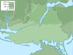
Oleksandrivka, Kherson Raion, Kherson Oblast
You can help expand this article with text translated from the corresponding article in Ukrainian. (April 2022) Click [show] for important translation instructions.
|
Oleksandrivka
| |
|---|---|
 The western edge of the village (foreground), the Dnieper–Bug estuary (left) and lake (center right) | |
| Coordinates: 46°36′54″N 32°6′41″E / 46.61500°N 32.11139°E | |
| Country | |
| Oblast | Kherson Oblast |
| Raion | Kherson Raion |
| Hromada | Stanislav rural hromada |
| Settlement | 1754 |
| Government | |
| • Head of town Council | Kamenetska Natalia Oleksandrivna |
| Area | |
• City | 4.611 km2 (1.780 sq mi) |
| Population | |
• City | 2,596 |
| • Density | 560/km2 (1,500/sq mi) |
| • Metro | Kherson |
| Time zone | UTC+2 (EET) |
| • Summer (DST) | UTC+3 (EEST) |
| Postal code | 75050 |
| Area code | +380 5547 |
| Climate | Cfa |
| Website | https://stanislavskaotg.dosvit.org.ua/ |
 | |
Oleksandrivka (Ukrainian: Олександрівка) is a village (selo) in Kherson Raion, Kherson Oblast, southern Ukraine. It has formerly been called Bublykov, Nyzhni Solonets, Kashov, Shtykhov, and Miloradovich.[1] The population was approximately 2,596 people.
Administrative status
[edit]Until 18 July 2020, Oleksandrivka was located in the Bilozerka Raion. The raion was abolished in July 2020 as part of the administrative reform of Ukraine, which reduced the number of raions of Kherson Oblast to five. The area of Bilozerka Raion was merged into Kherson Raion.[2][3]
Geography
[edit]
The village is on the shore of the Dnieper–Bug estuary, an inlet of the Black Sea. A lake at the western end of the village is separated from the estuary by a narrow strip of land with a road running along it. Beyond the lake, the coastal strip is part of the 996-hectare Oleksandrivka protected landscape area of national importance, which was created in 2002.[4]
History
[edit]Oleksandrivka is located near the suburbs of Olbia Pontica, an ancient Greek colony on the mouth of the river Borysthenes. The ruins of the colony were discovered in 1895 by Viktor Goshkevych and were excavated systematically by the National Academy of Sciences of Ukraine.

In 1754, the village of Oleksandrivka was founded by the Cossacks. There were winter quarters and fish factories (called Sapetnya), where the Cossacks were engaged in fishing and extracting salt from the Dnieper–Bug liman (estuary).
In 1781, the estate of Russian general Pyotr Rumyantsev had surrounded the earlier Cossack settlement, and a formal village was proclaimed.[5]
Several important battles of the Russo-Turkish War of 1787–1792 took place in the liman next to Oleksandrivka. These battles included the Dnieper Flotilla,[6] John Paul Jones's deep-water fleet,[7][8] and the Ottoman Navy, which fought in the First Battle of the Liman on June 7, 1788, and the Second Battle of the Liman on June 16–17.[6][8]
In 1918, the village became part of Ukrainian People's Republic. With the failure of the Ukrainian War of Independence, the village became part of the Soviet Union. In 2015, during nationwide decommunization, a statue of Vladimir Lenin was torn down by an unknown person.[9]
2022 Russian invasion of Ukraine
[edit]During the 2022 Russian invasion of Ukraine, Oleksandrivka changed hands multiple times due to its location between the cities of Mykolaiv and Kherson. The area was primarily defended by Ukraine's 28th Mechanized Brigade. As a result of the village's location on the front line, 90% of its buildings were destroyed.[10]
Demographics
[edit]The native languages as of the Ukrainian Census of 2001 were:[11]
- Ukrainian 90.68%
- Russian 8.59%
- Moldovan 0.23%
- Belarusian 0.19%
- Others 0.39%
References
[edit]- ^ С. Орлова, И. Д. Ратнер. Из истории заселения Херсонщины. Херсон. 1993 — с.124
- ^ "Про утворення та ліквідацію районів. Постанова Верховної Ради України № 807-ІХ". Голос України (in Ukrainian). 2020-07-18. Retrieved 2020-10-03.
- ^ "Нові райони: карти + склад" (in Ukrainian). Міністерство розвитку громад та територій України.
- ^ Nature Reserves of Kherson Oblast at Inventory of Nature Reserves of Ukraine.
- ^ Орлова З.С., Ратнер И.Д., Из истории заселения Херсонщины, Херсон 1993, s. 61.
- ^ a b A. B. Shirokorad, The Russian-Turkish War, cited at "Успехи Лиманской флотилии" [Advance of the Flotilla to the Liman]. Military history of the 2nd half of the 18th century. Retrieved March 4, 2015. (in Russian)
- ^ Morison, Samuel Eliot (1959). John Paul Jones - A Sailor's Biography. Atlantic Monthly Press. pp. 435–439. ISBN 978-1568524658. Retrieved March 4, 2015. (in English)
- ^ a b Martelle, Scott (2014). The Admiral and the Ambassador: One Man's Obsessive Search for the Body of John Paul Jones. Chicago Review Press. pp. 102–106. ISBN 978-1613747308. Retrieved March 4, 2015. (in English)
- ^ В области стало на одного Ленина меньше
- ^ "Living under the fire: everyday life of a family farm from Kherson region on the front line". Hromadske. 2023-08-27. Retrieved 2024-04-16.
- ^ Розподіл населення за рідною мовою на ukrcensus.gov.ua


