Pine, Colorado
Appearance
Pine, Colorado | |
|---|---|
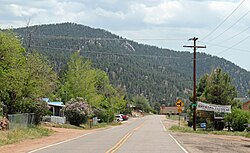
 Pine in 2013 | |
| Coordinates: 39°24′36″N 105°19′19″W / 39.41000°N 105.32194°W | |
| Country | |
| State | |
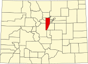
| County | Jefferson |
| Time zone | UTC-7 (MST) |
| • Summer (DST) | UTC-6 (MDT) |
| ZIP code[1] | 80470 |
| Website | historicpinegrove |
Pine is an unincorporated community and a U.S. Post Office in Jefferson County, Colorado, United States. The Pine Post Office has the ZIP Code 80470.[1]
The town is also called Pine Grove. Every summer the residents hold the annual Rhubarb Festival.[2]
Geography
Pine is located at 39°24′36″N 105°19′19″W / 39.41000°N 105.32194°W (39.409937,-105.321980).
References
- ^ a b "ZIP Code Lookup" (JavaScript/HTML). United States Postal Service. January 2, 2007. Retrieved January 2, 2007.
- ^ Rhubarb Festival.


