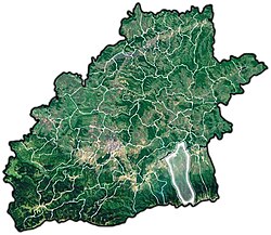
Porumbacu de Jos
Appearance
Porumbacu de Jos | |
|---|---|
Commune | |
 Location of Porumbacu de Jos | |
| Coordinates: 45°45′29″N 24°27′25″E / 45.75806°N 24.45694°E | |
| Country | |
| County | Sibiu County |
| Status | Commune |
| Government | |
| • Mayor | Ioan Strava (Social Democratic Party) |
| Area | |
| • Total | 184.87 km2 (71.38 sq mi) |
| Population (2011) | |
| • Total | 2,954 |
| Time zone | UTC+2 (EET) |
| • Summer (DST) | UTC+3 (EEST) |
| Website | http://www.cjsibiu.ro/ro/porumbacu.php |
Porumbacu de Jos (German: Unter-Bornbach; Hungarian: Alsóporumbák) is a commune in Sibiu County, Transylvania, central Romania, first documented in 1473. It is composed of five villages: Colun, Porumbacu de Jos, Porumbacu de Sus, Sărata and Scoreiu.
It has a population of 2954 (2011) and an administered area of 18,487 ha (see map). It is a base for hiking and climbing tours to the southern Carpathians, notably the Negoiu chalet at 1546 m altitude.
| In Romanian | In German | In Hungarian |
|---|---|---|
| Colun | Kellen | Kolun |
| Porumbacu de Jos | Unter-Bornbach | Alsóporumbák |
| Porumbacu de Sus | Felsőporumbák | |
| Sărata | Salz | Szarata |
| Scoreiu | Skorei |

