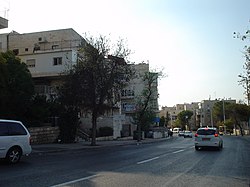
Sanhedria
Appearance
31°47′54″N 35°13′15″E / 31.798379°N 35.220805°E

Sanhedria (Hebrew: סנהדריה) is a Haredi neighborhood in northern Jerusalem, Israel. It lies east of Golda Meir Street and adjacent to Ramat Eshkol, Shmuel HaNavi, Maalot Dafna and the Sanhedria cemetery.
The neighborhood is named after the seventy elders of the Sanhedrin, who, according to local tradition, were buried in a cave nearby.
-
PAGI Synagogue in Sanhedria
-
View of Sanhedria from Ramot Road
-
Sanhedria junction. Right: cemetery. Background: neighborhood entrance.
Sources
External links (Hebrew)
Wikimedia Commons has media related to Category:Sanhedri'ya.


