
Santa Clara, Santa Maria
This article possibly contains original research. (September 2008) |
Barangay Santa Clara, Sta. Maria, Bulacan | |
|---|---|
Barangay | |
 Seal | |
 | |
| Coordinates: 14°49.10′N 120°57.38′E / 14.81833°N 120.95633°E | |
| Country | Philippines |
| Region | Central Luzon |
| Province | Bulacan |
| Municipality | Santa Maria |
| Barrio | circa 1647 |
| Government | |
| • Type | Barangay |
| • Barangay Captain | Geronimo M. Mauricio |
| Elevation | 43 m (141 ft) |
| Time zone | GMT (UTC+8) |
| Zip Code | 3022 |
| Area code | 44 |
| Website | [1] |
Santa Clara (PSGC: 031423021) is one of the twenty-four barangays comprising the municipality of Santa Maria, Bulacan, in the Philippines. It is bordered by Barangay Lalakhan on the south-west, Bagbaguin on the south, Poblacion on the east, Sta. Cruz on the north and Barangay Tambubong in Bocaue on the west.
Geography
Area and Location
Sta. Clara is the 17th largest barangay in Santa Maria with a land area of 214.70 hectares or 2.1470 km2, slightly smaller than the barangay of Poblacion.
Sta. Clara is located on the south-west portion of Sta. Maria and thirty-three kilometers north from Manila.
Climate
The prevailing climatic conditions in the barangay are categorized into two (2) types: dry and wet season.
The annual mean temperature in the area is 27℃. The warmest month is May with a mean temperature of 29.9℃ while the coldest is January at 25.2℃.
The mean annual relative humidity in the Barangay is 77% which is not high. The mean monthly relative humidity is lowest in March at 64% and highest in September at 84%
Demographics
As of 2007 census, Sta. Clara has a population of 10,052 people with a density of 4,682 person per km2. The projected population of the barangay by 2010 is 11,080 with a growth rate of 3.3%
Population Projection
This is the projected population of the barangay by the next few years:
- 2008 - 10,384
- 2009 - 10,726
- 2010 - 11,080
- 2011 - 11,446
- 2012 - 11,824
- 2013 - 12,214
- 2014 - 12,617
- 2015 - 13,033
- 2020 - 15,330
- 2030 - 21,210
Note: This is only a prediction.
Transportation and Communication
Transportation
Public vehicles such as buses, jeepneys, and tricycles are the means of transportation in the barangay. Tricycles are available for 24 hours.
Main Roads
- Narra St./J.P Rizal St.
- Sta. Clara By-Pass Road
- Tindalo St.
- Yakal St./Luwasan
Image gallery
-
 Saint Clare Sub-Parish Chapel
 -
 Barangay Hall
 -
 Logo, seal
 -
 School
 -
 Saint Clare, Patron saint
 -
 Walter Mart
 -
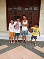 Altar boys in chapel door
 -
 Interior, chapel
 -
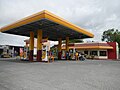 Gas station
 -


References
External links
- Official Website of Barangay Sta. Clara SMB
- Official Website of the Municipality of Santa Maria, Bulacan
- NSCB Sta. Maria, Bulacan
See also
| Municipalities | |
|---|---|
| Component cities | |