Santiago–Tuguegarao Road
Appearance
| Santiago–Tuguegarao Road | ||||
|---|---|---|---|---|
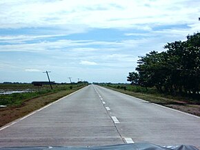
 The Quezon, Isabela-segment of Santiago–Tuguegarao Road. | ||||
| Route information | ||||
| Length | 130 km (81 mi) | |||
| Component highways | ||||
| Major junctions | ||||
| North end | ||||
| ||||
| South end | ||||
| Location | ||||
| Country | Philippines | |||
| Major cities | Tuguegarao, Santiago | |||
| Highway system | ||||
| ||||
| ||||
Santiago–Tuguegarao Road is a national primary road in the provinces of Cagayan and Isabela in the Philippines. It is a bypass junction of the Pan-Philippine Highway, connecting to the cities of Tuguegarao and Santiago. The entire road is designated as National Route 51 (N51) of the Philippine highway network.


