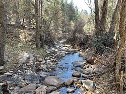
Horton Creek (Arizona)
Appearance
| Horton Creek | |
|---|---|
 | |
| Physical characteristics | |
| Source | |
| • location | spring |
| • elevation | 6,700 ft (2,000 m) |
| Mouth | |
• location | confluence with Tonto Creek |
• elevation | 5,400 ft (1,600 m) |
Horton Creek is located in the Mogollon Rim area of the state of Arizona. The closest town Payson is 20 miles away. The facilities are maintained by Tonto National Forest division of the USDA Forest Service.
Fish species
References
- Arizona Fishin' Holes, Phoenix, AZ: Arizona Game and Fish Department, 2007
{{citation}}:|first=missing|last=(help)
