
Pontian District
This article possibly contains original research. (November 2019) |
Pontian District | |
|---|---|
| Daerah Pontian | |
| Other transcription(s) | |
| • Jawi | فونتيان |
| • Chinese | 笨珍县 |
| • Tamil | பொந்தியான் |
 Flag | |
 Location of Pontian District in Johor | |
 | |
 Pontian District Location of Pontian District in Malaysia | |
| Coordinates: 1°35′N 103°25′E / 1.583°N 103.417°E | |
| Country | |
| State | |
| Granted Municipal Status | 31 July 2021 |
| Seat | Pontian Kechil |
| Local area government(s) | Pontian Municipal Council |
| Government | |
| • District officer | Haji Zulkifly bin Haji Mohd Tahir |
| Area | |
| • Total | 932.64 km2 (360.09 sq mi) |
| Population (2010)[2] | |
| • Total | 144,324 |
| • Density | 150/km2 (400/sq mi) |
| Time zone | UTC+8 (MST) |
| • Summer (DST) | UTC+8 (Not observed) |
| Postcode | 82xxx |
| Calling code | +6-07 |
| Vehicle registration plates | J |
Pontian Municipal Council Majlis Perbandaran Pontian مجليس ڤربندرن ڤونتين | |
|---|---|
 | |
| Type | |
| Type | |
| History | |
| Founded | 31 July 2021 |
| Preceded by | Pontian District Council |
| Leadership | |
President | Mohd Ezzuddin Sanusi |
Municipal Secretary | Hisyamuddin Amat |
| Motto | |
| Setia Khidmat/ستيا خدمت (Loyal, Service) | |
| Meeting place | |
 | |
| Jalan Alsagoff, 82000 Pontian,Johor Darul Ta'zim | |
| Website | |
| www | |

Pontian District (Malay: Daerah Pontian) is a district located in southwest part of the Malaysian state of Johor. It borders Batu Pahat and Kluang Districts to the north and Kulai and Johor Bahru Districts to the east.[3]
Etymology
The name of Pontian was derived from the Malay word “Perhentian” which means a stop, a reference to the sailors travelling to and from Singapore or Malacca stopping at Pontian Besar River for shelter from the rough waters in the Strait of Malacca.[4]
Administrative divisions

Pontian District is divided into 11 mukims, which are:[5]
- Api-Api
- Ayer Baloi
- Ayer Masin
- Benut
- Jeram Batu
- Pengkalan Raja
- Pontian
- Rimba Terjun
- Serkat
- Sungai Karang
- Sungai Pinggan
Federal Parliament and State Assembly Seats
List of Pontian district representatives in the Federal Parliament (Dewan Rakyat)
| Parliament | Seat Name | Member of Parliament | Party |
|---|---|---|---|
| P164 | Pontian | Ahmad Maslan | Barisan Nasional (UMNO) |
| P165 | Tanjung Piai | Wee Jeck Seng | Barisan Nasional (MCA) |
List of Pontian district representatives in the State Legislative Assembly (Dewan Undangan Negeri)
| Parliament | State | Seat Name | State Assemblyman | Party |
|---|---|---|---|---|
| P164 | N53 | Benut | Hasni Mohammad | Barisan Nasional (UMNO) |
| P164 | N54 | Pulai Sebatang | Hasrunizzah Hassan | Barisan Nasional (UMNO) |
| P165 | N55 | Pekan Nanas | Tan Eng Meng | Barisan Nasional (MCA) |
| P165 | N56 | Kukup | Jefridin Atan | Barisan Nasional (UMNO) |
Demographics
| Year | Pop. | ±% | ||
|---|---|---|---|---|
| 1991 | 129,356 | — | ||
| 2000 | 142,697 | +10.3% | ||
| 2010 | 149,938 | +5.1% | ||
| 2020 | 173,318 | +15.6% | ||
| ||||
| Source: [6] | ||||
In 2000, the annual population growth of Pontian District was 2.36%.[7]
Economy
The main economic activities in the district are agriculture, construction, ecotourism, fishery and marine and food processing industries. The former includes pineapple farms and palm oil plantations, which are mainly focused in the town of Pekan Nanas.[8][9][10]
Education
Secondary schools
- Maktab Rendah Sains MARA Pontian
- SMK Dato' Penggawa Barat
- SMK Sri Perhentian
- SMK Dato' Ali Haji Ahmad
- SMK Ayer Baloi
- SMK Benut
- SMK Telok Kerang
- SMK Sri Kukup
- SMK Kayu Ara Pasong
- SMK Pekan Nenas
- SMK Dato' Mohd Yunos Sulaiman
- Sek Men Agama Maahad Pontian
- SMK Tan Sri Osman Mohd Sa'at
- SMK Parit Betak
- Pei Chun High School (Independent)
- SMK Sri Tanjung
- SMK Sri Bandar
- Tanjung Piai Vocational College
- SMA Arab An-Nur
Primary schools
- SK Parit Sulaiman
- SK Parit Rambai
- SK Seri Bunian
- SK Seri Sinaran Chokoh
- SK Sungai Boh
- SK Api-Api
- SK Telok Kerang
- SK Rambah
- SK Rimba Terjun
- SK Sungai Durian
- SK Andek Mori
- SK Serkat
- SK Pekan Nanas
- SJK (C) Gau San
- SJK (C) Chien Hwa, Kampung Jawa
- SJK (C) Chi Chih, Ayer Baloi
- SJK (C) Lee Meng, Jelutong
- SK Tengku Mahmood Iskandar I & II
- SJK (C) Pei Hwa, Telok Kerang
- SK Bandar Pontian
- SJK (C) Pei Chun 1&2
- SJK (C) Bin Chong
- SJK (C) Tah Tong
- SK Sungai Bunyi
- SJK (C) Yu Ming 1 & 2, Pekan Nanas
- SK Parit Sapran
- SK Kayu Ara Pasong
- SK Tanjong Ayer Hitam
- SK Seri Al - Ulum
- SJK (C) Cheow Min
- SK Pulai Sebatang
- SK Parit Kudus
- SK Sri Kembar
- SK Parit Markom
- SJK(C) Siu Woon
- SK Penerok
- SJK(T) Parit Ibrahim
- SK Seri Pulai
- SK Parit Selangor
- SJK(C)Pei Chiao
- SK Parit Haji Adnan
- Sekolah Kebangsaan Sri Benut
- Sekolah Kebangsaan Seri Sinaran
- Sekolah Kebangsaan Seri Setia
- Sekolah Kebangsaan Seri Senang Hati
- Sekolah Kebangsaan Seri Semangat
- Sekolah Kebangsaan Seri Kembar
- Sekolah Kebangsaan Seri Jaya
- Sekolah Kebangsaan Seri Bahagia
- Sekolah Kebangsaan Seri Bugis Benut
- Sekolah Kebangsaan Benut
- Sekolah Jenis Kebangsaan (Cina) Lok Yu(2)
- Sekolah Jenis Kebangsaan (Cina) Lok Yu 6
- Sekolah Jenis Kebangsaan (Cina) Lok Yu 4
- Sekolah Jenis Kebangsaan (Cina) Lok Yu 3
- Sekolah Jenis Kebangsaan (Cina) Lok Yu 1
- Sekolah Jenis Kebangsaan (Cina) Lok York
Transportation
Road
The district is accessible by bus from Larkin Sentral (Mybas Johor- T50, Maju - 96) in Johor Bahru.[11][12]
Sea
There are regularly scheduled ferries connecting fishing village Kukup in Serkat Mukim with Tanjung Balai Karimun in Riau Islands, Indonesia.[13]
Gallery
-
 Pontian Kechil
 -
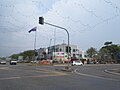
 Business district in Pontian
 -
 Pontian Public Transportation Terminal
 -
 Benut
Benut


References
- ^ "Rancangan Tempatan Daerah Pontian (Penggantian) 2030" (ZIP) (in Malay).
- ^ "Population Distribution and Basic Demographic Characteristics, 2010" (PDF). Department of Statistics, Malaysia. Archived from the original (PDF) on 22 May 2014. Retrieved 19 April 2012.
- ^ "Pontian". tourismjohor.my.
- ^ "Pontian". tourism.johor.my. Archived from the original on 24 December 2018.
- ^ "Pejabat Tanah Pontian" [Pontian Land Office]. Pentadbiran Tanah Johor (in Malay). Retrieved 22 July 2021.
- ^ "Key Findings of Population and Housing Census of Malaysia 2020" (pdf) (in Malay and English). Department of Statistics, Malaysia. ISBN 978-967-2000-85-3.
- ^ "Johor State Town and Country Planning Department Handbook" (PDF).
- ^ "Pontian". Tourism Johor. Archived from the original on 24 December 2018. Retrieved 21 February 2018.
- ^ "A positive change in its fortunes". The Star Online. 15 January 2018. Retrieved 19 January 2018.
- ^ "Muafakat ke Arah #Johor Berkemajuan" (PDF). Muafakat Johor (in Malay). Retrieved 17 March 2018.
- ^ "Bus Routes in Johor Bahru". BusInterchange.net. Retrieved 24 November 2017.
- ^ "Bus Routes and Schedule". Pengangkutan Awam Johor. Retrieved 17 March 2018.
- ^ (in Malay) Terminal Feri Kukup kembali sibuk
External links
- Official Portal of Pontian District Council
- "Rancangan Tempatan Daerah Pontian (Penggantian) 2030" (ZIP) (in Malay).
| |||||||||||||||
| General topics |
|  | |||||||||||||
| Administrative divisions |
| ||||||||||||||
| City councils (Majlis Bandaraya) |
| ||||||||||||||
| Municipal councils (Majlis Perbandaran) |
| ||||||||||||||
| District councils (Majlis Daerah) |
| ||||||||||||||