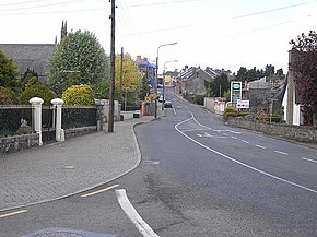
R199 road (Ireland)
Appearance
| R199 road | |
|---|---|
| Bóthar R199 | |
 R199 on Main Street, Killeshandra | |
| Route information | |
| Length | 28.9 km[1][2] (18.0 mi) |
| Major junctions | |
| From | |
| |
| To | |
| Location | |
| Country | Ireland |
| Highway system | |
The R199 road is a regional road in Ireland linking the R198 and R202 roads in Counties Cavan and Leitrim.[2] It is a key road for access to the Shannon–Erne Waterway.[3]
From the R198, the road goes north to Killeshandra. Leaving Killeshandra, the road passes Town Lough before turning west. Entering County Leitrim the road passes through Newtowngore. The road then crosses the Ballinamore Canal (a section of the Shannon–Erne Waterway) and passes the eastern shore of Garadice Lough. Passing near to Drumlonan Lough the R199 later ends in Ballinamore, joining the R202. The R199 is 28.9 kilometres (18.0 mi) long.[1]
See also
References
- ^ a b "R199 to Railway Rd" (Map). Google Maps. Retrieved 8 March 2016.
- ^ a b "S.I. No. 54/2012 – Roads Act 1993 (Classification of Regional Roads) Order 2012". Government of Ireland. 28 February 2012. Retrieved 8 March 2016.
- ^ "R199 Ballinamore/Newtowngore Road". Border Ireland. Retrieved 1 June 2016.

