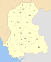
Shikarpur District
This article needs additional citations for verification. (December 2016) |
Shikarpur District
ضلعو شڪارپور | |
|---|---|
| Country | Pakistan |
| Province | Sindh |
| Headquarters | Shikarpur |
| Area | |
| • Total | 2,640 km2 (1,020 sq mi) |
| Population (2017)[1] | |
| • Total | 1,231,481 |
| • Density | 470/km2 (1,200/sq mi) |
| Time zone | UTC+5 (PST) |
| Website | Shikarpur Sindh www.shikarpur.tk |
Shikarpur district (Sindhi:شڪارپور) : (Urdu: ضِلع شِكارپُور), is a district in the Sindh province of Pakistan. The city of Shikarpur is the capital, there are four (04) Sub-Divisions Lakhi Ghulam Shah, Garhi Yasin, Khanpur and Shikarpur itself. It is spread over an area of 2,640 km2, according to the census of 1998 Shikarpur had population of 1,170,864 of which 23.51% were urban.[2] The East India Company occupied Sindh in 1843; They formed three districts in Sindh administratively; 1.Hyderabad 2. Karachi 3.Shikarpur. Then the Shikarpur city was the District Headquarters till 1901 until the British Government Shifted District Headquarters to Sukkur. At that time Shikarpur had 14 talukas which covered the area of all North Sindh except Khairpur. Those days Shikarpur District had its boundaries from Kashmore to Dadu district now days.
Administrative divisions
The district of Shikarpur is sub-divided into four talukas these are:[3]
Demographics
As per the 1998 census of the country, Shikarpur had a population of 880,000 out of which (24%) was urban.[4] The most common religion is Islam (98.03%) with small a population of Hindus (1.73%), which is larger in the urban areas – 4.36%.[5] The predominant first language is Sindhi accounting for 96% of the population, followed by Urdu (1.8%) and Balochi (1%).[6]
History
Shikarpur was an important place as commanding the trade route through the Bolan Pass, and its merchants have dealings with many towns in central Asia. Shikarpur was a city closed within a fort, that fort had seven gates like Hathi Gate, Lakhi Gate, Hazari gate, Khanpur Gate, Suvi Gate, Wagana Gate, Karan Gate & Noshero Gate.
Geography
Shikarpur district borders Larkana, Jacobabad, Khairpur and Sukkur. Two National Highways (N-65 & N-55) intersect the city of Shikarpur making it the junction points of 4 provinces.
Chak, Beechandi a town in taluka Lakhi has an important place in the district politically, socially and economically besides the main Shikarpur city.
Notable people and places
The famous poets of Shikarpur are Saami, Shaikh Ayaz & Moulana Abdul karim chishti. The famous personalities of the Shikarpur are Maulana Deen Mohammad Wafai, Shaheed Allah Bux Soomro, Sir Ghulam Hussain Hidayatullah, Agha lutufullah khan Durrani, Shaheed Quyoom Mangi; Advocate Ali Gohar Khan Baloch, Junaid Ahmed Soomro, Iftikar Ahmed Soomro, Imtiaz Ahmed shaikh, Bedal Masroor, Aftab Shahban Mirani, Agha Temoor Khan Pathan, Advocate Imran K. Baloch, Dr. Ibrahim Jatoi, Shaheed Altaf Khan Bhayo and his sons Babal Khan Bhayo & Mir Abid Khan Bhayo; Maqbool Ahmed Shaikh, Engr. Ali Bux Brohi. Dr. Bashir Ahmed Brohi; Mr. Aadil Ahmed Dayo; Mr. Mazhar Ujjan; Advocate Abdul Nabi Brohi; Advocate Ali Hassan Brohi; Prominent in Politics and adviser of Zia Government Advocate A.K Brohi; Sardar Ghaus Bux Khan Mahar, Sardar Wahid Bux Khan Bhayo, Sardar Jahangir Khan Kakepoto, Haji Saadat Baloch,Ghulam Mujtaba Ansari & many others.
The Shahi Bagh, was known for its thriving vegetation and scented flowers. Shahi Bagh had zoo with number of lions, cheetahs, bears and wild boars. These animals were later shifted to Karachi Zoo. The garden had a wooden pavilion that was designed by Perston Phel and constructed by Sir W. Merewether in September 1871. Many other public and private gardens and open spaces of Shikarpur have vanished.
Ram Jethmalini was also born in this place before partition of India. The Covered Bazaar, Contemporary cities of that time - Bukhara, Samarkand, and Istanbul - had bazaars with covered streets. Shikarpur's main bazaar too was covered. The long, narrow bazaar lined with shops on both sides almost pass through the centre of the old city.
References
- ^ "DISTRICT WISE CENSUS RESULTS CENSUS 2017" (PDF). www.pbscensus.gov.pk.
- ^ Urban Resource Centre (1998 Census figures
- ^ DISTRICT GOVERNMENT Shikarpur
- ^ PCO 1999, pp. 25, 27.
- ^ PCO 1999, p. 27.
- ^ PCO 1999, p. 29.
Bibliography
- 1998 District census report of Shikarpur. Census publication. Vol. 13. Islamabad: Population Census Organization, Statistics Division, Government of Pakistan. 1999.

