
Strathmere, New Jersey
Strathmere, New Jersey | |
|---|---|
 Map of Strathmere highlighted within Cape May County. Right: Location of Cape May County in New Jersey. | |
| Country | |
| State | |
| County | Cape May |
| Township | Upper |
| Area | |
| • Total | 0.760 sq mi (1.968 km2) |
| • Land | 0.598 sq mi (1.549 km2) |
| • Water | 0.162 sq mi (0.419 km2) 21.29% |
| Elevation | 3 ft (1 m) |
| Population | |
| • Total | 158 |
| • Density | 264.2/sq mi (102.0/km2) |
| Time zone | UTC-5 (Eastern (EST)) |
| • Summer (DST) | UTC-4 (Eastern (EDT)) |
| ZIP code | 08248[4] |
| Area code | 609 |
| FIPS code | 3471250[5] |
| GNIS feature ID | 02390365[6] |
Strathmere is an unincorporated community and census designated place (CDP) located within Upper Township in Cape May County, New Jersey, United States.[7][8] As of the 2010 United States Census, the CDP's population was 158.[3]
With its beaches in the Strathmere section, Upper Township is one of five municipalities in the state that offer free public access to oceanfront beaches monitored by lifeguards, joining Atlantic City, North Wildwood, Wildwood and Wildwood Crest.[9]
History
Strathmere was originally called Corson's Inlet, which was annexed to Upper Township in 1905. It was renamed Strathmere around 1912. The Whale Beach section of Strathmere got its name from the whales that would periodically beach themselves there.
Geography
According to the United States Census Bureau, the CDP had a total area of 0.760 square miles (1.968 km2), including 0.598 square miles (1.549 km2) of land and 0.162 square miles (0.419 km2) of water (21.29%).[1][10]
Demographics
| Census | Pop. | Note | %± |
|---|---|---|---|
| 2000 | 175 | — | |
| 2010 | 158 | −9.7% | |
| Population sources: 2000[11] 2010[3] | |||
Census 2010
Census 2000
As of the 2000 United States Census[5] there were 175 people, 93 households, and 54 families residing in the CDP. The population density was 104.0/km2 (269.6/mi2). There were 464 housing units at an average density of 275.6/km2 (714.7/mi2). The racial makeup of the CDP was 97.71% White, 1.14% Asian, and 1.14% from two or more races. Hispanic or Latino of any race were 1.71% of the population.[11]
Of the 93 households; 7.5% had children under the age of 18 living with them, 49.5% were married couples living together, 5.4% had a female householder with no husband present, and 40.9% were non-families. 38.7% of all households were made up of individuals and 12.9% had someone living alone who was 65 years of age or older. The average household size was 1.88 and the average family size was 2.44.[11]
In the CDP the population was spread out with 8.0% under the age of 18, 4.0% from 18 to 24, 17.1% from 25 to 44, 36.6% from 45 to 64, and 34.3% who were 65 years of age or older. The median age was 58 years. For every 100 females there were 96.6 males. For every 100 females age 18 and over, there were 96.3 males.[11]
The median income for a household in the CDP was $78,709, and the median income for a family was $77,783. Males had a median income of $40,972 versus $43,750 for females. The per capita income for the CDP was $52,045. None of the population or families were below the poverty line.[11]
References
- ^ a b Gazetteer of New Jersey Places, United States Census Bureau. Accessed June 13, 2013.
- ^ U.S. Geological Survey Geographic Names Information System: Strathmere Census Designated Place, Geographic Names Information System. Accessed October 19, 2012.
- ^ a b c DP-1 - Profile of General Population and Housing Characteristics: 2010 Demographic Profile Data for Strathmere CDP, New Jersey, United States Census Bureau. Accessed October 19, 2012.
- ^ Look Up a ZIP Code for Strathmere, NJ, United States Postal Service. Accessed October 19, 2012.
- ^ a b American FactFinder, United States Census Bureau. Accessed September 4, 2014.
- ^ US Board on Geographic Names, United States Geological Survey. Accessed September 4, 2014.
- ^ New Jersey: 2010 - Population and Housing Unit Counts - 2010 Census of Population and Housing (CPH-2-32), United States Census Bureau, August 2012. Accessed October 19, 2012.
- ^ Locality Search, State of New Jersey. Accessed April 19, 2015.
- ^ Spoto, MaryAnn. "Surfers fighting to save dwindling free beaches", NJ Advance Media for NJ.com, May 20, 2015. Accessed October 30, 2015. "New Jersey has five free guarded ocean beaches – Atlantic City, Wildwood, North Wildwood, Wildwood Crest and the Strathmere section of Upper Township."
- ^ US Gazetteer files: 2010, 2000, and 1990, United States Census Bureau. Accessed September 4, 2014.
- ^ a b c d e DP-1 - Profile of General Demographic Characteristics: 2000 from the Census 2000 Summary File 1 (SF 1) 100-Percent Data for Strathmere CDP, New Jersey, United States Census Bureau. Accessed October 19, 2012.
External links
- Strathmere web site
- The Upper Township Gazette serving Strathmere Local community newspaper
Municipalities and communities of Cape May County, New Jersey, United States | ||
|---|---|---|
| Cities | 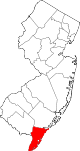 | |
| Boroughs | ||
| Townships | ||
| CDPs | ||
| Other communities | ||