
Sukhothai Airport
This article needs additional citations for verification. (October 2023) |
Sukhothai Airport ท่าอากาศยานสุโขทัย | |||||||||||
|---|---|---|---|---|---|---|---|---|---|---|---|
 | |||||||||||
| Summary | |||||||||||
| Airport type | Private | ||||||||||
| Owner/Operator | Bangkok Airways | ||||||||||
| Serves | Sukhothai | ||||||||||
| Location | Klong Krachong, Sawankhalok, Sukhothai, Thailand | ||||||||||
| Opened | 12 April 1996 | ||||||||||
| Elevation AMSL | 179 ft / 55 m | ||||||||||
| Coordinates | 17°14′16″N 099°49′05″E / 17.23778°N 99.81806°E | ||||||||||
| Maps | |||||||||||
 | |||||||||||
 THS Location of airport in Thailand | |||||||||||
 | |||||||||||
| Runways | |||||||||||
| |||||||||||
| Statistics (2015) | |||||||||||
| |||||||||||
Sukhothai Airport (IATA: THS, ICAO: VTPO) is a privately owned airport by Bangkok Airways in Klong Krachong subdistrict, Sawankhalok district, Sukhothai province in northern Thailand.[1][2]
Airline and destination[edit]
| Airlines | Destinations |
|---|---|
| Bangkok Airways | Bangkok–Suvarnabhumi |
Gallery[edit]
-
 Sukhothai Airport sign
 -
 Arrival hall
 -
 Bangkok Airways at airport
 -
 Passenger terminal
 -
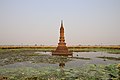 ornamentation near runway


.jpg)
Notes[edit]
References[edit]
External links[edit]
 Sukhothai travel guide from Wikivoyage
- Current weather for VTPO at NOAA/NWS
- Accident history for THS at Aviation Safety Network
| International | |
|---|---|
| National | |