Tulita Airport
Appearance
Tulita Airport | |||||||||||
|---|---|---|---|---|---|---|---|---|---|---|---|
 | |||||||||||
| Summary | |||||||||||
| Airport type | Public | ||||||||||
| Operator | Government of the Northwest Territories | ||||||||||
| Location | Tulita, Northwest Territories | ||||||||||
| Time zone | MST (UTC−07:00) | ||||||||||
| • Summer (DST) | MDT (UTC−06:00) | ||||||||||
| Elevation AMSL | 329 ft / 100 m | ||||||||||
| Coordinates | 64°54′35″N 125°34′10″W / 64.90972°N 125.56944°W | ||||||||||
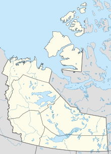
| Map | |||||||||||
 | |||||||||||
| Runways | |||||||||||
| |||||||||||
| Statistics (2010) | |||||||||||
| |||||||||||
Tulita Airport (IATA: ZFN, ICAO: CZFN) is located adjacent to Tulita, Northwest Territories, Canada. Its hours of operation are Monday to Friday from 9am to 5pm. The airport does operate outside of its operational hours when responding to MEDIVAC (air ambulance) call out.
Airlines and destinations
[edit]| Airlines | Destinations |
|---|---|
| North-Wright Airways | Déline, Fort Good Hope, Norman Wells[3] |
Cargo
[edit]| Airlines | Destinations |
|---|---|
| Buffalo Airways | Yellowknife |
References
[edit]- ^ Canada Flight Supplement. Effective 0901Z 16 July 2020 to 0901Z 10 September 2020.
- ^ Total aircraft movements by class of operation
- ^ http://www.north-wrightairways.com/documents/NWA%20flight%20schedule%20dec2012.pdf [dead link]
External links
[edit]- Accident history for ZFN at Aviation Safety Network
- Past three hours METARs, SPECI and current TAFs for Tulita Airport from Nav Canada as available.

