
Talk:Ghajar: Difference between revisions
→Needs abbreviating: Comment. |
|||
| (One intermediate revision by the same user not shown) | |||
| Line 169: | Line 169: | ||
:::I didn't remove it because I "don't like it.", but because it has nothing to do with Ghajar, its about the conflict between the PLO and Israel, this article is about Ghajar. Your comment above: "it has everything to do with Ghajar" is not an explanation for why the text is about Ghajar. All of it is sourced to the Jewish Virtual Library, which is an unreliable source, which means that it should be removed even if it had something to do with Ghajar, which in this case it doesn't. Consensus is based on arguments, you have not provided an argument for why text from an unreliable source about the conflict between the PLO and Israel should be in this article. --[[User:Supreme Deliciousness|Supreme Deliciousness]] ([[User talk:Supreme Deliciousness|talk]]) 17:34, 16 December 2010 (UTC) |
:::I didn't remove it because I "don't like it.", but because it has nothing to do with Ghajar, its about the conflict between the PLO and Israel, this article is about Ghajar. Your comment above: "it has everything to do with Ghajar" is not an explanation for why the text is about Ghajar. All of it is sourced to the Jewish Virtual Library, which is an unreliable source, which means that it should be removed even if it had something to do with Ghajar, which in this case it doesn't. Consensus is based on arguments, you have not provided an argument for why text from an unreliable source about the conflict between the PLO and Israel should be in this article. --[[User:Supreme Deliciousness|Supreme Deliciousness]] ([[User talk:Supreme Deliciousness|talk]]) 17:34, 16 December 2010 (UTC) |
||
:::::::[[Jewish Virtual Library]] is a reliable source based on articles written by leading historians. In light of past comments, I wonder if your opposition to it has something to do with the site calling itself "Jewish." Furthermore, JVL is only one source. For some reason, you have ignored the fact that the material is also backed up by the [[BBC]] and [[Haaretz]]. The text in question provides vital background for the dispute, without which Israel's responses are incomprehensible. Many editors have brought it back after your attempts to delete it, which shows there is no consensus for its removal. This article is not long and doesn't need pruning. If anything it needs more information, not less.--[[User:Gilabrand|Delishisoup]] ([[User talk:Gilabrand|talk]]) 17:53, 16 December 2010 (UTC) |
:::::::[[Jewish Virtual Library]] is a reliable source based on articles written by leading historians. In light of past comments, I wonder if your opposition to it has something to do with the site calling itself "Jewish." Furthermore, JVL is only one source. For some reason, you have ignored the fact that the material is also backed up by the [[BBC]] and [[Haaretz]]. The text in question provides vital background for the dispute, without which Israel's responses are incomprehensible. Many editors have brought it back after your attempts to delete it, which shows there is no consensus for its removal. This article is not long and doesn't need pruning. If anything it needs more information, not less.--[[User:Gilabrand|Delishisoup]] ([[User talk:Gilabrand|talk]]) 17:53, 16 December 2010 (UTC) |
||
:::::::::I didn't remove the Haaretz and BBC source. JVL is not a reliable source. JVL has "Myths and facts" material:[http://www.jewishvirtuallibrary.org/jsource/myths2/cover.html], It has hundreds maybe even thousands of articles sourced to Wikipedia:[http://www.google.com/search?hl=en&domains=http://www.jewishvirtuallibrary.org&sitesearch=www.jewishvirtuallibrary.org&q=wikipedia&start=10&sa=N#q=wikipedia&hl=en&domains=http://www.jewishvirtuallibrary.org&sitesearch=www.jewishvirtuallibrary.org&prmd=iv&ei=FpYKTa-7GYG28QPj1uBR&start=0&sa=N&fp=9111c1d610a8252], JVL is part of the "American-Israeli Cooperative Enterprise" [http://www.jewishvirtuallibrary.org/jsource/intro.html] and the Executive Director of it is Mitchell G. Bard who has worked for the American Israel Public Affairs Committee's (AIPAC)[http://www.jewishvirtuallibrary.org/jsource/mbbio.html]. JVL also contains texts that are in direct contradiction to reliable sources: [http://en.wikipedia.org/wiki/Talk:Israel_casualties_of_war#The_sources_for_the_foiled_suicide_bombing_attacks_data_give_completely_different_data]. Has maps of Israel that shows the occupied territories as part of Israel: [http://www.jewishvirtuallibrary.org/jsource/History/israel93.html][http://www.jewishvirtuallibrary.org/jsource/Peace/jordan.html][http://www.jewishvirtuallibrary.org/jsource/Peace/nymap.html][http://www.jewishvirtuallibrary.org/jsource/Peace/camap.html] JVLs articles almost always lack sources and authorship (including the JVL article you want to use here), the few times its articles links to sources they almost always lack inline citations and are inconsistent linking to broken links or main websites and not articles: [http://www.jewishvirtuallibrary.org/jsource/Peace/aksagraph.html]. I have here shown plenty of reasons for why its an unreliable source. The text you added does not provide any vital background for the "dispute", it has nothing to do with Ghajar, if people want to read about the Lebanon war they can click on the link. What you have done is cherry picking irrelevant texts from unreliable sources about the Arab-Israeli conflict with no connection to Ghajar. Do you want me to ad to this article that Palestinians were ethnically cleansed from their lands and that this was the reason why the PLO was created and launched attacks against Israel? --[[User:Supreme Deliciousness|Supreme Deliciousness]] ([[User talk:Supreme Deliciousness|talk]]) 23:16, 16 December 2010 (UTC) |
|||
*Can someone explain to me what the connection between the PLO and Ghajar is? Being well sourced is fine and dandy, but the content in question fails to establish why it is important to the subject of this article. ← [[User:George|<span style="color:#333;font-variant:small-caps;font-weight:bold">George</span>]]<sup> [[User talk:George|<small style="color:#dc143c;">talk</small>]]</sup> 22:16, 16 December 2010 (UTC) |
*Can someone explain to me what the connection between the PLO and Ghajar is? Being well sourced is fine and dandy, but the content in question fails to establish why it is important to the subject of this article. ← [[User:George|<span style="color:#333;font-variant:small-caps;font-weight:bold">George</span>]]<sup> [[User talk:George|<small style="color:#dc143c;">talk</small>]]</sup> 22:16, 16 December 2010 (UTC) |
||
::In this case its not well sourced, the text is from the JVL.--[[User:Supreme Deliciousness|Supreme Deliciousness]] ([[User talk:Supreme Deliciousness|talk]]) 23:16, 16 December 2010 (UTC) |
|||
Revision as of 23:39, 16 December 2010
| Warning: active arbitration remedies The contentious topics procedure applies to this article. This article is related to the Arab–Israeli conflict, which is a contentious topic. Furthermore, the following rules apply when editing this article:
Editors who repeatedly or seriously fail to adhere to the purpose of Wikipedia, any expected standards of behaviour, or any normal editorial process may be blocked or restricted by an administrator. Editors are advised to familiarise themselves with the contentious topics procedures before editing this page.
|
| Syria C‑class Mid‑importance | ||||||||||
| ||||||||||
.svg)


| Lebanon C‑class Mid‑importance | ||||||||||
| ||||||||||
 | It is requested that a photograph be included in this article to improve its quality.
Wikipedians in Israel may be able to help! The external tool WordPress Openverse may be able to locate suitable images on Flickr and other web sites. |
2006
Regarding "Hezbollah uses the Lebanese side of the village as a base to spy into Israel, smuggle drugs, and has also tried to attack Israeli soldiers from the area several times." I am pretty neutral when it comes to geography and politics, but such a claim clearly requires a serious reference or two, otherwise it is to be deleted. Please provide an article from any online newspaper (conservative or liberal, it's not important). Thanks. Hugo Dufort 19:30, 2 October 2006 (UTC)
The author claims that "Hezbollah uses the Lebanese side of the village as a base to spy into Israel, smuggle drugs, and has also tried to attack Israeli soldiers from the area several times." Other than the smuggling of drugs , the same can be said of Israel, so I call either for the deletion of this part or the mention of Israels part in the same.
We need references, references, references! Otherwise this page will descend into anarchy. Hugo Dufort 20:49, 2 October 2006 (UTC)
I wouldn't hold your breath waiting for the authors of some contentious statements here to support and source them, to be honest. Most of the text in this article is suspect and maybe that's not too surprising given the contentious subject but it's certainly not nearly good enough. There were apparent contradictions, major POV and a complete lack of sources. I would suggest a proactive/aggressive (whichever way you want to look at it) approach. Tonyobrienuk 01:09, 3 October 2006 (UTC)
nationality
The UN and most of the international community continue to recognize the southern half of Al Ghajar (in the Golan Heights) as Syria. Obviously, it has been occupied by Israel since 1967. Identifying Ghajar as in Israel violates the WP NPOV guideline. Using simply "Golan Heights" is more neutral.DLinth (talk) 15:13, 20 March 2008 (UTC)
I actually laughed reading this article, right from the beginning calling the Golan Heights controlled rather than occupied, right down to the end referring to the Kauffman article without actually using the article as a resource. Like all of the Middle Eastern related pages on wikipedia this seems to have absolutly no NPOV. I'd edit it myself, but do not have the energy or patience to watch it be reverted by someone with more time, energy, and more of an agenda than I do. —Preceding unsigned comment added by 58.170.81.207 (talk) 08:05, 20 November 2009 (UTC)
Kaufman's article
The detailed study of Kaufman, mentioned via a press article, is: Asher Kaufman, “Let Sleeping Dogs Lie:” On Ghajar and Other Anomalies in the Syria-Lebanon-Israel Tri-Border Region, MIDDLE EAST JOURNAL, Volume 63, No. 4, Autumn 2009, pp. 539-560. Since I don't have time to edit this article, I will send a copy of the study to anyone who asks by email. Zerotalk 12:16, 26 October 2009 (UTC)
Recent edits
Recent edits have shown a desire to turn this article into an essay, rather than an encyclopedia entry. Inserting commentary to "introduce readers" to facts is inappropriate in this context. Our job as editors is to be objective and uphold the WP:NPOV policy. Adding commentaries that provide no added fact, only throw in POV, does not uphold this policy. This is even the case when the commentary is sourced to a newspaper. The sentence that was added to the beginning of the Early History section does not belong in an encyclopedia entry. It is trying to push POV; therefore, it should be removed. Breein1007 (talk) 20:05, 8 December 2009 (UTC)
- Recent edits in the history section all come from the same ref article and same paragraph of it, while the ref itself discusses more recent issues related to Ghajar. If one feels that specific statement of Ghajar's history is somehow inappropriate, one could rephrase it to add who said it, for example, rather than repeated deletion. I do not think it adds any 'commentary'; it makes a statement about Ghajar's history in a summary light, which seems both notable and relevant to that section. What commentary do you see?
- I do note that this discussion comes quite late after the actual editing skirmishes, but just 5 minutes before you post the supposed 3RR incident at AN/I, so that all the is are dotted and the ts crossed. I really hope that they make a decision, rather than deciding not to make one. I certainly an incident, but only one of disruptive editing, on the part of another. CasualObserver'48 (talk) 06:27, 9 December 2009 (UTC) P.S. I really don't care which country it is in; the facts are that it is on the border between two. From that, one could certainly opine that "they are in the middle of it." CasualObserver'48 (talk) 06:54, 9 December 2009 (UTC)
Map?
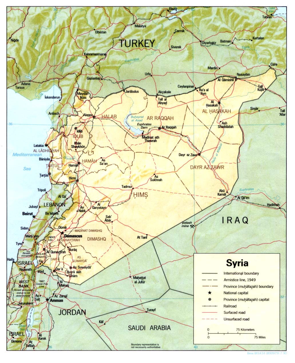
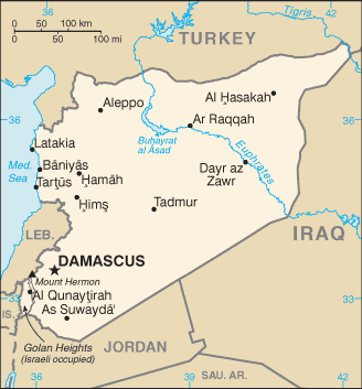
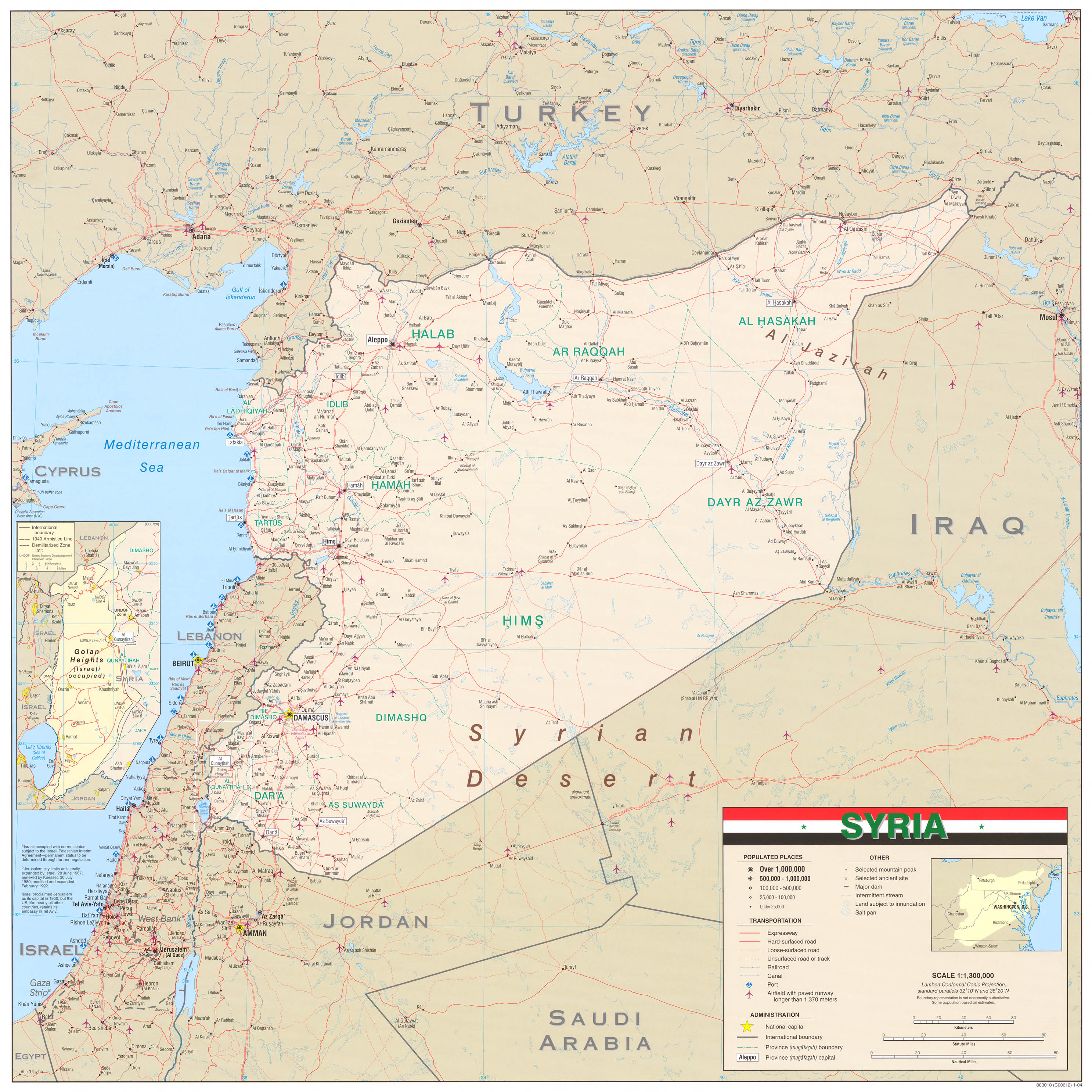
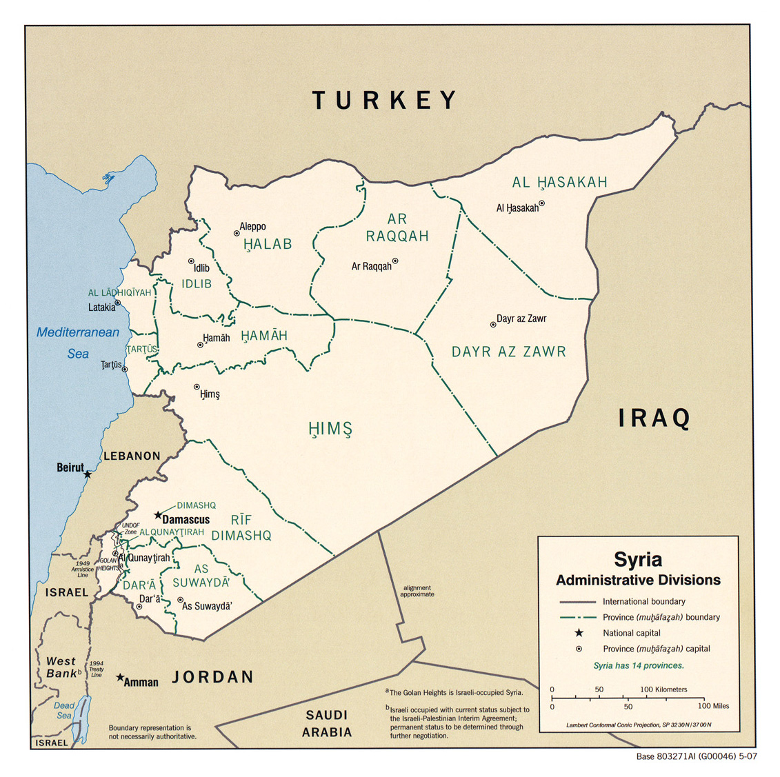
Can someone explain why the map of Israel would be best to use for this article? Apparently part of the village is inside Lebanon, and part is inside the Golan Heights. According to the article on the latter, "The United Nations, the United States, the European Union, the United Kingdom, the Arab League, the International Committee of the Red Cross, Amnesty International, and Human Rights Watch consider the Golan Heights to be territory occupied by Israel and not part of Israel proper". I can understand the case for using the map of Lebanon, and the case for using the map of the Golan Heights, and the case for using no map at all (or a more ambiguous one), but it doesn't appear that anyone feels it's a part of Israel, aside from the Israelis themselves? The residents having passports does not dictate which country has claims on the land. ← George talk 21:54, 9 December 2009 (UTC)
- So change it to a Golan Heights map. Lebanon has no claims to the land. Breein1007 (talk) 21:58, 9 December 2009 (UTC)
- It is inappropriate to use the Lebanon map to show Ghajar's location. Ghajar is not in Lebanon; it is in the Golan Heights. The residents are Israeli citizens; they have Israeli ID cards. They requested annexation by Israel because they are historically and culturally part of the Golan Heights, and not Lebanon. This would be like using a map of Mexico to show the location of El Paso in Texas. If someone wants to replace the current map with one of the Golan Heights, please go ahead and do so. Otherwise, if it's a choice of Israel vs Lebanon, Israel is clearly more appropriate, because Lebanon has nothing to do with the Golan Heights land dispute. Breein1007 (talk) 21:57, 9 December 2009 (UTC)
- According to the article, part of the town is in Lebanon, and part is in the Golan Heights. While some of the citizens carry Israeli citizenship, and some carry Lebanese citizenship, that doesn't have anything to do with the territory - a British family living in Canada does not mean that the house they live in is part of Britain.
- I think the best map to use would be one similar to this one, modified to highlight Ghajar instead of the Shebaa Farms. Thoughts? ← George talk 01:04, 10 December 2009 (UTC)
- That map is fine. Go for it. Thanks,Breein1007 (talk) 03:24, 10 December 2009 (UTC)
- Any progress on updating the current map to an appropriate one? Breein1007 (talk) 01:02, 11 December 2009 (UTC)
- I've been looking for the best available map while waiting to see if others agree with this proposal. ← George talk 00:20, 12 December 2009 (UTC)
- Any progress on updating the current map to an appropriate one? Breein1007 (talk) 01:02, 11 December 2009 (UTC)
- That map is fine. Go for it. Thanks,Breein1007 (talk) 03:24, 10 December 2009 (UTC)
Appropriate maps are either Lebanon or Syria since the village is on the border between these two countries. --Supreme Deliciousness (talk) 14:20, 11 December 2009 (UTC)
- How do you feel about using a map of the border between the two countries? Because the village is half in Lebanon and half in the Golan Heights, I think the best map would be one like this one (not this exact map, since I found it on someone's blog, but something very similar). Thoughts? ← George talk 00:20, 12 December 2009 (UTC)
- I think that the first map you linked was perfect, and if you modify it to show Ghajar instead, it will be appropriate for the article. As far as what Supreme Deliciousness thinks, his last post clearly shows that he is unwilling to compromise and come up with an NPOV solution. With that said, I hope you will go ahead with that map as soon as possible, because the longer you wait, the longer the readers who come to this page will be misled. Breein1007 (talk) 08:25, 12 December 2009 (UTC)
- I think it has been long enough. I am removing the current map, something that should have been done a long time ago. If someone wants to create/find an appropriate map to replace it with, please do so. Breein1007 (talk) 01:05, 18 December 2009 (UTC)
- I'm fine with removing the map until editors can agree on a better one. ← George talk 10:27, 18 December 2009 (UTC)
- George--I agree with you and Breein that the form of map you linked to works.--Epeefleche (talk) 12:10, 18 December 2009 (UTC)
- I'm fine with removing the map until editors can agree on a better one. ← George talk 10:27, 18 December 2009 (UTC)
- I think it has been long enough. I am removing the current map, something that should have been done a long time ago. If someone wants to create/find an appropriate map to replace it with, please do so. Breein1007 (talk) 01:05, 18 December 2009 (UTC)
That is just dumb. Sources in the article and below show that this village straddles the border between Syria and Lebanon, either map would be fine. Instead of doing all this why did you not just use the Golan Heights pushpin map? Or do you still only want to use a map of Israel for a village nowhere near Israel? nableezy - 14:56, 18 December 2009 (UTC)
- Nableezy, I'm going to ignore the first half of your comment and just respond to the second suggestion. I've been suggesting using a Golan Heights map all along, but I wasn't aware that there was a pushpin for it. I tried "Golan Heights" and "Golan" in the source; neither worked. If you know how to do it, please go ahead. In terms of your last sentence, there's no need for sarcasm like that. Not only does it not translate well over the internet(!), but you and I both know very well that this village is definitely somewhere "near" Israel. Breein1007 (talk) 18:40, 18 December 2009 (UTC)
- It is not "near" Israel, it is "near" Syrian territory occupied by Israel. And I would fix the map, but a certain user seems intent on having me blocked or banned for any edits that I make, so Ill sit this one out. nableezy - 19:31, 18 December 2009 (UTC)
- I have to agree with User:Nableezy. His position is well and accurately referenced. NickCT (talk) 15:46, 18 December 2009 (UTC)
- Exactly, the village is on the Syrian/Lebanese border, so either a map of Syria or Lebanon is correct.--Supreme Deliciousness (talk) 15:57, 18 December 2009 (UTC)
- I have to agree with Breein. There's no need for comments that others will view dimly, ignore, or find uncivil.--Epeefleche (talk) 18:51, 18 December 2009 (UTC)
- Agree with what you like, this village straddles the border between Syria and Lebanon, either one of those is fine to use. Breein has repeatedly inserted the map for Israel even though this village is nowhere close to Israel. nableezy - 19:31, 18 December 2009 (UTC)
- I know that you are a person of precision, not at all given to exaggeration or misrepresentation. So how long a distance is "nowhere close" in your book, pray tell?--Epeefleche (talk) 19:48, 18 December 2009 (UTC)
- You do not know anything about me. By "nowhere close" I mean not in the vicinity of Israeli territory. Ghajar is more than 1 km from Israeli territory. It does not border Israel, it does not cross over into Israel. It is however both near and, depending on the source for which, within Lebanese and Syrian territory. nableezy - 19:57, 18 December 2009 (UTC)
- I stand corrected. My first comment was apparently incorrect, and I retract it with apologies.--Epeefleche (talk) 20:09, 18 December 2009 (UTC)
- I thought you were against comments that others will "view dimly, ignore, or find uncivil." nableezy - 20:31, 18 December 2009 (UTC)
- OK. I apologize for my apology, and retract my retraction.--Epeefleche (talk) 20:41, 18 December 2009 (UTC)
- Your life. But to the actual issue here, Ghajar straddles the border of Lebanon and Syria. Either map would be fine to use. nableezy - 20:44, 18 December 2009 (UTC)
- Ghajar straddles the border of Lebanon and the Golan Heights. Let's leave it at that and stop arguing things that know we won't agree on. My insertion of the flag of Israel may have been inappropriate in your eyes, but it was much less inappropriate than a map of Syria would be. Israel at least has administrative control of the village. Breein1007 (talk) 03:40, 19 December 2009 (UTC)
- And if you can't make the edit, why don't you tell me how to make a pushpin map of the Golan Heights and I'll do it myself? Breein1007 (talk) 03:41, 19 December 2009 (UTC)
- It does not matter what you agree about, the sources are clear about this simple point. Ghajar straddles the border between Lebanon and Syria. I presented multiple scholarly peer-reviewed sources that make this point. And there are problems with the Golan Heights map that I would like to fix before using it. nableezy - 04:17, 19 December 2009 (UTC)
- So I guess that means we'll leave it without a map until your ban expires so you can deal with your problems with the map and post it. Breein1007 (talk) 07:23, 19 December 2009 (UTC)
- Given that according to the blue line the northern half of the city is in Lebanon why exactly do you object to the Lebanon map? There is evidence for one of the following things, and these words are from the sources, I am not inserting "Syria" in place of "Israel". The three scenarios are 1. The entire city is in Lebanon; that is supported by some maps from pre-1967 (including Israeli maps). 2. The entire city is in Syria (in one source labeled variously as "Israeli-controlled portion of the Golan Heights" and "the occupied Golan Heights" and "area occupied by Israel in the Syrian Golan Heights" but not once as in Israel), this is supported by other maps from pre-1967 and was the de-facto state prior to the war. The last option, 3. the northern portion of the city is in Lebanon and the southern portion of the city is in the Golan, again consistently labeled as Syrian territory or Israeli-occupied territory. That is the current state of affairs until a formal treaty between Syria and Lebanon to settle border questions unanswered by the 1923 Anglo-French Agreement. But given that these are the only 3 things that sources support why do you oppose either the Syria map or the Lebanon map? nableezy - 07:35, 19 December 2009 (UTC)
- The southern half of the village is undoubtedly in the Golan Heights. While some claim that the northern half is "in" Lebanon, others argue that it too is in the Golan Heights. The residents are completely against splitting the village and having the north given to Lebanon as Israel has reportedly considered, according to the media anyway. The residents also never wanted to be part of Lebanon; their connection is with the Golan Heights. They specifically requested for Israel to annex them; Israel did not have this intention. Prior to Israel conquering the land, it was part of Syria. The Syrian government has supported Lebanon's claim to the land only to pressure Israel into withdrawing, because Israel withdrew from southern Lebanon in 2000 and therefore by claiming that Ghajar was part of Lebanon, they can try to convince the world that under this withdrawal, Israel should have to leave Ghajar as well. The reality is that Syria was the owner of this land prior to Israel, and never Lebanon. And this is all sourced. I have no problem with you labeling it as "Israeli-occupied territory", ie: Golan Heights. Syria on the other hand, is not an accurate portrayal of the current facts on the ground. It would be similar to showing a map of Jordan for the Hebron page or a map of Egypt for Gaza City. Breein1007 (talk) 07:58, 19 December 2009 (UTC)
- They did not ask that Israel "annex" them, they asked that they be included with the rest of the occupied Golan. And it would in no way be similar to using the Jordan map for Hebron, as the "facts on the ground" are that Hebron is occupied Palestinian territory, not occupied Jordanian territory. And it is not Syria that has come up with the idea that the northern half is in Lebanon, that was the determination of the UN when demarcating the blue line. And the reality really is that nobody can say for sure if this village was in Syria or Lebanon. The UN cartographic team head explained the decision:
Kaufman goes on to explain that "This was the most recent map which Syria and Israel had signed together, thus, in fact, accepting the contours of its delineated boundary." This is all in Kaufman, Asher (2009). ""Let Sleeping Dogs Lie": On Ghajar and Other Anomalies in the Syria-Lebanon-Israel Tri-Border Region". Middle East Journal (Middle East Institute) 63 (4) p. 556-7. But you are right on a few things, if not the major points. The residents are against splitting the village. nableezy - 08:13, 19 December 2009 (UTC)The line across the Al Wazzani-Al Ghajar village(s) was problematic from the very beginning. This segment of the Withdrawal Line, of course, was neither part of the 1923 Anglo-French Agreement, nor the 1950 Armistice Demarcation, which were the accepted basis for our work. Moreover, the adjacent villages shown on numerous maps we have consulted were functioning as one settlement in 2000. … After much consideration we decided that the alignment of the Withdrawal Line shall be in conformity with the boundary shown on the 1974 UNDOF disengagement map.
- They did not ask that Israel "annex" them, they asked that they be included with the rest of the occupied Golan. And it would in no way be similar to using the Jordan map for Hebron, as the "facts on the ground" are that Hebron is occupied Palestinian territory, not occupied Jordanian territory. And it is not Syria that has come up with the idea that the northern half is in Lebanon, that was the determination of the UN when demarcating the blue line. And the reality really is that nobody can say for sure if this village was in Syria or Lebanon. The UN cartographic team head explained the decision:
- The southern half of the village is undoubtedly in the Golan Heights. While some claim that the northern half is "in" Lebanon, others argue that it too is in the Golan Heights. The residents are completely against splitting the village and having the north given to Lebanon as Israel has reportedly considered, according to the media anyway. The residents also never wanted to be part of Lebanon; their connection is with the Golan Heights. They specifically requested for Israel to annex them; Israel did not have this intention. Prior to Israel conquering the land, it was part of Syria. The Syrian government has supported Lebanon's claim to the land only to pressure Israel into withdrawing, because Israel withdrew from southern Lebanon in 2000 and therefore by claiming that Ghajar was part of Lebanon, they can try to convince the world that under this withdrawal, Israel should have to leave Ghajar as well. The reality is that Syria was the owner of this land prior to Israel, and never Lebanon. And this is all sourced. I have no problem with you labeling it as "Israeli-occupied territory", ie: Golan Heights. Syria on the other hand, is not an accurate portrayal of the current facts on the ground. It would be similar to showing a map of Jordan for the Hebron page or a map of Egypt for Gaza City. Breein1007 (talk) 07:58, 19 December 2009 (UTC)
- Given that according to the blue line the northern half of the city is in Lebanon why exactly do you object to the Lebanon map? There is evidence for one of the following things, and these words are from the sources, I am not inserting "Syria" in place of "Israel". The three scenarios are 1. The entire city is in Lebanon; that is supported by some maps from pre-1967 (including Israeli maps). 2. The entire city is in Syria (in one source labeled variously as "Israeli-controlled portion of the Golan Heights" and "the occupied Golan Heights" and "area occupied by Israel in the Syrian Golan Heights" but not once as in Israel), this is supported by other maps from pre-1967 and was the de-facto state prior to the war. The last option, 3. the northern portion of the city is in Lebanon and the southern portion of the city is in the Golan, again consistently labeled as Syrian territory or Israeli-occupied territory. That is the current state of affairs until a formal treaty between Syria and Lebanon to settle border questions unanswered by the 1923 Anglo-French Agreement. But given that these are the only 3 things that sources support why do you oppose either the Syria map or the Lebanon map? nableezy - 07:35, 19 December 2009 (UTC)
- So I guess that means we'll leave it without a map until your ban expires so you can deal with your problems with the map and post it. Breein1007 (talk) 07:23, 19 December 2009 (UTC)
- It does not matter what you agree about, the sources are clear about this simple point. Ghajar straddles the border between Lebanon and Syria. I presented multiple scholarly peer-reviewed sources that make this point. And there are problems with the Golan Heights map that I would like to fix before using it. nableezy - 04:17, 19 December 2009 (UTC)
- And if you can't make the edit, why don't you tell me how to make a pushpin map of the Golan Heights and I'll do it myself? Breein1007 (talk) 03:41, 19 December 2009 (UTC)
- Ghajar straddles the border of Lebanon and the Golan Heights. Let's leave it at that and stop arguing things that know we won't agree on. My insertion of the flag of Israel may have been inappropriate in your eyes, but it was much less inappropriate than a map of Syria would be. Israel at least has administrative control of the village. Breein1007 (talk) 03:40, 19 December 2009 (UTC)
- Your life. But to the actual issue here, Ghajar straddles the border of Lebanon and Syria. Either map would be fine to use. nableezy - 20:44, 18 December 2009 (UTC)
- OK. I apologize for my apology, and retract my retraction.--Epeefleche (talk) 20:41, 18 December 2009 (UTC)
- I thought you were against comments that others will "view dimly, ignore, or find uncivil." nableezy - 20:31, 18 December 2009 (UTC)
- I stand corrected. My first comment was apparently incorrect, and I retract it with apologies.--Epeefleche (talk) 20:09, 18 December 2009 (UTC)
- You do not know anything about me. By "nowhere close" I mean not in the vicinity of Israeli territory. Ghajar is more than 1 km from Israeli territory. It does not border Israel, it does not cross over into Israel. It is however both near and, depending on the source for which, within Lebanese and Syrian territory. nableezy - 19:57, 18 December 2009 (UTC)
- I know that you are a person of precision, not at all given to exaggeration or misrepresentation. So how long a distance is "nowhere close" in your book, pray tell?--Epeefleche (talk) 19:48, 18 December 2009 (UTC)
- Agree with what you like, this village straddles the border between Syria and Lebanon, either one of those is fine to use. Breein has repeatedly inserted the map for Israel even though this village is nowhere close to Israel. nableezy - 19:31, 18 December 2009 (UTC)
- I have to agree with Breein. There's no need for comments that others will view dimly, ignore, or find uncivil.--Epeefleche (talk) 18:51, 18 December 2009 (UTC)
- Exactly, the village is on the Syrian/Lebanese border, so either a map of Syria or Lebanon is correct.--Supreme Deliciousness (talk) 15:57, 18 December 2009 (UTC)
Map is done, any objections? nableezy - 03:36, 30 December 2009 (UTC)
- I think this is really good. If you could label the countries of Lebanon, Syria, and Israel it would be perfect, but even without those it should be less controversial than what was there before. ← George talk 05:52, 30 December 2009 (UTC)
A newer Kaufman
A newer reference to Kaufman, unfiltered by Ha'aretz, may be found here. CasualObserver'48 (talk) 08:06, 14 December 2009 (UTC)
pov
In the modern era section it says PLO carried out "terrorist attacks".. Also part about Abu Nidal and Operation Peace for Galilee is not connected to article topic. --Supreme Deliciousness (talk) 13:21, 16 December 2009 (UTC)
- I suggest jewishvirtuallibrary.com not be reliable source. It be pro israel interest group that naturally be antiarab. Ani medjool (talk) 21:10, 16 December 2009 (UTC)
- I think it's fine. We have the Lebanon Daily Star, which is anti-Israel. Being pro or anti Israel does not make a source reliable or unreliable.--Epeefleche (talk) 21:44, 16 December 2009 (UTC)
- The Lebanon Daily Star is a major news source. JVL is a collection of other sources. JVL in itself is not a reliable source, though some of the things they host may be. nableezy - 21:50, 16 December 2009 (UTC)
- As I said, being pro or anti Israel is not the basis for determining whether something is an RS.--Epeefleche (talk) 21:58, 16 December 2009 (UTC)
- Do you see the words "pro" or "anti" in what I wrote? The issue is not "pro" or "anti" Israel, though it is noted how you choose to define things (rather than say pro or anti Arab). The issue is with editorial oversight and a reputation for fact checking. Major news sources are reliable sources, the Daily Star is thus a RS (same as JPost, or Haaretz, or Yedioth Ahronoth). JVL is not a news source, it is not published by an academic press, it is not peer-reviewed, it is none of the things that make a source "reliable". nableezy - 22:20, 16 December 2009 (UTC)
- As I said, being pro or anti Israel is not the basis for determining whether something is an RS.--Epeefleche (talk) 21:58, 16 December 2009 (UTC)
- The Lebanon Daily Star is a major news source. JVL is a collection of other sources. JVL in itself is not a reliable source, though some of the things they host may be. nableezy - 21:50, 16 December 2009 (UTC)
- I think it's fine. We have the Lebanon Daily Star, which is anti-Israel. Being pro or anti Israel does not make a source reliable or unreliable.--Epeefleche (talk) 21:44, 16 December 2009 (UTC)
Outdent: Back to the original point by Supreme. The lengthy and off-topic detail included in the description of why the area was invaded again in 1982 seems excessive and looking like a coatrack. Other than that, it is poorly written along NPOV lines, since it doesn't include mention of the contextural nature of the 'Abu Nidal--Abu Schmidal' assassination final pretext. This should really be re-written, mostly by deletion. As far as relevance for the Ghajar article is concerned, it is pretty much limited to the fact that something else started and happened, their area was invaded again and occupied for 18 more years. Following that, all Wiki presents now is a much later date without even a para break. CasualObserver'48 (talk) 00:49, 18 December 2009 (UTC)
- I have removed this text because it has no connection with article topic. --Supreme Deliciousness (talk) 22:47, 26 December 2009 (UTC)
sources to use
- Kaufman, Asher (2002). "Who Owns the Shebaa Farms? Chronicle of a Territorial Dispute". Middle East Journal. 56 (4). Middle East Institute: 576–595.
p. 577: According to the Lebanese stand, the border between Syria and Lebanon in that area does not correspond with the line demarcated by UN surveyors. Rather, it runs from east of Jabal Hawarta, one of the summits of Mt. Hermon, westward, following the riverbed of Wadi al-'Assal (known in Hebrew as Si'on River) to the 'Ayun valley, circling the village of Nkheileh [Nukhayla] from the south and ascending northward to the village of Ghajar, leaving Ghajar on the Syrian side.
p. 586: Pierre Bart, wrote an illuminating report regarding the situation in the area of the Shebaa farms ... The sketch indicates that Bart left Ghajar within Syrian territory and placed the rest of the region within Lebanon. This reflects an awkward reality that may have existed in the region at the time, and if this was the case, there was hardly any territorial continuity between Ghajar and the contiguous Syrian territory.
p. 587: Like Bart, Bernoville also sketched an awkward reality where Ghajar was a Syrian village whereas the rest of the adjacent area was in fact part of Lebanon.
p. 595: All parties, including the residents themselves, agree that Ghajar is a Syrian village.
- Hof, Frederic C. (2001). "A Practical Line: The Line of Withdrawal from Lebanon and Its Potential Applicability to the Golan Heights". Middle East Journal. 55 (1). Middle East Institute: 25–42.
p. 34: With respect to the village of Al-Ghajar the UN did what it dared not do in Misgav Am: it drew a blue line right through the place. Over the years Al-Ghajar had expanded northward, swallowing the Lebanese hamlet of Al-Wazzani, an erasure facilitated by the incorporation of Al-Wazzani and points north within Israel's security zone in 1978. In June 2000, however, "Greater Al-Ghajar" was split by a line of withdrawal coinciding with the border that formerly separated it from Al-Wazzani. With the populace rising in anger over its potential separation from "uptown" and much of its supporting farmlands, Israel gave the UN team a map purporting to show that the Blue Line should be drawn farther north. In the end the Israeli argument failed, but as of October 2000 the line of withdrawal had not been translated into the physical partition of Al-Ghajar
footnote on p. 34: UN Chief Cartographer Pinther confirmed that the single map submitted by Lebanon in support of its claim to Shab'a Farms used Wadi Al-Aasal as the boundary and placed Al-Ghajar inside Lebanon.
p. 35: in a telephone conversation with the Secretary-General on 25 July 2000, Syrian Foreign Minister Faruq al-Shar'a objected to the partition of Al-Ghajar on the grounds that it is occupied Syrian territory
nableezy - 22:17, 16 December 2009 (UTC)
I also have the full text of Kaufman, Asher (2009). ""Let Sleeping Dogs Lie": On Ghajar and Other Anomalies in the Syria-Lebanon-Israel Tri-Border Region". Middle East Journal. 63 (4). Middle East Institute: 539–560., will work through that to see what may be useful (my guess is a lot). nableezy - 22:30, 16 December 2009 (UTC)
removal of background info
some editors have unilaterally decided to remove legitimately sourced background information. If any of those editors can make the case for removal here at this talkpage before edit-warring the information out, it would be greatly appreciated.--brewcrewer (yada, yada) 13:26, 27 December 2009 (UTC)
- It's unclear to me why we need the level of detail present in the article. I haven't reviewed the sourcing of the statement yet, but the current wording goes into far too much detail - detail that isn't related to Ghajar in any way. "A force of 15,000-18,000 PLO members was encamped in Lebanon, with an arsenal of mortars, Katyusha rockets, tanks and anti -aircraft launchers"? What does this have to do with Ghajar? Or "Israeli strikes and commando raids failed to contain the growth of this PLO army"? Or "Thousands of residents of the Galilee were forced to flee their homes or sit in bomb shelters"? I can certainly see mentioning that the PLO attacked Israel, Israel invaded Lebanon in response in 1982, and Israeli troops withdrew in 2000, but the rest of the statement is superfluous to this article. ← George talk 13:44, 27 December 2009 (UTC)
- Of course it is unnecessary and unrelated, but you are expecting people to be logical here. Good luck with that. nableezy - 17:00, 27 December 2009 (UTC)
I did not unilaterally remove anything, if you look at the "pov" section above there were editor agreeing with me that the section had no connection to article and also it is sourced from jewishlibrary which is a pro-israeli website. The info I removed here has no connection to the article which is the village of Ghajar, and it should be removed. --Supreme Deliciousness (talk) 19:29, 28 December 2009 (UTC)
- I've partially reverted the re-inclusion of this material, per my comments above. I left some of the broader information about why Israel invaded in 1982, but removed the superfluous bits that have nothing to do with Ghajar. ← George talk 05:56, 30 December 2009 (UTC)
I removed the PLO part,[1] it has no connection to the article, and it is sourced from an unreliable pro-israeli and jewish-centric website, also its pov to call these Palestinian attacks for "terrorist"--Supreme Deliciousness (talk) 21:13, 14 January 2010 (UTC)
Location map
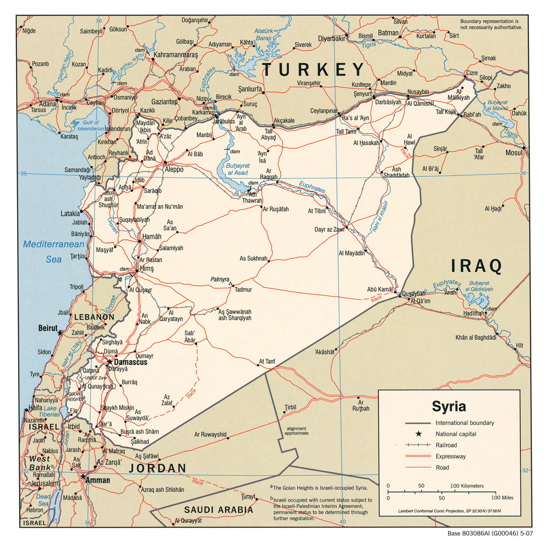
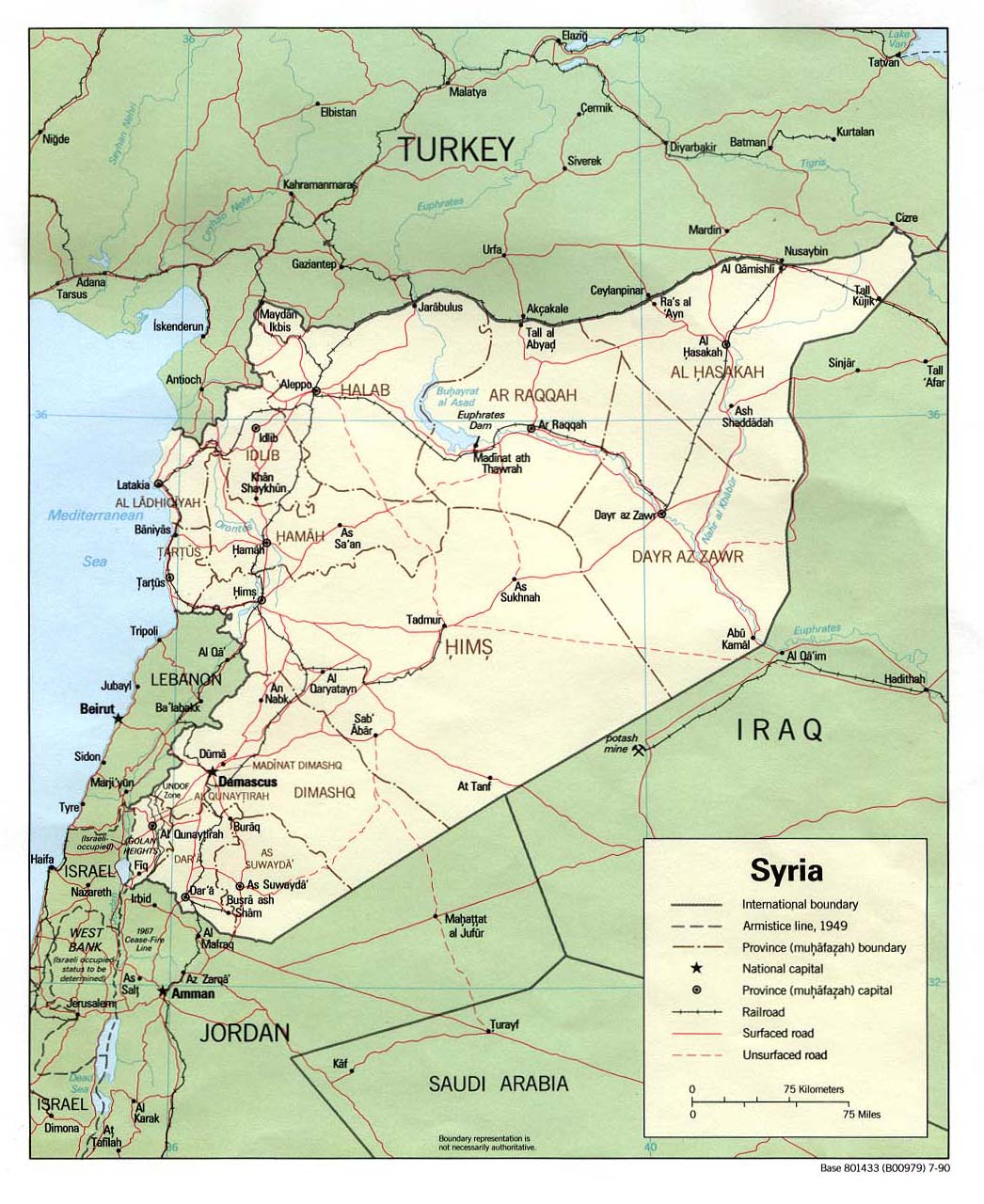
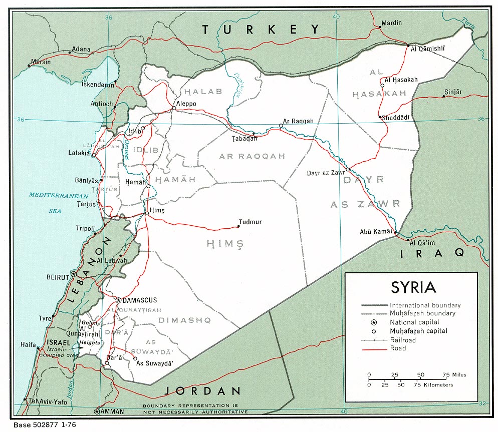
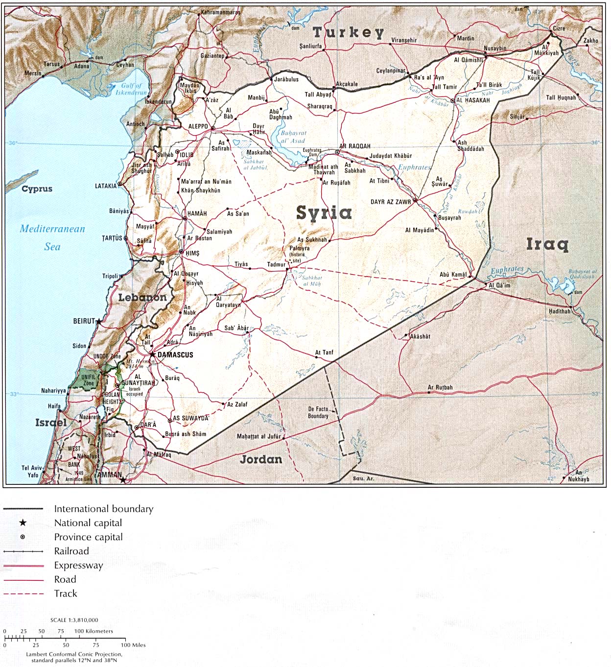
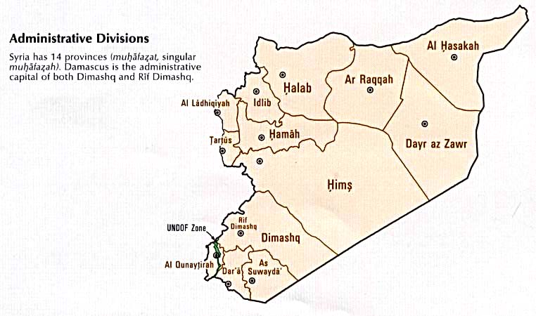
Location map should be the Golan map as it follows the worldview per these mainstream maps:
- http://www.lib.utexas.edu/maps/middle_east_and_asia/syria_pol_2007.jpg
- http://www.lib.utexas.edu/maps/middle_east_and_asia/syria_pol90.jpg
- http://www.lib.utexas.edu/maps/middle_east_and_asia/syria_pol_1976.jpg
- http://www.lib.utexas.edu/maps/atlas_middle_east/syria_map.jpg
- http://www.lib.utexas.edu/maps/middle_east_and_asia/syria_rel90.jpg
- http://www.lib.utexas.edu/maps/cia10/syria_sm_2010.gif
- http://www.lib.utexas.edu/maps/middle_east_and_asia/syria_wall_2004.jpg
- http://www.lib.utexas.edu/maps/middle_east_and_asia/syria_admin_2007.jpg
- http://www.lib.utexas.edu/maps/atlas_middle_east/syria_divisions.jpg
- http://www.lib.utexas.edu/maps/atlas_middle_east/syria_econ.jpg
- http://www.un.org/Depts/Cartographic/map/profile/syria.pdf
--Supreme Deliciousness (talk) 12:14, 15 October 2010 (UTC)
- OK, let's just say everybody is confused where exactly Ghajar is located. British maps say one thing, UN maps say another. As we discussed previously UN themselves discredit their blue line. Couple of months in 1967 the place was not claimed by any nation, remaining a no man land. The people of Ghajar requested to be both part of Lebanon and of Israel and currently the village is populated by Israelis with some holding also Lebanese passport. The blue line is the middle. So strange. AgadaUrbanit (talk) 12:46, 15 October 2010 (UTC)
- You reinserted a map that says this place is in Israel. That is, you intentionally inserted false information into an encyclopedia article. Such behavior should lead to bans. nableezy - 15:34, 21 October 2010 (UTC)
- The village is on the border between Syria and Lebanon, so either a Syria or Lebanon map should be used, not a map of a country it is not in (Israel). --Supreme Deliciousness (talk) 15:39, 21 October 2010 (UTC)
- OK guys. No one says the village is in Israel, the consensus, that you both are part of, is that the village is part of Syria, called Golan Heights, which is occupied by Israel since 1967. The "wrong" image, that you two object, also made clear distinction, in color-coding, between "Israel-proper" and "occupied territories". The real story, according to sources is more complicated than that, but let's leave it alone. The issue here is not to edit Wikipedia to make a WP:POINT though, that we all should be careful about. AgadaUrbanit (talk) 16:45, 21 October 2010 (UTC)
- Dont cite things you havent read. You inserted a map that says it is in Israel and now say "No one says the village is in Israel". Since you now agree the village is not in Israel Ill remove the map that says it is in Israel. nableezy - 16:47, 21 October 2010 (UTC)
- Interesting... Maybe you should re-read WP:AGF. Nab. You are welcome to continue this discussion on my talk page. AgadaUrbanit (talk) 16:50, 21 October 2010 (UTC)
- No, maybe you should read what it is you are writing. You said here that "No one says the village is in Israel" but place in the article a map with alt text that reads "Ghajar is in Israel". nableezy - 16:53, 21 October 2010 (UTC)
- This is a good point, however, tis is not due to text in this article, but due to technical glich in the Wikipedia ;) Don't be mad about it. AgadaUrbanit (talk) 16:56, 21 October 2010 (UTC)
- It is not a "glitch", it is a product of you using a map for Israel in an article on a place nowhere near Israel. nableezy - 17:37, 21 October 2010 (UTC)
- Interesting ;) You should stop pushing your POV, community might not treat it with understanding. According to sources, half of the village is to the north of the Blue Line half to the south. Today the entire village is surrounded by a fence, with no division between the Israeli and Lebanese sides. There is an Israeli army checkpoint at the entrance to the village from Israel. See here. So UN disagrees that it is nowhere near Israel. AgadaUrbanit (talk) 17:44, 21 October 2010 (UTC)
- The UN agrees it is nowhere near Israel, and nobody who has read even a single page from an article about this place would say otherwise. The UN says that last map signed by Syria, Israel, and Lebanon put the village in Syrian territory. Nobody says it is in Israel. I dont need lessons from you on "POV-pushing" you clearly dont know what you are talking about. nableezy - 17:49, 21 October 2010 (UTC)
- UN source talking about no division between the Israeli and Lebanese sides and the entrance to the village from Israel. So I never been there, but I guess you could enter the village from Israel. Thus "nowhere near Israel" is just POV-pushing. Do you read the source differently? AgadaUrbanit (talk) 18:00, 21 October 2010 (UTC)
- No, and you still have no idea what you are talking about. There is no "Israeli side" except for an "Israeli-occupied side". The Blue Line division between Lebanon and the Golan was only to demarcate Lebanese territory, not Israeli territory. Neither the UN nor any other state or organization has ever said that the territory in the Golan south of the Blue Line is "Israeli territory". The Blue Line was created to mark were Israel must withdraw from to no longer be occupying Lebanese territory. Stop annoying me, you dont know what you are talking about. If you do want to learn a thing or two you can try reading “Let Sleeping Dogs Lie:” On Ghajar and Other Anomalies in the Syria-Lebanon-Israel Tri-Border Region. Also, we had this same discussion here which ended with the map used here. Why is it that certain users repeatedly ignore the sources and the past consensus? nableezy - 18:10, 21 October 2010 (UTC)
- Nab, I'm just quoting the UN document, they might be confused, just look another complex issue sub-section here. On personal level, no argument, as I've got older I've realized that I actually know very little about anything and what I thought I knew often turns out to be wrong but I tend to not let that stand in my way of contributing to Wikipedia ;) Stay well. AgadaUrbanit (talk) 18:58, 21 October 2010 (UTC)
- First of all, that isnt a UN document. Second, read the document. It says "This Alawite village is on the border, cut in two by the Blue Line between Lebanon and the Israeli-occupied Golan Heights", not divided in two between Lebanon and Israel. nableezy - 19:16, 21 October 2010 (UTC)
- I guess we're talking about UNIFIL essay, i.e. UN peace keeping forces, that could be described in Wiki lingo as secondary reliable source. You just want to argue, don't you? I guess when you look south from UN positions in Lebanon, you might get confused. Anyway, hope to see you, Nab, at wikimania2011. I guess, from the amount of effort you invest in Wikipedia generally, it is only reasonable to expect to see you there. Just a thought, according to Google maps, the distance between Haifa and the subject of this article is close by and could be easily covered by rental car or something. AgadaUrbanit (talk) 19:43, 21 October 2010 (UTC)
- First of all, that isnt a UN document. Second, read the document. It says "This Alawite village is on the border, cut in two by the Blue Line between Lebanon and the Israeli-occupied Golan Heights", not divided in two between Lebanon and Israel. nableezy - 19:16, 21 October 2010 (UTC)
- Nab, I'm just quoting the UN document, they might be confused, just look another complex issue sub-section here. On personal level, no argument, as I've got older I've realized that I actually know very little about anything and what I thought I knew often turns out to be wrong but I tend to not let that stand in my way of contributing to Wikipedia ;) Stay well. AgadaUrbanit (talk) 18:58, 21 October 2010 (UTC)
- No, and you still have no idea what you are talking about. There is no "Israeli side" except for an "Israeli-occupied side". The Blue Line division between Lebanon and the Golan was only to demarcate Lebanese territory, not Israeli territory. Neither the UN nor any other state or organization has ever said that the territory in the Golan south of the Blue Line is "Israeli territory". The Blue Line was created to mark were Israel must withdraw from to no longer be occupying Lebanese territory. Stop annoying me, you dont know what you are talking about. If you do want to learn a thing or two you can try reading “Let Sleeping Dogs Lie:” On Ghajar and Other Anomalies in the Syria-Lebanon-Israel Tri-Border Region. Also, we had this same discussion here which ended with the map used here. Why is it that certain users repeatedly ignore the sources and the past consensus? nableezy - 18:10, 21 October 2010 (UTC)
- UN source talking about no division between the Israeli and Lebanese sides and the entrance to the village from Israel. So I never been there, but I guess you could enter the village from Israel. Thus "nowhere near Israel" is just POV-pushing. Do you read the source differently? AgadaUrbanit (talk) 18:00, 21 October 2010 (UTC)
- The UN agrees it is nowhere near Israel, and nobody who has read even a single page from an article about this place would say otherwise. The UN says that last map signed by Syria, Israel, and Lebanon put the village in Syrian territory. Nobody says it is in Israel. I dont need lessons from you on "POV-pushing" you clearly dont know what you are talking about. nableezy - 17:49, 21 October 2010 (UTC)
- Interesting ;) You should stop pushing your POV, community might not treat it with understanding. According to sources, half of the village is to the north of the Blue Line half to the south. Today the entire village is surrounded by a fence, with no division between the Israeli and Lebanese sides. There is an Israeli army checkpoint at the entrance to the village from Israel. See here. So UN disagrees that it is nowhere near Israel. AgadaUrbanit (talk) 17:44, 21 October 2010 (UTC)
- It is not a "glitch", it is a product of you using a map for Israel in an article on a place nowhere near Israel. nableezy - 17:37, 21 October 2010 (UTC)
- This is a good point, however, tis is not due to text in this article, but due to technical glich in the Wikipedia ;) Don't be mad about it. AgadaUrbanit (talk) 16:56, 21 October 2010 (UTC)
- No, maybe you should read what it is you are writing. You said here that "No one says the village is in Israel" but place in the article a map with alt text that reads "Ghajar is in Israel". nableezy - 16:53, 21 October 2010 (UTC)
- Interesting... Maybe you should re-read WP:AGF. Nab. You are welcome to continue this discussion on my talk page. AgadaUrbanit (talk) 16:50, 21 October 2010 (UTC)
- Dont cite things you havent read. You inserted a map that says it is in Israel and now say "No one says the village is in Israel". Since you now agree the village is not in Israel Ill remove the map that says it is in Israel. nableezy - 16:47, 21 October 2010 (UTC)
- OK guys. No one says the village is in Israel, the consensus, that you both are part of, is that the village is part of Syria, called Golan Heights, which is occupied by Israel since 1967. The "wrong" image, that you two object, also made clear distinction, in color-coding, between "Israel-proper" and "occupied territories". The real story, according to sources is more complicated than that, but let's leave it alone. The issue here is not to edit Wikipedia to make a WP:POINT though, that we all should be careful about. AgadaUrbanit (talk) 16:45, 21 October 2010 (UTC)
As another user has reverted, without saying one word here or in the edit summary, I have removed the map completely. I will upload one specifically for Ghajar. nableezy - 17:49, 21 October 2010 (UTC)
- Someone might want to just take the Map of the World in .svg format, download it, open it, cut a square, centered on Ghajar, that shows parts of Lebanon, Israel, and Syria, and make a new map out of it. ← George talk 17:58, 21 October 2010 (UTC)
- I just took the Blue Line map from UNIFIL on commons and highlighted Ghajar. nableezy - 18:02, 21 October 2010 (UTC)
- I think that map is quite reasonable, though I might suggest highlighting it more visibly (like with that red dot, or a more contrasting color maybe). It took me a minute to notice the yellow rectangle over that pale orange background. ← George talk 18:35, 21 October 2010 (UTC)
- Changed to dark red for a highlight color. nableezy - 19:12, 21 October 2010 (UTC)
- Still confusing, maybe additional eyeballs are required. Additional concern is that Nab had chosen older version of the map used in the Blue_Line_(Lebanon) article as basis for his contribution. AgadaUrbanit (talk) 19:49, 21 October 2010 (UTC)
- Changed to dark red for a highlight color. nableezy - 19:12, 21 October 2010 (UTC)
- Agree, this is step in more constructive direction. Though the map might need additional tweaking. AgadaUrbanit (talk) 18:58, 21 October 2010 (UTC)
- I think that map is quite reasonable, though I might suggest highlighting it more visibly (like with that red dot, or a more contrasting color maybe). It took me a minute to notice the yellow rectangle over that pale orange background. ← George talk 18:35, 21 October 2010 (UTC)
- I just took the Blue Line map from UNIFIL on commons and highlighted Ghajar. nableezy - 18:02, 21 October 2010 (UTC)
"Lebanon Golan Heights"
In reply to this edit summary, I removed the word "Lebanon" because it simply didn't make sense. It said "Lebanon Golan Heights", which is not something I am familiar with in any way. That's why. Basket of Puppies 17:22, 7 November 2010 (UTC)
- That is partially true, but you also made it say "Lebanon Golan Heights" in this edit where it had said "between Lebanon and the Israeli-occupied area of the Golan Heights". You first removed one part what made sense and then removed the rest when it no longer made sense. nableezy - 18:47, 7 November 2010 (UTC)
- You're right. This is called making a mistake. I am sorry. Basket of Puppies 03:11, 8 November 2010 (UTC)
Needs abbreviating
There is a lot of non-relevant non-NPOV propaganda here - can it all be deleted please by somebody who knows more abot the issue than I do?
Example of irrelevant non-NPOV stuff"After Operation Litani in 1978, Israel turned over its positions inside Lebanon to the South Lebanon Army and inaugurated its Good Fence policy. The United Nations Interim Force in Lebanon (UNIFIL) was created after the incursion, following the adoption of Security Council Resolution 425 in March 1978 to confirm Israeli withdrawal from Southern Lebanon, restore international peace and security, and help the government of Lebanon restore its effective authority in the area.[4] Ghajar expanded northward into Lebanese territory, subsuming the Wazzani settlement north of the border.[2] However, the PLO repeatedly violated the cease-fire and carried out terrorist attacks in Israel in which dozens of Israelis were killed and hundreds injured. [5]A force of 15,000-18,000 PLO members was encamped in Lebanon, with an arsenal of mortars, Katyusha rockets, tanks and anti -aircraft launchers. Israeli strikes and commando raids failed to contain the growth of this PLO army.[6] Thousands of residents of the Galilee were forced to flee their homes or sit in bomb shelters. In June 1982, after Abu Nidal masterminded an assassination attempt on Israel's ambassador to Great Britain, Shlomo Argov,[7] Israel launched Operation Peace for Galilee.[8] In 2000, following the campaign promise and election of Ehud Barak as Prime Minister, Israel withdrew their troops from Lebanon. In an attempt to demarcate permanent borders between Israel and Lebanon, the United Nations drew up what became known as the Blue Line. Due to Ghajar's location, wedged between Lebanon and the Israeli-controlled Golan Heights, the northern half of the village came under Lebanese control and the southern part remained under Israeli control.[9]This arrangement created much resentment among the residents, who see themselves as Syrian.[10]" —Preceding unsigned comment added by Aa42john (talk • contribs) 09:49, 18 November 2010 (UTC)
I brought up almost the exact same thing above and it was reinserted without explanation.--Supreme Deliciousness (talk) 16:24, 16 December 2010 (UTC)
- This information is based on reliable sources and it has everything to do with Ghajar. Do not delete it because you "don't like it." You are not the only person who can edit this article and decide what goes into it. The fact that this material has been reinserted several times indicates that there is no consensus for removing it. So don't.--Delishisoup (talk) 17:06, 16 December 2010 (UTC)
- I didn't remove it because I "don't like it.", but because it has nothing to do with Ghajar, its about the conflict between the PLO and Israel, this article is about Ghajar. Your comment above: "it has everything to do with Ghajar" is not an explanation for why the text is about Ghajar. All of it is sourced to the Jewish Virtual Library, which is an unreliable source, which means that it should be removed even if it had something to do with Ghajar, which in this case it doesn't. Consensus is based on arguments, you have not provided an argument for why text from an unreliable source about the conflict between the PLO and Israel should be in this article. --Supreme Deliciousness (talk) 17:34, 16 December 2010 (UTC)
- Jewish Virtual Library is a reliable source based on articles written by leading historians. In light of past comments, I wonder if your opposition to it has something to do with the site calling itself "Jewish." Furthermore, JVL is only one source. For some reason, you have ignored the fact that the material is also backed up by the BBC and Haaretz. The text in question provides vital background for the dispute, without which Israel's responses are incomprehensible. Many editors have brought it back after your attempts to delete it, which shows there is no consensus for its removal. This article is not long and doesn't need pruning. If anything it needs more information, not less.--Delishisoup (talk) 17:53, 16 December 2010 (UTC)
- I didn't remove the Haaretz and BBC source. JVL is not a reliable source. JVL has "Myths and facts" material:[2], It has hundreds maybe even thousands of articles sourced to Wikipedia:[3], JVL is part of the "American-Israeli Cooperative Enterprise" [4] and the Executive Director of it is Mitchell G. Bard who has worked for the American Israel Public Affairs Committee's (AIPAC)[5]. JVL also contains texts that are in direct contradiction to reliable sources: [6]. Has maps of Israel that shows the occupied territories as part of Israel: [7][8][9][10] JVLs articles almost always lack sources and authorship (including the JVL article you want to use here), the few times its articles links to sources they almost always lack inline citations and are inconsistent linking to broken links or main websites and not articles: [11]. I have here shown plenty of reasons for why its an unreliable source. The text you added does not provide any vital background for the "dispute", it has nothing to do with Ghajar, if people want to read about the Lebanon war they can click on the link. What you have done is cherry picking irrelevant texts from unreliable sources about the Arab-Israeli conflict with no connection to Ghajar. Do you want me to ad to this article that Palestinians were ethnically cleansed from their lands and that this was the reason why the PLO was created and launched attacks against Israel? --Supreme Deliciousness (talk) 23:16, 16 December 2010 (UTC)
- Jewish Virtual Library is a reliable source based on articles written by leading historians. In light of past comments, I wonder if your opposition to it has something to do with the site calling itself "Jewish." Furthermore, JVL is only one source. For some reason, you have ignored the fact that the material is also backed up by the BBC and Haaretz. The text in question provides vital background for the dispute, without which Israel's responses are incomprehensible. Many editors have brought it back after your attempts to delete it, which shows there is no consensus for its removal. This article is not long and doesn't need pruning. If anything it needs more information, not less.--Delishisoup (talk) 17:53, 16 December 2010 (UTC)
- I didn't remove it because I "don't like it.", but because it has nothing to do with Ghajar, its about the conflict between the PLO and Israel, this article is about Ghajar. Your comment above: "it has everything to do with Ghajar" is not an explanation for why the text is about Ghajar. All of it is sourced to the Jewish Virtual Library, which is an unreliable source, which means that it should be removed even if it had something to do with Ghajar, which in this case it doesn't. Consensus is based on arguments, you have not provided an argument for why text from an unreliable source about the conflict between the PLO and Israel should be in this article. --Supreme Deliciousness (talk) 17:34, 16 December 2010 (UTC)
- This information is based on reliable sources and it has everything to do with Ghajar. Do not delete it because you "don't like it." You are not the only person who can edit this article and decide what goes into it. The fact that this material has been reinserted several times indicates that there is no consensus for removing it. So don't.--Delishisoup (talk) 17:06, 16 December 2010 (UTC)
- Can someone explain to me what the connection between the PLO and Ghajar is? Being well sourced is fine and dandy, but the content in question fails to establish why it is important to the subject of this article. ← George talk 22:16, 16 December 2010 (UTC)
- In this case its not well sourced, the text is from the JVL.--Supreme Deliciousness (talk) 23:16, 16 December 2010 (UTC)