
Goshen County, Wyoming: Difference between revisions
Caveman1949 (talk | contribs) →History: History of the county and origin of the name |
Caveman1949 (talk | contribs) →History: Correct reference for creation of county |
||
| Line 19: | Line 19: | ||
== History == |
== History == |
||
Goshen County was created on February 21, 1911 with land given up by [[Laramie County, Wyoming|Laramie County]]<ref>{{cite web|url= http://historical-county.newberry.org/website/ |
Goshen County was created on February 21, 1911 with land given up by [[Laramie County, Wyoming|Laramie County]].<ref name=chronology>{{cite web|url= http://historical-county.newberry.org/website/Wyoming/documents/WY_Individual_County_Chronologies.htm#Individual_County_Chronologies |title=Wyoming: Individual County Chronologies |accessdate= 2011-09-06 |author= |last= Long |first= John H. |authorlink= |coauthors= |date= |year= 2006|month= |format= |work= Wyoming Atlas of Historical County Boundaries|publisher= The Newberry Library}}</ref> |
||
The county was named for Goshen Hole, a valley in the southwest part of the county <ref>{{cite book | last = Urbanek | first = Mae | title = Wyoming Place Names | publisher = Mountain Press Publishing Company |location= Missoula, MT | year = 1988 | isbn = 0-87842-204-8}}</ref> At least four conflicting stories are available for the origin of the name Goshen Hole. |
The county was named for Goshen Hole, a valley in the southwest part of the county <ref>{{cite book | last = Urbanek | first = Mae | title = Wyoming Place Names | publisher = Mountain Press Publishing Company |location= Missoula, MT | year = 1988 | isbn = 0-87842-204-8}}</ref> At least four conflicting stories are available for the origin of the name Goshen Hole. |
||
Revision as of 16:06, 6 September 2011
Goshen County | |
|---|---|
 Location within the U.S. state of Wyoming | |
 Wyoming's location within the U.S. | |
| Coordinates: 42°05′N 104°22′W / 42.09°N 104.36°W | |
| Country | |
| State | |
| Founded | 1911 |
| Seat | Torrington |
| Largest city | Torrington |
| Area | |
| • Total | 2,232 sq mi (5,780 km2) |
| • Land | 2,225 sq mi (5,760 km2) |
| • Water | 7 sq mi (20 km2) 0.31% |
| Population (2010) | |
| • Total | 13,249 |
| • Density | 6/sq mi (2.3/km2) |
| Website | goshencounty |
Goshen County is a county located in the U.S. state of Wyoming. As of 2010, the population was 13,249. Its county seat is TorringtonTemplate:GR.
History
Goshen County was created on February 21, 1911 with land given up by Laramie County.[1]
The county was named for Goshen Hole, a valley in the southwest part of the county [2] At least four conflicting stories are available for the origin of the name Goshen Hole.
In the late spring of 2009, a weather research team known as VORTEX2 observed the full life cycle of a tornado near the border with Nebraska in Goshen County.
Geography
According to the U.S. Census Bureau, the county has a total area of 2,232 square miles (5,780.9 km2), of which 2,225 square miles (5,762.7 km2) is land and 7 square miles (18.1 km2) (0.31%) is water.
Adjacent counties
- Niobrara County, Wyoming - north
- Platte County, Wyoming - west
- Laramie County, Wyoming - south
- Banner County, Nebraska - southeast
- Scotts Bluff County, Nebraska - east
- Sioux County, Nebraska - east
Major Highways
National protected area
Demographics
| Census | Pop. | Note | %± |
|---|---|---|---|
| 1920 | 8,064 | — | |
| 1930 | 11,754 | 45.8% | |
| 1940 | 12,207 | 3.9% | |
| 1950 | 12,634 | 3.5% | |
| 1960 | 11,941 | −5.5% | |
| 1970 | 10,885 | −8.8% | |
| 1980 | 12,040 | 10.6% | |
| 1990 | 12,373 | 2.8% | |
| 2000 | 12,538 | 1.3% | |
| 2010 | 13,249 | 5.7% |

As of the censusTemplate:GR of 2000, there were 12,538 people, 5,061 households, and 3,426 families residing in the county. The population density was 6 people per square mile (2/km²). There were 5,881 housing units at an average density of 3 per square mile (1/km²). The racial makeup of the county was 93.83% White, 0.20% Black or African American, 0.86% Native American, 0.20% Asian, 0.12% Pacific Islander, 3.65% from other races, and 1.14% from two or more races. 8.83% of the population were Hispanic or Latino of any race. 38.2% were of German, 10.4% English, 8.0% American and 8.0% Irish ancestry according to Census 2000.
There were 5,061 households out of which 28.60% had children under the age of 18 living with them, 56.70% were married couples living together, 7.70% had a female householder with no husband present, and 32.30% were non-families. 27.60% of all households were made up of individuals and 13.10% had someone living alone who was 65 years of age or older. The average household size was 2.38 and the average family size was 2.90.
In the county the population was spread out with 24.20% under the age of 18, 9.40% from 18 to 24, 24.30% from 25 to 44, 24.80% from 45 to 64, and 17.30% who were 65 years of age or older. The median age was 40 years. For every 100 females there were 98.90 males. For every 100 females age 18 and over, there were 95.00 males.
The median income for a household in the county was $32,228, and the median income for a family was $40,297. Males had a median income of $27,713 versus $17,584 for females. The per capita income for the county was $15,965. About 9.70% of families and 13.90% of the population were below the poverty line, including 16.30% of those under age 18 and 12.50% of those age 65 or over.
Government and infrastructure
The Wyoming Department of Corrections Wyoming Medium Correctional Institution is located in unincorporated Goshen County, near Torrington.[3][4][5] WMCI, a facility of the Wyoming Department of Corrections, serves as an intake center for men who are not sentenced to death. The grand opening and ribbon cutting occurred on January 6, 2010.[6]
Communities
City
Towns
Census-designated places
Other community
See also
References
- ^ Long, John H. (2006). "Wyoming: Individual County Chronologies". Wyoming Atlas of Historical County Boundaries. The Newberry Library. Retrieved 2011-09-06.
{{cite web}}: Cite has empty unknown parameters:|month=and|coauthors=(help) - ^ Urbanek, Mae (1988). Wyoming Place Names. Missoula, MT: Mountain Press Publishing Company. ISBN 0-87842-204-8.
- ^ "Torrington city, Wyoming." U.S. Census Bureau. Retrieved on December 12, 2010.
- ^ "Wyoming Medium Correctional Institution (WMCI)." Goshen County GIS Department. 2009. Retrieved on December 12, 2010.
- ^ "Contact Institutions." Wyoming Department of Corrections. Retrieved on August 22, 2010. "7076 Road 55F Torrington, WY 82240"
- ^ "Wyoming Medium Correctional Institution." Wyoming Department of Corrections. Retrieved on August 22, 2010.
Places adjacent to Goshen County, Wyoming | ||||||||||||||||
|---|---|---|---|---|---|---|---|---|---|---|---|---|---|---|---|---|
| ||||||||||||||||
Municipalities and communities of Goshen County, Wyoming, United States | ||
|---|---|---|
| City | 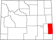 | |
| Towns | ||
| CDPs | ||
| Unincorporated community | ||