Santa Catarina, Cape Verde: Difference between revisions
cleanup |
mNo edit summary |
||
| Line 8: | Line 8: | ||
| area = 242.6 |
| area = 242.6 |
||
}} |
}} |
||
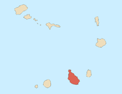
'''Santa Catarina''' is a ''[[Administrative divisions of Cabo Verde|concelho]]'' (municipality) of [[Cape Verde]]. It is situated in the western part of the island of [[Santiago, Cape Verde|Santiago]]. Its seat is the town [[Assomada]]. Its population was |
'''Santa Catarina''' is a ''[[Administrative divisions of Cabo Verde|concelho]]'' (municipality) of [[Cape Verde]]. It is situated in the western part of the island of [[Santiago, Cape Verde|Santiago]]. Its seat is the town [[Assomada]]. Its population was 44,388 at the 2013 census.<ref name=census10/> |
||
==Subdivisions== |
==Subdivisions== |
||
| Line 80: | Line 80: | ||
| '''1990'''<ref name="Stat"/><ref name="forty to two thousand"/> |
| '''1990'''<ref name="Stat"/><ref name="forty to two thousand"/> |
||
| '''2000'''<ref name="forty to two thousand"/><ref>Source: [http://www.ine.cv/index.aspx Instituto Nacional de Estatísticas].</ref> |
| '''2000'''<ref name="forty to two thousand"/><ref>Source: [http://www.ine.cv/index.aspx Instituto Nacional de Estatísticas].</ref> |
||
| ''' |
| '''2013'''<ref name=census13/> |
||
|- style="text-align:center;" |
|- style="text-align:center;" |
||
| 26848 |
| 26848 |
||
| Line 89: | Line 89: | ||
| 41584 |
| 41584 |
||
| 50024 |
| 50024 |
||
| |
| 44388 |
||
|} |
|} |
||
Revision as of 13:12, 28 April 2014
Santa Catarina | |
|---|---|
Municipality | |
 | |
| Country | Cape Verde |
| Island | Santiago |
| Area | |
| • Total | 242.6 km2 (93.7 sq mi) |
| Population (2010)[1] | |
| • Total | 43,297 |
| • Density | 180/km2 (460/sq mi) |
| ID | 72 |
Santa Catarina is a concelho (municipality) of Cape Verde. It is situated in the western part of the island of Santiago. Its seat is the town Assomada. Its population was 44,388 at the 2013 census.[1]
Subdivisions
The municipality consists of one freguesia (civil parish), Santa Catarina. The freguesia is subdivided into the following settlements:
- Achada Galego
- Achada Gomes
- Achada Lazão
- Achada Leite
- Achada Lém
- Achada Ponta
- Achada Tossa
- Aguas Podres
- Arribada
- Assomada
- Banana Semedo
- Boa Entrada
- Boa Entradinha
- Bombardeiro
- Chã de Lagoa
- Chã de Tanque
- Charco
- Cruz Grande
- Entre Picos
- Entre Picos de Reda
- Figueira das Naus
- Fonte Lima
- Fonteana
- Fundura
- Furna
- Gamchemba
- Gil Bispo
- Japluma
- João Bernardo
- João Dias
- Junco
- Librão
- Lugar Velho
- Mancholy
- Mato Baixo
- Mato Gege
- Mato Sancho
- Palha Carga
- Pata Brava
- Pau Verde
- Pingo Chuva
- Pinha dos Engenhos
- Ribeira da Barca
- Ribeira Riba
- Ribeirão Isabel
- Ribeirão Manuel
- Rincão
- Saltos Acima
- Sedeguma
- Serra Malagueta
- Tomba Touro
History
By the end of the 19th century, the Municipality of Santa Catarina occupied the northern half of the island, while the southern half was the Municipality of Praia. In the beginning of the 20th century, two northern parishes of the municipality were split off to become the Municipality of Tarrafal. In 2005, a southern parish of the Municipality was split off to become the Municipality of São Salvador do Mundo.
Demography
| Population of Santa Catarina, Cape Verde (1940—2010) | |||||||
|---|---|---|---|---|---|---|---|
| 1940[2][3] | 1950[2][3] | 1960[2][3] | 1970[2][3] | 1980[2][3] | 1990[2][3] | 2000[3][4] | 2013[5] |
| 26848 | 19428 | 30207 | 41462 | 41012 | 41584 | 50024 | 44388 |
Persons
- António Mascarenhas Monteiro (b. February 16, 1944), a former president of Cape Verde from March 22, 1991 to March 22, 2001.
- Ivone Ramos (b.July 9, 1926)
- Jose Maria Neves (b. March 28, 1960), Cape Verdean statesman
International relations
Santa Catarina is twinned with:
References
- ^ a b "2010 Census results". Instituto Nacional de Estatística Cabo Verde (in Portuguese). 24 November 2016.
- ^ a b c d e f Source: Statoids
- ^ a b c d e f g Includes the population of the present-day São Salvador do Mundo municipality.
- ^ Source: Instituto Nacional de Estatísticas.
- ^ Cite error: The named reference
census13was invoked but never defined (see the help page). - ^ "Lisboa - Geminações de Cidades e Vilas". Associação Nacional de Municípios Portugueses [National Association of Portuguese Municipalities] (in Portuguese). Retrieved 2013-08-23.
{{cite web}}: Unknown parameter|trans_title=ignored (|trans-title=suggested) (help)

