
Haliyal: Difference between revisions
Content deleted Content added
No edit summary Tags: Reverted Visual edit Mobile edit Mobile web edit |
Restored revision 1125512148 by Vismayanews (talk): Undid revision |
||
| Line 58: | Line 58: | ||
}} |
}} |
||
'''Haliyala''' is a [[town]] in [[Uttara Kannada]] |
'''Haliyala''' is a [[town]] in [[Uttara Kannada]] in the [[India]]n [[States and territories of India|state]] of [[Karnataka]]. It is the headquarters town for Haliyal Taluk. It can be classified as a [[Main road towns|main-road town]]. |
||
==Geography== |
==Geography== |
||
| Line 66: | Line 66: | ||
==Demographics== |
==Demographics== |
||
In the 2001 Indian [[census]], Haliyal had a population of 20,652. Males constituted 51% of the population. Haliyal had an average literacy rate of 66%, higher than the national average (59.5%); male literacy was 72%, and female literacy was 60%. In 2001 in Haliyal, 13% of the population was under 6 years of age.<ref>{{cite web|url=http://www.censusindia.net/results/town.php?stad=A&state5=999|archive-url=https://web.archive.org/web/20040616075334/http://www.censusindia.net/results/town.php?stad=A&state5=999|archive-date=2004-06-16|title= Census of India 2001: Data from the 2001 Census, including cities, villages and towns (Provisional)|access-date=2008-11-01|publisher= Census Commission of India}}</ref> |
In the 2001 Indian [[census]], Haliyal had a population of 20,652. Males constituted 51% of the population. Haliyal had an average literacy rate of 66%, higher than the national average (59.5%); male literacy was 72%, and female literacy was 60%. In 2001 in Haliyal, 13% of the population was under 6 years of age.<ref>{{cite web|url=http://www.censusindia.net/results/town.php?stad=A&state5=999|archive-url=https://web.archive.org/web/20040616075334/http://www.censusindia.net/results/town.php?stad=A&state5=999|archive-date=2004-06-16|title= Census of India 2001: Data from the 2001 Census, including cities, villages and towns (Provisional)|access-date=2008-11-01|publisher= Census Commission of India}}</ref> Kannada is the main language spoken in the city. |
||
== Media == |
== Media == |
||
Revision as of 13:00, 16 July 2023
Haliyala | |
|---|---|
Town | |
 Haliyala Location in Karnataka, India | |
| Coordinates: 15°19′50″N 74°45′53″E / 15.33056°N 74.76472°E | |
| Country | |
| State | Karnataka |
| Region | Malenadu |
| District | Uttara Kannada |
| Elevation | 559 m (1,834 ft) |
| Population (2001) | |
| • Total | 20,652 |
| Languages | |
| • Official | Kannada |
| Time zone | UTC+5:30 (IST) |
| PIN | 581329 |
| Vehicle registration | KA65 |
| Lok Sabha constituency | Uttara Kannada |
| Vidhan Sabha constituency | Haliyal |
| Website | haliyalatown |
Haliyala is a town in Uttara Kannada in the Indian state of Karnataka. It is the headquarters town for Haliyal Taluk. It can be classified as a main-road town.
Geography
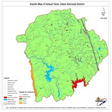
Haliyal has an average elevation of 559 metres (1834 feet).
Demographics
In the 2001 Indian census, Haliyal had a population of 20,652. Males constituted 51% of the population. Haliyal had an average literacy rate of 66%, higher than the national average (59.5%); male literacy was 72%, and female literacy was 60%. In 2001 in Haliyal, 13% of the population was under 6 years of age.[1] Kannada is the main language spoken in the city.
Media
- Karwar eNews[2] is a major local newspaper in the region.
See also
References
- ^ "Census of India 2001: Data from the 2001 Census, including cities, villages and towns (Provisional)". Census Commission of India. Archived from the original on 16 June 2004. Retrieved 1 November 2008.
- ^ http://www.karwarenews.com Archived 4 February 2009 at the Wayback Machine Karwar website
Forts in Karnataka
This article related to a location in Uttara Kannada district, Karnataka, India is a stub. You can help Wikipedia by expanding it. |