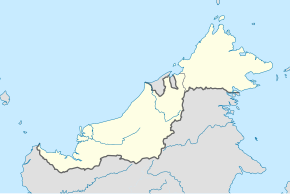
Selangau District
Appearance
This article needs additional citations for verification. (January 2018) |
Selangau District | |
|---|---|
| Coordinates: 2°29′57″N 112°19′19″E / 2.49917°N 112.32194°E | |
| District Office location | Selangau |
| Local area government | Sibu Rural District Council |
| Area | |
| • Total | 3,795 km2 (1,465 sq mi) |
| Population (2018[1]) | |
| • Total | 22,100 (projection) |
| District Officer | Inting@Enting Anak Nyami[2] |
| Postcode | 96000 |

The Selangau District is a district in Sarawak, Malaysia.[3]
History
[edit]Selangau was declared a district on 1 March 2002.[4]
Demographics
[edit]According to the Department of Statistics Malaysia, Selangau has a population of 26,100.[1]
References
[edit]- ^ a b c "Population Demography by Districts". Jabatan Perangkaan Malaysia. Retrieved 4 July 2018.
- ^ "Pejabat Daerah Selangau" (in Malay). Pentadbiran Bahagian Sibu. Retrieved 4 July 2018.
- ^ "Sarawak Population". The Official Portal of the Sarawak Government. Retrieved 7 January 2018.
- ^ Florence Genta (15 April 2018). "More developments in store for Selangau". New Sarawak Tribune. Retrieved 4 July 2018.


