Pimento, Indiana
Pimento, Indiana | |
|---|---|
 | |
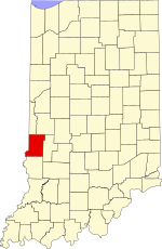
 Vigo County's location in Indiana | |
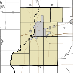
Location in Vigo County, Indiana | |
| Coordinates: 39°18′34″N 87°22′45″W / 39.30944°N 87.37917°W | |
| Country | United States |
| State | Indiana |
| County | Vigo |
| Township | Linton |
| Elevation | 600 ft (183 m) |
| Time zone | UTC-5 (Eastern (EST)) |
| • Summer (DST) | UTC-4 (EDT) |
| ZIP code | 47866[2] |
| Area code(s) | 812, 930 |
| FIPS code | 18-59868[3] |
| GNIS feature ID | 441145 |
Pimento is an unincorporated community in Linton Township, Vigo County, in the U.S. state of Indiana.[4] It is part of the Terre Haute Metropolitan Statistical Area.
Pimento has one listing on the National Register of Historic Places, the Linton Township High School and Community Building.
History
[edit]Formerly known as Hartford, Pimento was laid out in 1852 by Israel French. The name was changed to Pimento when it became a railroad station on the Evansville & Terre Haute Railroad. Thomas French made the first location in the place and put up a store. The next year came Harvey Weeks, who became a partner in the store. N. B. Bennett began a drug store in 1865, and then a grocery store. A large flour mill was built in 1877, and a tavern, large dry goods store and blacksmith shop soon followed. A town-house was erected in 1858 and the lower part used as a school house.[5]
The post office at Pimento has been in operation since 1855.[6]
Geography
[edit]Pimento is located at 39°18′34″N 87°22′45″W / 39.30944°N 87.37917°W.
References
[edit]- ^ "US Board on Geographic Names". United States Geological Survey. October 25, 2007. Retrieved January 31, 2008.
- ^ "Pimento ZIP Code". zipdatamaps.com. 2022. Retrieved November 11, 2022.
- ^ "U.S. Census website". United States Census Bureau. Retrieved January 31, 2008.
- ^ "Pimento, Indiana". Geographic Names Information System. United States Geological Survey. Retrieved August 7, 2017.
- ^ Bradsby, H.C. (1891). History of Vigo County, Indiana, with Biographical Selections. Chicago: S. B. Nelson & Co. pp. 479.
- ^ "Vigo County". Jim Forte Postal History. Retrieved July 14, 2016.


