
Lashio
Lashio | |
|---|---|
 Lashio | |
| Country | |
| Admin. division | Shan State |
| District | Lashio District |
| Township | Lashio Township |
| Elevation | 2,746 ft (836 m) |
| Population (1960) | |
| • Total | 5,000 |
| • Religions | Buddhism |
Lashio (Burmese: လာရှီုးမြို့; MLCTS: la hri: mrui.;) is the largest town in northern Shan State, Myanmar, about 200 kilometres (125 miles) northeast of Mandalay. It is situated on a low mountain spur overlooking the valley of the Nam Yao river. The population, which in 1960 counted some 5000 souls, is made up of mostly Bamar (Burmans), Shan and Chinese. The annual rainfall averages 54 in. The average maximum temperature is 80.5° and the average minimum 55.5°.[1][2] The Census of 1983 counted a population of 88,590.
History
The British colonial period in this part of the country began in 1883, and the Burma Railways line from Mandalay reached Lashio in 1903[3].
Before British rule Lashio was also the centre of authority for the northern Shan States, but the Burmese post in the valley was close to the Nam Yao, in an old Chinese fortified camp. The Lashio valley was formerly very populous; but a rebellion, started by the sawbwa of Hsenwi, about ten years before the British occupation, ruined it.
In 1900, the town of Lashio consisted of the European station, with court house and quarters for the civil officers; the military police post, the headquarters of the Lashio battalion of military police; and the native station, in which the various nationalities, Shans, Burmans, Hindus and Mahommedans, who were divided into separate quarters, with reserves for government servants and for the temporary residences of the five sawbwas of the northern Shan States; and a bazaar.
Transport
Lashio is located at the end of the Burma Road, and at the terminus of the [Mandalay-Kun Long railway. It is also the end point of the government cart road from Mandalay, from which it is 178 m. distant.
Culture
Religious sites include the Sasana (Pyilon Chanta) Pagoda and the Mansu Pagoda. Yepusan spa is nearly five miles away from the city center, and is healthful in winter. In 2000, Lashio was important for border trade between Burma and China. [citation needed]
Lashio Thein Aung is a famous Burmese singer who derived his name from this city.
The town is home to the Lashio Degree College.
References
See also
Gallery
-
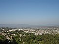 Lashio sight
 -
 Lashio chinese temple 臘戌觀音寺
 -
 Lashio gate
 -
Nagayon pagoda
-
 Sudownpyi pogoda
 -
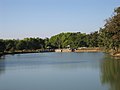 big pool
 -
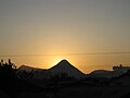 Lashio sunglow


This article incorporates text from a publication now in the public domain: Chisholm, Hugh, ed. (1911). Encyclopædia Britannica (11th ed.). Cambridge University Press. {{cite encyclopedia}}: Missing or empty |title= (help)
22°56′N 97°45′E / 22.933°N 97.750°E

