
Loch Ness: Difference between revisions
Uranium Site (talk | contribs) m Reverted 2 edits by 85.255.236.221 (talk) to last revision by Sjö |
ad ref for max depth |
||
| (37 intermediate revisions by 7 users not shown) | |||
| Line 1: | Line 1: | ||
{{Use dmy dates|date=October 2021}} |
|||
{{for|the monster|Loch Ness Monster}} |
{{for|the monster|Loch Ness Monster}} |
||
{{other uses}} |
{{other uses}} |
||
| Line 22: | Line 23: | ||
| area = {{convert|21.8|sqmi|abbr=on|order=flip}} |
| area = {{convert|21.8|sqmi|abbr=on|order=flip}} |
||
| depth = {{convert|132|m|abbr=on}} |
| depth = {{convert|132|m|abbr=on}} |
||
| max-depth = {{convert|226.96|m|fathom ft|abbr=on}} |
| max-depth = {{convert|226.96|m|fathom ft|abbr=on}}<ref name=cooperS /> |
||
| volume = {{convert|1.8|cumi|abbr=on|order=flip}} |
| volume = {{convert|1.8|cumi|abbr=on|order=flip}} |
||
| residence_time = |
| residence_time = |
||
| shore = |
| shore = |
||
| elevation = {{convert|15.8|m|abbr=on}} |
| elevation = {{convert|15.8|m|abbr=on}} |
||
| islands = 1 ( |
| islands = 1 (Cherry Island) |
||
| cities = [[Fort Augustus]], [[Invermoriston]], [[Drumnadrochit]], [[Abriachan]], [[Lochend (Loch Ness)|Lochend]]; [[Whitebridge, Scotland|Whitebridge]], [[Foyers]], [[Inverfarigaig]], [[Dores, Highland|Dores]]. |
| cities = [[Fort Augustus]], [[Invermoriston]], [[Drumnadrochit]], [[Abriachan]], [[Lochend (Loch Ness)|Lochend]]; [[Whitebridge, Scotland|Whitebridge]], [[Foyers]], [[Inverfarigaig]], [[Dores, Highland|Dores]]. |
||
}} |
}} |
||
'''Loch Ness''' ({{IPAc-en|ˌ|l|ɒ|x|_|ˈ|n|ɛ|s}}; {{lang-gd|Loch Nis}} {{IPA-gd|l̪ˠɔx ˈniʃ|}}) is a large freshwater [[loch]] in the [[Scottish Highlands]] extending for approximately {{convert|37|km|abbr=off}} southwest of [[Inverness]]. It is named for the [[River Ness]], which flows from the northern end. Loch Ness is best known for alleged sightings of the [[cryptozoology|cryptozoological]] [[Loch Ness Monster]], also known affectionately as "Nessie" ({{lang-gd|Niseag}}). It is one of a series of interconnected, murky bodies of water in Scotland; its water visibility is exceptionally low due to a high [[peat]] content in the surrounding soil. The southern end connects to [[Loch Oich]] by the [[River Oich]] and a section of the [[Caledonian Canal]]. The northern end connects to [[Loch Dochfour]] via the River Ness, which then ultimately leads to the [[North Sea]] via the [[Moray Firth]]. |
|||
'''Loch Ness''' ({{IPAc-en|ˌ|l|ɒ|x|_|ˈ|n|ɛ|s}}; {{lang-gd|Loch Nis}}<ref>{{cite book | pages = 60 | url = https://books.google.com/books?id=uQVsjhSlwLgC&q=loch+ness+loch+nis&pg=PA60 | title = Score Higher on the UKCAT: The Expert Guide from Kaplan, with Over 800 Questions and a Mock Online Test | publisher = Oxford University Press | year = 2012 | author = Brian Holmes, Marianna Parker, Katie Hunt |isbn = 9780199698288| access-date = 2019-11-24 }}</ref> {{IPA-gd|l̪ˠɔx ˈniʃ|}}) is a large, deep, freshwater [[loch]] in the [[Scottish Highlands]] extending for approximately {{convert|37|km|abbr=off}} southwest of [[Inverness]]. Its surface is {{convert|52|ft|order=flip|abbr=off}} above [[sea level]]. |
|||
Loch Ness is the second-largest [[List of lochs in Scotland|Scottish loch]] by surface area after [[Loch Lomond]] at {{convert|56|km2|abbr=on}}, but due to its great depth it is the largest by volume in the British Isles. Its deepest point is {{convert|230|m|fathom ft|0|abbr=off}}, making it the second deepest loch in Scotland after [[Loch Morar]]. It contains more water than all the lakes in England and Wales combined, and is the largest body of water in the [[Great Glen]], which runs from Inverness in the north to [[Fort William, Scotland|Fort William]] in the south. Its surface is {{convert|52|ft|order=flip|abbr=off}} above [[sea level]]. It contains a single, artificial island named Cherry Island ({{lang-gd|Eilean Muireach}}) at the southwestern end. There are nine villages around the loch, as well as [[Urquhart Castle]]; the village of [[Drumnadrochit]] contains a "Loch Ness Centre and Exhibition". |
|||
Loch Ness is best known for alleged sightings of the [[cryptozoology|cryptozoological]] [[Loch Ness Monster]], also known affectionately as "Nessie" ({{lang-gd|Niseag}}). It is connected at the southern end by the [[River Oich]] and a section of the [[Caledonian Canal]] to [[Loch Oich]]. At the northern end there is the Bona [[Narrows]] which opens out into [[Loch Dochfour]], which feeds the [[River Ness]] and a further section of canal to [[Inverness]], ultimately leading to the [[North Sea]] via the [[Moray Firth]]. It is one of a series of interconnected, murky bodies of water in Scotland; its water visibility is exceptionally low due to a high [[peat]] content in the surrounding soil. |
|||
==Geography== |
|||
[[Image:Loch Ness.jpg|thumb|right|200px|Map of Loch Ness]] |
|||
At {{convert|56|km2|abbr=on}}, |
Loch Ness is an elongated freshwater [[loch]] in the [[Scottish Highlands]] southwest of [[Inverness]], extending for approximately {{convert|37|km|abbr=off}} and flowing from southwest to northeast. At {{convert|56|km2|abbr=on}}, it is the second-largest [[List of lochs in Scotland|Scottish loch]] by surface area after [[Loch Lomond]], but due to its great depth it is the largest by volume in the British Isles. Its deepest point is {{convert|230|m|fathom ft|0|abbr=off}},<ref>{{cite web |title=Bathymetrical Survey of the Fresh-Water Lochs of Scotland, 1897–1909 |url= http://www.nls.uk/maps/early/bathymetric/main_info.html |publisher=[[National Library of Scotland]] |archive-url = https://web.archive.org/web/20070208122134/http://www.nls.uk/maps/early/bathymetric/main_info.html |archive-date = 8 February 2007}}</ref><ref name=scotgaz>{{cite web |url= http://www.scottish-places.info/features/featurefirst2397.html |title= Ness, Loch |publisher= The Gazetteer for Scotland |access-date= 9 February 2010 |archive-date= 22 July 2011 |archive-url= https://web.archive.org/web/20110722032352/http://www.scottish-places.info/features/featurefirst2397.html |url-status= live }}</ref> making it the second deepest loch in Scotland after [[Loch Morar]]. A 2016 survey claimed to have discovered a crevice extending to a depth of {{convert|889|ft|m|0|order=flip|abbr=on}}, but further research determined this to be a [[sonar]] anomaly.<ref>{{cite news |url= https://www.telegraph.co.uk/news/newstopics/howaboutthat/12108324/A-new-hideaway-for-the-Loch-Ness-monster-Skipper-uncovers-900-feet-deep-crevice.html |title= A new hideaway for the Loch Ness monster? Skipper claims to have uncovered deepest crevice yet |newspaper= The Telegraph |access-date= 4 March 2016 |archive-date= 21 March 2016 |archive-url= https://web.archive.org/web/20160321093201/http://www.telegraph.co.uk/news/newstopics/howaboutthat/12108324/A-new-hideaway-for-the-Loch-Ness-monster-Skipper-uncovers-900-feet-deep-crevice.html |url-status= live }}</ref> Its surface is {{convert|52|ft|order=flip|abbr=off}} above [[sea level]]. It contains more water than all the lakes in England and Wales combined,<ref name=scotgaz /> and is the largest body of water in the [[Great Glen]], which runs from Inverness in the north to [[Fort William, Scotland|Fort William]] in the south. Loch Ness lies along the [[Great Glen Fault]], which forms a line of weakness in the rocks which have been excavated by glacial erosion, forming the [[Great Glen]] and the basins of [[Loch Lochy]], [[Loch Oich]] and Loch Ness.<ref>{{cite journal |last=Piccardi |first=Luigi |author-link=John Tuzo Wilson |title=Post-glacial activity and earthquakes of the Great Glen Fault (Scotland) |journal=Memorie Descrittive della Carta Geologica d'Italia |volume=96 |pages=431–446 |date=2014 |url=http://www.isprambiente.gov.it/it/pubblicazioni/periodici-tecnici/memorie-descrittive-della-carta-geologica-ditalia/memdes_96_piccardi2.pdf |access-date=6 April 2016 |archive-date=20 April 2016 |archive-url=https://web.archive.org/web/20160420050544/http://www.isprambiente.gov.it/it/pubblicazioni/periodici-tecnici/memorie-descrittive-della-carta-geologica-ditalia/memdes_96_piccardi2.pdf |url-status=live }}</ref> |
||
Loch Ness has one small island, Cherry Island ({{lang-gd|Eilean Muireach}}, meaning Murdoch's Island), at the southwestern end of the loch. It is an artificial island, known as a [[crannog]], and was probably constructed during the [[Iron Age]].<ref name=Blundell>{{citation|url=http://ads.ahds.ac.uk/catalogue/adsdata/PSAS_2002/pdf/vol_043/43_159_164.pdf|first=O.|last=Blundell|year=1909|title=Proceedings of the Society of Antiquaries of Scotland|volume=43|pages=159–164|mode=cs1|access-date=29 June 2008|archive-date=31 October 2008|archive-url=https://web.archive.org/web/20081031121603/http://ads.ahds.ac.uk/catalogue/adsdata/PSAS_2002/pdf/vol_043/43_159_164.pdf|url-status=live}}</ref> The island was originally {{convert|160|ft|m}} by {{convert|168|ft|m}} across, but is now smaller as the water level was raised during the construction of the [[Caledonian Canal]] in the early nineteenth century.<ref name=Blundell/> There was formerly a second, natural island nearby named Dog Island ({{lang-gd|Eilean Nan Con}}), but it was submerged when the water level rose.<ref name=Blundell/><ref>http://ads.ahds.ac.uk/catalogue/adsdata/arch-352-1/dissemination/pdf/vol_043/43_159_164.pdf</ref> A castle stood on Cherry Island during the 15th century; this was constructed of stone and oak wood and was probably used as a fortified refuge. It has been suggested that Eilean Muireach may have been a hunting lodge, with Eilean Nan Con the home for the hunting dogs.<ref name=Blundell/> |
|||
| ⚫ | |||
Loch Ness is named for the [[river Ness]] which flows from the loch's northern end. The river's name probably derives from an old Celtic word meaning "roaring one".<ref>{{cite web|url=https://www.etymonline.com/word/loch|title=Online Etymology Dictionary|access-date=20 June 2020}}</ref> |
|||
The loch is one of a series of interconnected, murky bodies of water in Scotland; its water visibility is exceptionally low due to a high [[peat]] content in the surrounding soil. The southern end is fed by the [[River Oich]], which runs from Loch Oich. The northern end flows out through the Bona [[Narrows]] into the [[River Ness]], which connects to the nearby [[Loch Dochfour]] and ultimately leads through Inverness to the [[North Sea]] via the [[Moray Firth]]. Loch Ness forms part of the Caledonian Canal, which comprises {{convert|60|mi|km|-1|abbr=off}} of waterways connecting the east coast of Scotland at Inverness with the west coast at [[Corpachthe]] near [[Fort William, Scotland|Fort William]]. Only one-third of the entire length is man-made, the rest being formed by Loch Dochfour, Loch Ness, Loch Oich, and Loch Lochy, with the man-made canals running parallel with rivers such as the River Oich.<ref name=BW-Cldn-Cnl-waterscape>{{cite web |title=Caledonian Canal |series=Canals and rivers – [[British Waterways#Waterscape|Waterscape]] |publisher=[[British Waterways]] |url=http://www.waterscape.com/canals-and-rivers/caledonian-canal |archive-url=https://web.archive.org/web/20120305135130/http://www.waterscape.com/canals-and-rivers/caledonian-canal |archive-date=5 March 2012}}</ref> |
|||
William Mac Kay in his book ''Urquhart and Glenmoriston: Olden times in a highland parish'', published in 1914, claims that the origin of the name is from an old Scottish legend which contains the sentence "Tha loch ‘nis ann, tha loch ‘nis ann!" ("There's a loch now, there's a loch now!"). |
|||
==Villages and places== |
===Villages and places=== |
||
{| class="wikitable" |
{| class="wikitable" |
||
|+ Places on Loch Ness |
|+ {{sronly|Places on Loch Ness}} |
||
!scope=col| Shore |
|||
!scope=col| Places |
|||
|- |
|- |
||
!scope=row| Northern |
|||
! North |
|||
| |
|||
* [[Lochend (Loch Ness)|Lochend]] |
|||
|- |
|- |
||
| ⚫ | |||
!rowspan=2|Shores |
|||
| ⚫ | |||
| ⚫ | |||
|- valign=top |
|||
| |
| |
||
* [[Abriachan]] |
* [[Abriachan]] |
||
| Line 58: | Line 59: | ||
* [[Urquhart Castle]] |
* [[Urquhart Castle]] |
||
* [[Invermoriston]] |
* [[Invermoriston]] |
||
|- |
|||
| ⚫ | |||
| |
| |
||
* [[Dores, Highland|Dores]] |
* [[Dores, Highland|Dores]] |
||
| Line 64: | Line 67: | ||
* [[Whitebridge, Scotland|Whitebridge]] |
* [[Whitebridge, Scotland|Whitebridge]] |
||
|- |
|- |
||
!scope=row| Southern |
|||
! South |
|||
| |
|||
|colspan=2 width=350 style="text-align:center"|[[Fort Augustus]] |
|||
* [[Fort Augustus]] |
|||
|} |
|} |
||
At [[Drumnadrochit]] is the "Loch Ness Centre and Exhibition"<ref>{{cite web|url=http://www.lochness.com|title=The Loch Ness Centre}}</ref> which examines the natural history and legend of Loch Ness. Boat cruises operate from various locations on the loch shore, giving visitors the chance to look for the "[[Loch Ness Monster|monster]]". |
At [[Drumnadrochit]] is the "Loch Ness Centre and Exhibition"<ref>{{cite web|url=http://www.lochness.com|title=The Loch Ness Centre|access-date=28 October 2021|archive-date=20 June 2010|archive-url=https://web.archive.org/web/20100620220710/http://www.lochness.com/|url-status=live}}</ref> which examines the natural history and legend of Loch Ness. Boat cruises operate from various locations on the loch shore, giving visitors the chance to look for the "[[Loch Ness Monster|monster]]". |
||
[[Urquhart Castle]] is located on the western shore, {{convert|2|km|mi|abbr=off|frac=4}} east of Drumnadrochit. |
[[Urquhart Castle]] is located on the western shore, {{convert|2|km|mi|abbr=off|frac=4}} east of Drumnadrochit. |
||
| ⚫ | [[Lighthouses in Scotland|Lighthouses]] are located at the northern and southern ends at Lochend ([[Bona Lighthouse]]) and Fort Augustus. There is an [[RNLI]] lifeboat station on the northern shore near Drumnadrochit, which has been operational since 2008 and was the first non-coastal RNLI station.<ref>{{cite news |title=RNLI is heading inland with Loch Ness Lifeboat |url=https://www.heraldscotland.com/news/12460810.rnli-is-heading-inland-with-loch-ness-lifeboat/ |date=28 March 2008 |access-date=12 August 2020 |newspaper=[[The Herald (Glasgow)|The Herald]] |location=Glasgow |archive-date=28 October 2021 |archive-url=https://web.archive.org/web/20211028120302/https://www.heraldscotland.com/default_content/12460810.rnli-heading-inland-loch-ness-lifeboat/ |url-status=live }}</ref> It is staffed by a volunteer crew and equipped with an inshore lifeboat (ILB).<ref>{{cite web |url=https://rnli.org/find-my-nearest/lifeboat-stations/loch-ness-lifeboat-station |title=Find my nearest > Lifeboat stations > Loch Ness Lifeboat Station |publisher=[[Royal National Lifeboat Institution]] |website=rnli.org |access-date=12 August 2020 |archive-date=6 September 2020 |archive-url=https://web.archive.org/web/20200906090823/https://rnli.org/find-my-nearest/lifeboat-stations/loch-ness-lifeboat-station |url-status=live }}</ref> |
||
[[Lighthouses in Scotland|Lighthouses]] are located at Lochend ([[Bona Lighthouse]]) and Fort Augustus. |
|||
| ⚫ | |||
Loch Ness is named for the River Ness which flows from the loch's northern end. The river's name probably derives from an old Celtic word meaning "roaring one".<ref>{{cite web|url=https://www.etymonline.com/word/loch|title=Online Etymology Dictionary|access-date=20 June 2020|archive-date=22 June 2020|archive-url=https://web.archive.org/web/20200622070423/https://www.etymonline.com/word/loch|url-status=live}}</ref> William Mackay in his 1893 book ''Urquhart and Glenmoriston: Olden times in a highland parish'' recounts two Scottish legends that have been reported as the source of the name. In the first, a spring in a valley had been enchanted by Daly the Druid for purity, with the admonition that the well opening must be covered by a stone whenever not in use, or else "desolation will overtake the land". One day a woman left the well uncovered when rushing to save her baby from a fire, and it overflowed and filled the vale, forming the loch. The inhabitants cried out "Tha loch 'nis ann, tha loch 'nis ann!" ("There's a loch now, there's a loch now!"), and so it was named "Loch Nis". A second legend, named "The Tales of the Sons of Uisneach" by Mackay and now considered part of the [[Ulster Cycle]] of [[Irish mythology]],<!-- it's usually called "The Tragic Tale of the Sons of Uisnech", or "Exiles of the Sons of Uisnech", in the Táin Bó Cúailnge --> recounts the Irish woman [[Deirdre]] or Dearduil, "the most beautiful woman of her age", who was courted by the king of [[Ulster]], [[Conchobar mac Nessa|Conachar MacNessa]]; she fell in love instead with his cousin [[Naoise|Noais]], son of Uisneach. They fled to Scotland and were married on the banks of the loch, but Noais was slain by MacNessa, and the Loch Naois, River Naois, and Iverness were named after him. Mackay claims that while these legends are not the "true" origin of the name, that many places in the district have names associated with "The Tales of the Sons of Uisneach", and that the same tales have Conachar MacNessa's mother as the river goddess Ness. He argued instead that the etymology of the Celtic "Ness" derived from earlier words for "river".<ref>{{cite book |title=Urquhart and Glenmoriston: Olden times in a highland parish |last=Mackay |first=William |year=1893 |publisher=Northern Counties Newspaper and Printing and Publishing Company |pages=5–7, 575}}</ref> |
|||
==Loch Ness Monster== |
==Loch Ness Monster== |
||
{{Main|Loch Ness Monster}} |
{{Main|Loch Ness Monster}} |
||
Loch Ness is known as the home of the Loch Ness Monster (also known as "Nessie"), a [[cryptid]], reputedly a large unknown animal. It is similar to other supposed lake monsters in Scotland and elsewhere, though its description varies from one account to the next. Popular interest and belief in the animal's existence have varied since it was first brought to the world's attention in 1933.<ref>{{Cite web |
Loch Ness is known as the home of the Loch Ness Monster (also known as "Nessie"), a [[cryptid]], reputedly a large unknown animal. It is similar to other supposed lake monsters in Scotland and elsewhere, though its description varies from one account to the next. Popular interest and belief in the animal's existence have varied since it was first brought to the world's attention in 1933.<ref>{{Cite web| url = http://www.nessie.co.uk/| title = The Legend of Nessie the Ultimate Loch Ness Monster Site| last = Nessie| first = Legend of| website = www.nessie.co.uk| access-date = 28 February 2016| archive-date = 21 May 2013| archive-url = https://web.archive.org/web/20130521155250/http://nessie.co.uk/| url-status = live}}</ref> |
||
| url = http://www.nessie.co.uk/| title = The Legend of Nessie the Ultimate Loch Ness Monster Site| last = Nessie| first = Legend of |
|||
| website = www.nessie.co.uk| access-date = 2016-02-28}}</ref> |
|||
==Lifeboat== |
|||
| ⚫ | There is an [[RNLI]] lifeboat station on |
||
==Fish species== |
==Fish species== |
||
[[Image:Loch Ness from Urquhart Castle - kingsley - 30-JUN-09.jpg|thumb|right|250px|Urquhart Bay and Loch Ness viewed from Grant's Tower at [[Urquhart Castle]]]] |
[[Image:Loch Ness from Urquhart Castle - kingsley - 30-JUN-09.jpg|thumb|right|250px|Urquhart Bay and Loch Ness viewed from Grant's Tower at [[Urquhart Castle]]]] |
||
The following fish species are native to Loch Ness. A number of others such as [[European perch|perch]] and [[Common roach|roach]] have been [[Introduced species|introduced]] in the Loch or [[Caledonian Canal]] with various levels of success.<ref>Loch Ness Information site: ''[http://www.loch-ness.org/fishandothervertebrates.html The Fish and Invertebrates of Loch Ness.]'' Retrieved 24 March 2015.</ref> |
The following fish species are native to Loch Ness. A number of others such as [[European perch|perch]] and [[Common roach|roach]] have been [[Introduced species|introduced]] in the Loch or [[Caledonian Canal]] with various levels of success.<ref>Loch Ness Information site: ''[http://www.loch-ness.org/fishandothervertebrates.html The Fish and Invertebrates of Loch Ness.] {{Webarchive|url=https://web.archive.org/web/20150316033003/http://www.loch-ness.org/fishandothervertebrates.html |date=16 March 2015 }}'' Retrieved 24 March 2015.</ref> |
||
{| class="wikitable" |
{| class="wikitable" |
||
| Line 110: | Line 112: | ||
|- |
|- |
||
|} |
|} |
||
==Island == |
|||
Loch Ness has one island, [[Cherry Island (Loch Ness)|Cherry Island]], at the southwestern end of the loch, near [[Fort Augustus]]. It is an artificial island, known as a [[crannog]], and was probably constructed during the [[Iron Age]].<ref name=Blundell>{{citation|url=http://ads.ahds.ac.uk/catalogue/adsdata/PSAS_2002/pdf/vol_043/43_159_164.pdf|first=O.|last=Blundell|year=1909|title=Proceedings of the Society of Antiquaries of Scotland|volume=43|pages=159–164|mode=cs1}}</ref> |
|||
There was formerly a second island (Dog Island) but this was submerged when the water level was raised during the construction of the [[Caledonian Canal]].<ref name=Blundell/> |
|||
==Hydroelectricity== |
==Hydroelectricity== |
||
Loch Ness serves as the lower storage reservoir for the [[Falls of Foyers|Foyers]] [[pumped-storage hydroelectricity|pumped-storage]] [[hydroelectricity|hydroelectric]] scheme, which was the first of its kind in the [[United Kingdom]]. The turbines were originally used to provide power for a nearby [[aluminium]] [[smelting]] plant, but now [[electricity]] is generated and supplied to the [[National Grid (Great Britain)|National Grid]]. Another scheme, the 100-[[Watt|megawatt]] [[Glendoe Hydro Scheme]] near [[Fort Augustus]], began generation in June 2009.<ref>{{Cite |
Loch Ness serves as the lower storage reservoir for the [[Falls of Foyers|Foyers]] [[pumped-storage hydroelectricity|pumped-storage]] [[hydroelectricity|hydroelectric]] scheme, which was the first of its kind in the [[United Kingdom]] when it opened in 1975.<ref name=cooperS>{{cite thesis |last=Cooper |first=Michael Colin |date=1999 |title=Laminated Sediments of Loch Ness, Scotland: Indicators of Holocene Environmental Change |type=PhD |chapter=Site description |publisher=University of Plymouth |url=https://www.reddit.com/r/SquaredCircle/comments/qjoglz/other_than_reverend_dvon_beating_triple_h_in_2002/ |access-date=31 October 2021}}</ref> The turbines were originally used to provide power for a nearby [[aluminium]] [[smelting]] plant, but now [[electricity]] is generated and supplied to the [[National Grid (Great Britain)|National Grid]]. Another scheme, the 100-[[Watt|megawatt]] [[Glendoe Hydro Scheme]] near [[Fort Augustus]], began generation in June 2009.<ref>{{Cite web |url=http://www.glendoe.co.uk/ |title=Glendoe Hydro scheme |publisher=[[Scottish and Southern Energy]] |access-date=28 August 2007 |url-status=dead |archive-url=https://web.archive.org/web/20070828020540/http://www.glendoe.co.uk/ |archive-date=28 August 2007 }}</ref> It was out of service between 2009 and 2012 for repair of the tunnels connecting the reservoir to the turbines.<ref>{{Cite web |url= http://news.bbc.co.uk/2/hi/uk_news/scotland/highlands_and_islands/7591395.stm |title= Hydro-electric scheme's dam close |date= 1 September 2008 |publisher= [[BBC]] |access-date= 9 February 2010 |archive-date= 5 January 2009 |archive-url= https://web.archive.org/web/20090105014058/http://news.bbc.co.uk/2/hi/uk_news/scotland/highlands_and_islands/7591395.stm |url-status= live }}</ref><ref>{{cite web|url=http://www.sse.com/Glendoe/TheAsset/|title=SSE Glendoe}}{{Dead link|date=July 2018 |bot=InternetArchiveBot |fix-attempted=yes }}</ref> |
||
==Geology== |
|||
Loch Ness lies along the [[Great Glen Fault]], which forms a line of weakness in the rocks which have been excavated by glacial erosion, forming the [[Great Glen]] and the basins of [[Loch Lochy]], [[Loch Oich]] and Loch Ness.<ref>{{cite journal |last=Piccardi |first=Luigi |author-link=John Tuzo Wilson |title=Post-glacial activity and earthquakes of the Great Glen Fault (Scotland) |journal=Memorie Descrittive della Carta Geologica d'Italia |volume=96 |pages=431–446 |date=2014 |url=http://www.isprambiente.gov.it/it/pubblicazioni/periodici-tecnici/memorie-descrittive-della-carta-geologica-ditalia/memdes_96_piccardi2.pdf}}</ref> |
|||
==Image gallery== |
==Image gallery== |
||
<gallery mode="packed"> |
<gallery mode="packed"> |
||
File:Fort Augustus locks 2017.jpg|Locks on [[Caledonian Canal]] in [[Fort Augustus]], Loch Ness in the background |
|||
File:Loch Ness 0406.JPG|Loch Ness looking south, taken in May 2006. |
|||
File:Loch_Ness_Panorama.png|Sunrise over Loch Ness, taken at [[Urquhart Castle]] |
|||
File:Loch_Ness_Panoramin_July_2008.JPG|Loch Ness panorama from a ship in 2008 |
|||
File:Cherry Island - geograph.org.uk - 648235.jpg|Cherry Island |
|||
Image:Loch ness , Urquhart castle exit .jpg|Loch Ness Urquhart castle |
|||
</gallery> |
</gallery> |
||
==Loch Ness records== |
==Loch Ness records== |
||
[[John Cobb (racing driver)|John Cobb]] died in an attempt at the [[water speed record]] when his boat ''[[Crusader (speedboat)|Crusader]]'' struck an unexplained wake on the surface of the loch in 1952.<ref>{{cite news |title=Loch Ness could become testing ground for world water speed record 64 years after tragedy |url=https://www.express.co.uk/news/uk/656203/Loch-Ness-become-testing-ground-world-water-speed-record-year-after-tragedy |date=March |
[[John Cobb (racing driver)|John Cobb]] died in an attempt at the [[water speed record]] when his boat ''[[Crusader (speedboat)|Crusader]]'' struck an unexplained wake on the surface of the loch in 1952.<ref>{{cite news |title=Loch Ness could become testing ground for world water speed record 64 years after tragedy |url=https://www.express.co.uk/news/uk/656203/Loch-Ness-become-testing-ground-world-water-speed-record-year-after-tragedy |date=28 March 2016 |access-date=19 January 2018 |newspaper=[[Daily Express]] |archive-date=20 January 2018 |archive-url=https://web.archive.org/web/20180120070450/https://www.express.co.uk/news/uk/656203/Loch-Ness-become-testing-ground-world-water-speed-record-year-after-tragedy |url-status=live }}</ref> His accident was recorded by the BBC reporters on site at the time.<ref>{{cite web|last=Gallacher|first=Terry|title=Loch Ness 1966|date=8 April 2011|url=http://terencegallacher.wordpress.com/2011/04/08/loch-ness-1966/|access-date=24 May 2012|archive-date=9 September 2011|archive-url=https://web.archive.org/web/20110909081118/http://terencegallacher.wordpress.com/2011/04/08/loch-ness-1966/|url-status=live}}</ref> Nearby, there is a memorial to him erected by the people of [[Glenurquhart]]. |
||
On 31 August 1974, David Scott Munro, of Ross-shire Caberfeidh Water Ski Club, became the first person in the world to [[water ski]] (mono ski) the length of Loch Ness. From Lochend to [[Fort Augustus]] and back, he covered the {{convert|48|miles|order=flip|abbr=in}} in 77 minutes at an average speed of {{convert|37|mph|km/h|abbr=on|order=flip}}.<ref>{{citation|title=Press & Journal newspaper|publisher=Inverness edition|date=2 September 1974|mode=cs1}}</ref> |
On 31 August 1974, David Scott Munro, of Ross-shire Caberfeidh Water Ski Club, became the first person in the world to [[water ski]] (mono ski) the length of Loch Ness. From Lochend to [[Fort Augustus]] and back, he covered the {{convert|48|miles|order=flip|abbr=in}} in 77 minutes at an average speed of {{convert|37|mph|km/h|abbr=on|order=flip}}.<ref>{{citation|title=Press & Journal newspaper|publisher=Inverness edition|date=2 September 1974|mode=cs1}}</ref> |
||
In July 1966, [[Brenda Sherratt]] became the first person to swim the length of the loch. It took her 31 hours and 27 minutes.<ref>{{Cite web|url=https://openwaterswimming.com/2014/06/a-birthday-swim-to-remember/|title=Brenda Sherratt's Birthday Swim To Remember|website=Open Water Swimming|access-date=2020- |
In July 1966, [[Brenda Sherratt]] became the first person to swim the length of the loch. It took her 31 hours and 27 minutes.<ref>{{Cite web|url=https://openwaterswimming.com/2014/06/a-birthday-swim-to-remember/|title=Brenda Sherratt's Birthday Swim To Remember|website=Open Water Swimming|date=8 June 2014|access-date=17 August 2020|archive-date=28 October 2021|archive-url=https://web.archive.org/web/20211028120314/https://www.openwaterswimming.com/wp-admin/admin-ajax.php|url-status=live}}</ref> |
||
==References== |
==References== |
||
{{reflist}} |
{{reflist}} |
||
| Line 146: | Line 139: | ||
{{portal|Lakes}} |
{{portal|Lakes}} |
||
* {{Commons category-inline|Loch Ness}} |
* {{Commons category-inline|Loch Ness}} |
||
* {{Commons category-inline|Cherry Island, Loch Ness|Cherry Island}} |
|||
* {{Wikivoyage-inline|Loch Ness}} |
* {{Wikivoyage-inline|Loch Ness}} |
||
* Cherry Island {{gbmapping|NH385102}} |
|||
* [http://www.Loch-Ness.org/ Loch Ness information Website, Editor Tony Harmsworth] |
|||
* Cherry Island coordinates: {{coord|57.15417|-4.67153|type:landmark_region:GB_source:enwiki-osgb36(NH385102)|display=inline|name=Cherry Island}} |
|||
* [http://www.lochnessproject.org/ Loch Ness Project Research Site, Editor Adrian Shine] |
|||
* [http://www.lochnessinvestigation.com/ Loch Ness Investigation website, Editor Dick Raynor] |
|||
* [http://www.castlepictures.com/lochness/ Loch Ness Pictures] |
|||
* [https://web.archive.org/web/20150520002817/http://www.lochnessphotographs.com/ Loch Ness Photographs] |
|||
* [https://web.archive.org/web/20081008034436/http://www.discover360.co.uk/portfolio_lochness.html Virtual Tour of Loch Ness and surrounding area] |
|||
* [http://www.nessieland.co.uk/ Nessieland at Loch Ness] |
|||
{{Authority control}} |
{{Authority control}} |
||
{{DEFAULTSORT:Ness}} |
{{DEFAULTSORT:Ness}} |
||
[[Category: |
[[Category:Loch Ness]] |
||
[[Category:Freshwater lochs of Scotland]] |
[[Category:Freshwater lochs of Scotland]] |
||
[[Category:Lochs of Highland (council area)]] |
|||
[[Category:Ness basin|LNess]] |
[[Category:Ness basin|LNess]] |
||
[[Category:Loch Ness]] |
|||
Revision as of 19:14, 31 October 2021
| Loch Ness | |
|---|---|
 With Urquhart Castle in the foreground | |
 Loch Ness | |
| Location | Scottish Highlands |
| Coordinates | 57°18′N 4°27′W / 57.300°N 4.450°W |
| Type | freshwater loch, oligotrophic, dimictic[1] |
| Primary inflows | River Oich/Caledonian Canal, River Moriston, River Foyers, River Enrick, River Coiltie |
| Primary outflows | River Ness/Caledonian Canal |
| Catchment area | 1,770 km2 (685 sq mi) |
| Basin countries | Scotland, United Kingdom |
| Max. length | 36.2 km (22.5 mi) |
| Max. width | 2.7 km (1.7 mi) |
| Surface area | 56 km2 (21.8 sq mi) |
| Average depth | 132 m (433 ft) |
| Max. depth | 226.96 m (124.10 fathoms; 744.6 ft)[2] |
| Water volume | 7.5 km3 (1.8 cu mi) |
| Surface elevation | 15.8 m (52 ft) |
| Islands | 1 (Cherry Island) |
| Settlements | Fort Augustus, Invermoriston, Drumnadrochit, Abriachan, Lochend; Whitebridge, Foyers, Inverfarigaig, Dores. |
Loch Ness (/ˌlɒx ˈnɛs/; Scottish Gaelic: Loch Nis [l̪ˠɔx ˈniʃ]) is a large freshwater loch in the Scottish Highlands extending for approximately 37 kilometres (23 miles) southwest of Inverness. It is named for the River Ness, which flows from the northern end. Loch Ness is best known for alleged sightings of the cryptozoological Loch Ness Monster, also known affectionately as "Nessie" (Scottish Gaelic: Niseag). It is one of a series of interconnected, murky bodies of water in Scotland; its water visibility is exceptionally low due to a high peat content in the surrounding soil. The southern end connects to Loch Oich by the River Oich and a section of the Caledonian Canal. The northern end connects to Loch Dochfour via the River Ness, which then ultimately leads to the North Sea via the Moray Firth.
Loch Ness is the second-largest Scottish loch by surface area after Loch Lomond at 56 km2 (22 sq mi), but due to its great depth it is the largest by volume in the British Isles. Its deepest point is 230 metres (126 fathoms; 755 feet), making it the second deepest loch in Scotland after Loch Morar. It contains more water than all the lakes in England and Wales combined, and is the largest body of water in the Great Glen, which runs from Inverness in the north to Fort William in the south. Its surface is 16 metres (52 feet) above sea level. It contains a single, artificial island named Cherry Island (Scottish Gaelic: Eilean Muireach) at the southwestern end. There are nine villages around the loch, as well as Urquhart Castle; the village of Drumnadrochit contains a "Loch Ness Centre and Exhibition".
Geography

Loch Ness is an elongated freshwater loch in the Scottish Highlands southwest of Inverness, extending for approximately 37 kilometres (23 miles) and flowing from southwest to northeast. At 56 km2 (22 sq mi), it is the second-largest Scottish loch by surface area after Loch Lomond, but due to its great depth it is the largest by volume in the British Isles. Its deepest point is 230 metres (126 fathoms; 755 feet),[3][4] making it the second deepest loch in Scotland after Loch Morar. A 2016 survey claimed to have discovered a crevice extending to a depth of 271 m (889 ft), but further research determined this to be a sonar anomaly.[5] Its surface is 16 metres (52 feet) above sea level. It contains more water than all the lakes in England and Wales combined,[4] and is the largest body of water in the Great Glen, which runs from Inverness in the north to Fort William in the south. Loch Ness lies along the Great Glen Fault, which forms a line of weakness in the rocks which have been excavated by glacial erosion, forming the Great Glen and the basins of Loch Lochy, Loch Oich and Loch Ness.[6]
Loch Ness has one small island, Cherry Island (Scottish Gaelic: Eilean Muireach, meaning Murdoch's Island), at the southwestern end of the loch. It is an artificial island, known as a crannog, and was probably constructed during the Iron Age.[7] The island was originally 160 feet (49 m) by 168 feet (51 m) across, but is now smaller as the water level was raised during the construction of the Caledonian Canal in the early nineteenth century.[7] There was formerly a second, natural island nearby named Dog Island (Scottish Gaelic: Eilean Nan Con), but it was submerged when the water level rose.[7][8] A castle stood on Cherry Island during the 15th century; this was constructed of stone and oak wood and was probably used as a fortified refuge. It has been suggested that Eilean Muireach may have been a hunting lodge, with Eilean Nan Con the home for the hunting dogs.[7]
The loch is one of a series of interconnected, murky bodies of water in Scotland; its water visibility is exceptionally low due to a high peat content in the surrounding soil. The southern end is fed by the River Oich, which runs from Loch Oich. The northern end flows out through the Bona Narrows into the River Ness, which connects to the nearby Loch Dochfour and ultimately leads through Inverness to the North Sea via the Moray Firth. Loch Ness forms part of the Caledonian Canal, which comprises 60 miles (100 kilometres) of waterways connecting the east coast of Scotland at Inverness with the west coast at Corpachthe near Fort William. Only one-third of the entire length is man-made, the rest being formed by Loch Dochfour, Loch Ness, Loch Oich, and Loch Lochy, with the man-made canals running parallel with rivers such as the River Oich.[9]
Villages and places
| Shore | Places |
|---|---|
| Northern | |
| Western | |
| Eastern | |
| Southern |
At Drumnadrochit is the "Loch Ness Centre and Exhibition"[10] which examines the natural history and legend of Loch Ness. Boat cruises operate from various locations on the loch shore, giving visitors the chance to look for the "monster".
Urquhart Castle is located on the western shore, 2 kilometres (1+1⁄4 miles) east of Drumnadrochit.
Lighthouses are located at the northern and southern ends at Lochend (Bona Lighthouse) and Fort Augustus. There is an RNLI lifeboat station on the northern shore near Drumnadrochit, which has been operational since 2008 and was the first non-coastal RNLI station.[11] It is staffed by a volunteer crew and equipped with an inshore lifeboat (ILB).[12]
Etymology
Loch Ness is named for the River Ness which flows from the loch's northern end. The river's name probably derives from an old Celtic word meaning "roaring one".[13] William Mackay in his 1893 book Urquhart and Glenmoriston: Olden times in a highland parish recounts two Scottish legends that have been reported as the source of the name. In the first, a spring in a valley had been enchanted by Daly the Druid for purity, with the admonition that the well opening must be covered by a stone whenever not in use, or else "desolation will overtake the land". One day a woman left the well uncovered when rushing to save her baby from a fire, and it overflowed and filled the vale, forming the loch. The inhabitants cried out "Tha loch 'nis ann, tha loch 'nis ann!" ("There's a loch now, there's a loch now!"), and so it was named "Loch Nis". A second legend, named "The Tales of the Sons of Uisneach" by Mackay and now considered part of the Ulster Cycle of Irish mythology, recounts the Irish woman Deirdre or Dearduil, "the most beautiful woman of her age", who was courted by the king of Ulster, Conachar MacNessa; she fell in love instead with his cousin Noais, son of Uisneach. They fled to Scotland and were married on the banks of the loch, but Noais was slain by MacNessa, and the Loch Naois, River Naois, and Iverness were named after him. Mackay claims that while these legends are not the "true" origin of the name, that many places in the district have names associated with "The Tales of the Sons of Uisneach", and that the same tales have Conachar MacNessa's mother as the river goddess Ness. He argued instead that the etymology of the Celtic "Ness" derived from earlier words for "river".[14]
Loch Ness Monster
Loch Ness is known as the home of the Loch Ness Monster (also known as "Nessie"), a cryptid, reputedly a large unknown animal. It is similar to other supposed lake monsters in Scotland and elsewhere, though its description varies from one account to the next. Popular interest and belief in the animal's existence have varied since it was first brought to the world's attention in 1933.[15]
Fish species

The following fish species are native to Loch Ness. A number of others such as perch and roach have been introduced in the Loch or Caledonian Canal with various levels of success.[16]
| European eel | Anguilla anguilla |
| Northern pike | Esox lucius |
| European sea sturgeon | Acipenser sturio (unconfirmed in the Loch, but known from Beauly–Moray Firth, which is connected via the River Ness) |
| Three-spined stickleback | Gasterosteus aculeatus. |
| Brook lamprey | Lampetra planeri |
| Eurasian minnow | Phoxinus phoxinus |
| Atlantic salmon | Salmo salar |
| Sea trout | Salmo trutta |
| Brown trout (ferox trout) | Salmo trutta (Salmo ferox) |
| Arctic char | Salvelinus alpinus |
Hydroelectricity
Loch Ness serves as the lower storage reservoir for the Foyers pumped-storage hydroelectric scheme, which was the first of its kind in the United Kingdom when it opened in 1975.[2] The turbines were originally used to provide power for a nearby aluminium smelting plant, but now electricity is generated and supplied to the National Grid. Another scheme, the 100-megawatt Glendoe Hydro Scheme near Fort Augustus, began generation in June 2009.[17] It was out of service between 2009 and 2012 for repair of the tunnels connecting the reservoir to the turbines.[18][19]
Image gallery
-
 Locks on Caledonian Canal in Fort Augustus, Loch Ness in the background
 -
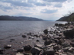 Loch Ness looking south, taken in May 2006.
 -
 Sunrise over Loch Ness, taken at Urquhart Castle
 -
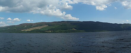 Loch Ness panorama from a ship in 2008
 -
 Cherry Island


Loch Ness records
John Cobb died in an attempt at the water speed record when his boat Crusader struck an unexplained wake on the surface of the loch in 1952.[20] His accident was recorded by the BBC reporters on site at the time.[21] Nearby, there is a memorial to him erected by the people of Glenurquhart.
On 31 August 1974, David Scott Munro, of Ross-shire Caberfeidh Water Ski Club, became the first person in the world to water ski (mono ski) the length of Loch Ness. From Lochend to Fort Augustus and back, he covered the 77 km (48 miles) in 77 minutes at an average speed of 60 km/h (37 mph).[22]
In July 1966, Brenda Sherratt became the first person to swim the length of the loch. It took her 31 hours and 27 minutes.[23]
References
- ^ Dill, W.A. (1993). Inland Fisheries of Europe, p. 227. EIFAC FAO Technical Report 52 suppl.
- ^ a b Cooper, Michael Colin (1999). "Site description". Laminated Sediments of Loch Ness, Scotland: Indicators of Holocene Environmental Change (PhD). University of Plymouth. Retrieved 31 October 2021.
- ^ "Bathymetrical Survey of the Fresh-Water Lochs of Scotland, 1897–1909". National Library of Scotland. Archived from the original on 8 February 2007.
- ^ a b "Ness, Loch". The Gazetteer for Scotland. Archived from the original on 22 July 2011. Retrieved 9 February 2010.
- ^ "A new hideaway for the Loch Ness monster? Skipper claims to have uncovered deepest crevice yet". The Telegraph. Archived from the original on 21 March 2016. Retrieved 4 March 2016.
- ^ Piccardi, Luigi (2014). "Post-glacial activity and earthquakes of the Great Glen Fault (Scotland)" (PDF). Memorie Descrittive della Carta Geologica d'Italia. 96: 431–446. Archived (PDF) from the original on 20 April 2016. Retrieved 6 April 2016.
- ^ a b c d Blundell, O. (1909). Proceedings of the Society of Antiquaries of Scotland (PDF). Vol. 43. pp. 159–164. Archived (PDF) from the original on 31 October 2008. Retrieved 29 June 2008.
- ^ http://ads.ahds.ac.uk/catalogue/adsdata/arch-352-1/dissemination/pdf/vol_043/43_159_164.pdf
- ^ "Caledonian Canal". Canals and rivers – Waterscape. British Waterways. Archived from the original on 5 March 2012.
- ^ "The Loch Ness Centre". Archived from the original on 20 June 2010. Retrieved 28 October 2021.
- ^ "RNLI is heading inland with Loch Ness Lifeboat". The Herald. Glasgow. 28 March 2008. Archived from the original on 28 October 2021. Retrieved 12 August 2020.
- ^ "Find my nearest > Lifeboat stations > Loch Ness Lifeboat Station". rnli.org. Royal National Lifeboat Institution. Archived from the original on 6 September 2020. Retrieved 12 August 2020.
- ^ "Online Etymology Dictionary". Archived from the original on 22 June 2020. Retrieved 20 June 2020.
- ^ Mackay, William (1893). Urquhart and Glenmoriston: Olden times in a highland parish. Northern Counties Newspaper and Printing and Publishing Company. pp. 5–7, 575.
- ^ Nessie, Legend of. "The Legend of Nessie the Ultimate Loch Ness Monster Site". www.nessie.co.uk. Archived from the original on 21 May 2013. Retrieved 28 February 2016.
- ^ Loch Ness Information site: The Fish and Invertebrates of Loch Ness. Archived 16 March 2015 at the Wayback Machine Retrieved 24 March 2015.
- ^ "Glendoe Hydro scheme". Scottish and Southern Energy. Archived from the original on 28 August 2007. Retrieved 28 August 2007.
- ^ "Hydro-electric scheme's dam close". BBC. 1 September 2008. Archived from the original on 5 January 2009. Retrieved 9 February 2010.
- ^ "SSE Glendoe".[permanent dead link]
- ^ "Loch Ness could become testing ground for world water speed record 64 years after tragedy". Daily Express. 28 March 2016. Archived from the original on 20 January 2018. Retrieved 19 January 2018.
- ^ Gallacher, Terry (8 April 2011). "Loch Ness 1966". Archived from the original on 9 September 2011. Retrieved 24 May 2012.
- ^ Press & Journal newspaper. Inverness edition. 2 September 1974.
- ^ "Brenda Sherratt's Birthday Swim To Remember". Open Water Swimming. 8 June 2014. Archived from the original on 28 October 2021. Retrieved 17 August 2020.
External links
 Media related to Loch Ness at Wikimedia Commons
- Media related to Cherry Island at Wikimedia Commons
 Loch Ness travel guide from Wikivoyage
- Cherry Island grid reference NH385102
- Cherry Island coordinates: 57°09′15″N 4°40′18″W / 57.15417°N 4.67153°W
| International | |
|---|---|
| National | |