Burtoft
Appearance
| Burtoft | |
|---|---|
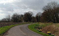
 Road approaching Burtoft | |
Location within Lincolnshire | |
| OS grid reference | TF265341 |
| • London | 95 mi (153 km) S |
| Civil parish | |
| Shire county | |
| Region | |
| Country | England |
| Sovereign state | United Kingdom |
| Post town | Boston |
| Postcode district | PE20 |
| Police | Lincolnshire |
| Fire | Lincolnshire |
| Ambulance | East Midlands |
| UK Parliament | |
Burtoft is a hamlet in the civil parish of Wigtoft, Lincolnshire, England, approximately 7 miles (11 km) southwest of the market town of Boston.[1]
Burtoft is mentioned in the Domesday Book of 1086.[2]
References
- ^ "Burtoft". Vision of Britain. University of Portsmouth. Retrieved 31 August 2011.
- ^ "Burtoft". Domesday Map. Anna Powell-Smith/University of Hull. Archived from the original on 7 October 2012. Retrieved 31 August 2011.
External links
 Media related to Burtoft at Wikimedia Commons

