Oshnavieh County
Oshnavieh County
| |
|---|---|
County | |
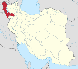
 Location of Oshnavieh County in West Azerbaijan province (bottom left, green) | |
 Location of West Azerbaijan province in Iran | |
| Coordinates: 37°04′N 45°05′E / 37.067°N 45.083°E[1] | |
| Country | Iran |
| Province | West Azerbaijan |
| Capital | Oshnavieh |
| Districts | Central, Nalus |
| Population (2016)[2] | |
• Total | 73,886 |
| Time zone | UTC+3:30 (IRST) |
| Oshnavieh County can be found at GEOnet Names Server, at this link, by opening the Advanced Search box, entering "9205904" in the "Unique Feature Id" form, and clicking on "Search Database". | |
Oshnavieh County (Template:Lang-fa; Kurdish: 'اشنۆ'شنۆ'شنه) is in West Azerbaijan province, Iran. Its capital is the city of Oshnavieh.
At the 2006 census, the county's population was 63,798 in 12,998 households.[3] The following census in 2011 counted 70,030 people in 17,778 households.[4] At the 2016 census, the county's population was 73,886 in 19,336 households.[2]
The county lies west of Lake Urmia about 1,300 metres above sea level, on the border with the Kurdish provinces of Iraq. The county is surrounded by high mountains which remain cool even at the height of summer.
History
During Iran-Iraq war, Ba'athist Iraq regime bombarded some parts of Oshnavieh in West Azerbaijan Province (on 2 August 1988) by Chemical bombs;[5][6] and about 2700 persons were injured as a result of that.[7]
Administrative divisions
The population history of Oshnavieh County's administrative divisions over three consecutive censuses is shown in the following table. The latest census shows two districts, four rural districts, and two cities.[2]
| Administrative Divisions | 2006[3] | 2011[4] | 2016[2] |
|---|---|---|---|
| Central District | 48,482 | 54,023 | 57,628 |
| Dasht-e Bil Rural District | 8,271 | 9,096 | 9,178 |
| Oshnavieh-ye Shomali Rural District | 10,315 | 12,204 | 8,649 |
| Oshnavieh (city) | 29,896 | 32,723 | 39,801 |
| Nalus District | 15,316 | 16,007 | 16,258 |
| Haq Rural District | 8,556 | 8,824 | 9,168 |
| Oshnavieh-ye Jonubi Rural District | 4,272 | 4,245 | 4,117 |
| Nalus (city) | 2,488 | 2,938 | 2,973 |
| Total | 63,798 | 70,030 | 73,886 |
References
- ^ OpenStreetMap contributors (6 April 2023). "Oshnavieh County" (Map). OpenStreetMap. Retrieved 6 April 2023.
- ^ a b c d "Census of the Islamic Republic of Iran, 1395 (2016)". AMAR (in Persian). The Statistical Center of Iran. p. 04. Archived from the original (Excel) on 30 August 2022. Retrieved 19 December 2022.
- ^ a b "Census of the Islamic Republic of Iran, 1385 (2006)". AMAR (in Persian). The Statistical Center of Iran. p. 04. Archived from the original (Excel) on 20 September 2011. Retrieved 25 September 2022.
- ^ a b "Census of the Islamic Republic of Iran, 1390 (2011)" (Excel). Iran Data Portal (in Persian). The Statistical Center of Iran. p. 04. Retrieved 19 December 2022.
- ^ "Anniversary of Oshnavieh bombard". tabnak.ir. Retrieved 11 June 2019.
- ^ "Oshanavieh chemical attack". yjc.ir. Retrieved 23 June 2019.
- ^ "Oshnavieh bombard". farsnews.ir. Retrieved 11 June 2019.

