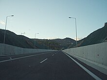
Greek National Road 2
Appearance

| National Road 2 | |
|---|---|
| Εθνική Οδός 2 | |
| Route information | |
| Existed | 23 July 1963–present |
| Major junctions | |
| West end | Albanian border at Krystallopigi |
| East end | Turkish border at Kipoi |
| Location | |
| Country | Greece |
| Regions | West Macedonia, Central Macedonia, East Macedonia and Thrace |
| Major cities | Florina, Edessa, Giannitsa, Thessaloniki, Kavala, Xanthi, Komotini, Alexandroupoli |
| Highway system | |
| |
Greek National Road 2 (Template:Lang-el, abbreviated as EO2) is a single carriageway with at-grade intersections, located in the regions of West Macedonia, Central Macedonia and East Macedonia and Thrace. It connects the Albanian border near Florina with the Turkish border near Alexandroupoli. Its section east of Thessaloniki has been replaced by the new A2 (Egnatia Odos) motorway. The section between the Albanian border and Thessaloniki is part of European route E86.
The Greek National Road 2 passes through the following places (west to east):
- Florina
- Edessa (bypass)
- Giannitsa (future bypass)
- Thessaloniki
- Asprovalta
- Kavala
- Xanthi
- Komotini
- Alexandroupoli
40°45′31″N 22°30′11″E / 40.7587°N 22.5031°E


