
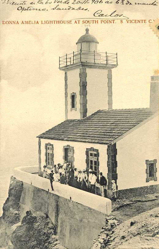
Dona Amélia Lighthouse
 Farol de Dona Amélia | |
 | |
| Location | near São Pedro São Vicente Cape Verde |
|---|---|
| Coordinates | 16°49′35.7″N 25°05′06.9″W / 16.826583°N 25.085250°W |
| Tower | |
| Constructed | 1894 |
| Construction | masonry tower |
| Height | 14 metres (46 ft) |
| Shape | square tower with balcony and lantern rising from one-story keeper's house |
| Markings | white tower |
| Light | |
| Focal height | 56 metres (184 ft) |
| Range | 17 nautical miles (31 km; 20 mi)[1] |
| Characteristic | Fl W 5s.[1] |
| Cape Verde no. | PT-2020 |
Farol de D. Amélia (also: farol da ponta Machado, Ponta Machado Lighthouse) is a lighthouse in the southwestern point of the island of São Vicente in northwestern Cape Verde. It lies 3 km west of the village of São Pedro. The lighthouse is a white square tower with a lantern and a gallery, 14 m high. The lighthouse was completed in 1894.[2]
Light characteristics
- Characteristics: Light: 0.2s, occlusion: 4.8s, visible: 302°—172° (230°).[1]
See also
References
- ^ a b c List of Lights, Pub. 113: The West Coasts of Europe and Africa, the Mediterranean Sea, Black Sea and Azovskoye More (Sea of Azov) (PDF). List of Lights. United States National Geospatial-Intelligence Agency. 2018. p. 425.
- ^ a b Rowlett, Russ. "Lighthouses of Cape Verde". The Lighthouse Directory. University of North Carolina at Chapel Hill. Retrieved 6 September 2018.
External links
Wikimedia Commons has media related to Ponta Machado Lighthouse.
The island of São Vicente | ||
|---|---|---|
| Communities and settlements |  | |
| Mountains | ||
| Streams | ||
| Other geographical features | ||
| Topics | ||
| Culture | ||
| |