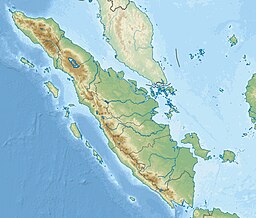
Rupat Strait
| Rupat Strait | |
|---|---|
| Indonesian: Selat Rupat | |
 Urban area of Dumai, shown in red. Rupat Strait separates urban area from island of Rupat. | |
| Coordinates | 1°50′00″N 101°25′00″E / 1.83333°N 101.41667°E |
| Type | strait |
| Basin countries | Indonesia |
| References | Selat Rupat: Indonesia National Geospatial-Intelligence Agency, Bethesda, MD, USA |
The Rupat Strait (Indonesian: Selat Rupat) is the strait which separates small island of Rupat from major island of Sumatra in Indonesia. It is the main shipping route to city of Dumai.[1]
References

