
Old Mission, Michigan
Old Mission, Michigan | |
|---|---|
 A replica of the Old Mission for which the peninsula is named | |
 Old Mission | |
| Coordinates: 44°57′44″N 85°29′07″W / 44.96222°N 85.48528°W | |
| Country | United States |
| State | Michigan |
| County | Grand Traverse |
| Township | Peninsula |
| Elevation | 587 ft (179 m) |
| Time zone | UTC-5 (Eastern (EST)) |
| • Summer (DST) | UTC-4 (EDT) |
| ZIP code(s) | 49673, 49686 |
| Area code | 231 |
| GNIS feature ID | 634007[1] |
Old Mission is an unincorporated community within Peninsula Township, Grand Traverse County in the U.S. state of Michigan.[1]
In the 1836 Treaty of Washington, the U.S. federal government agreed to provide local native tribes with both a mission and schools for their reservation. Henry Schoolcraft, the Indian agent representing the government, selected a natural harbor on the eastern shore of the peninsula in Grand Traverse Bay for the planned facilities. In 1838 the Presbyterian Board of Missions, sent the Reverend Peter Dougherty (1805–1894) to establish the mission, now known as Old Mission, for which the peninsula would eventually become known.
The peninsula has extensive cherry orchards and vineyards. There are seven vineyards, but only five have tasting rooms. Because of the remoteness of the peninsula, wine tours take some planning.[2] It is an American Viticultural Area and a center of the Michigan wine industry. See Old Mission Peninsula AVA.
The Old Mission Point Lighthouse is located at the northern terminus of M-37,[3] at the tip of the Old Mission Peninsula, which juts 18 miles into Grand Traverse Bay. It is located at 44°59′7″N 85°28′24″W / 44.98528°N 85.47333°W, just south of the 45th parallel north, midway between the North Pole and the Equator.
There are two signs that denote the location on the 45th parallel.[4] It is one of 26 places in the United States where such signs are known to exist.[5]
Currently, there is a community of families who own cottages along Forest Avenue and use these as summer vacation homes.
Recurrent events
- On Saturday, the second weekend in May, Leelanau County hosts a Cherry Blossom Tour with free bus rides to orchards.
- The Wineries of Old Mission host their annual Blossom Days the third weekend in May.[6]
Further reading
- Potter, Elizabeth V. The Story of Old Mission. (Ann Arbor, MI: Edward Brothers, 1956).
References
- ^ a b c "Old Mission, Michigan". Geographic Names Information System. United States Geological Survey, United States Department of the Interior.
- ^ "Silfven, Sandra, Old Mission makes wine touring easy up north, The Wine Report, Detroit News". Archived from the original on 20 August 2006. Retrieved 4 May 2008.
- ^ M-37 Endpoint Photos. Archived 29 May 2013 at the Wayback Machine
- ^ Photographs, Old Mission 45th Parallel signs.
- ^ List and map of 45th Parallel markers, with links to pictures (accessed 17 December 2007).
- ^ Michigan in Pictures, Cherry Blossom Time.
External links
Municipalities and communities of Grand Traverse County, Michigan, United States | ||
|---|---|---|
| City | 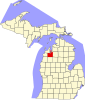 | |
| Villages | ||
| Charter townships | ||
| Civil townships | ||
| CDPs | ||
| Other communities | ||
| Ghost towns | ||
| Indian reservation | ||
| Footnotes | ‡This populated place also has portions in an adjacent county or counties | |