Krupunder station
| Rapid transit | |||||
 Krupunder railway station, S-Bahn, platform | |||||
| General information | |||||
| Location | Seestr. 201 25469 Halstenbek Germany | ||||
| Line(s) | S3 | ||||
| Platforms | 1 | ||||
| Tracks | 2 | ||||
| Connections | Buses | ||||
| Construction | |||||
| Structure type | Elevated | ||||
| Parking | Park and ride | ||||
| Bicycle facilities | 25 bicycle stands | ||||
| Other information | |||||
| Station code | ds100: AKRS DB station code: 3443 Type: Hp Category: 5 | ||||
| Fare zone | HVV: A and B/201, 203, and 302[1] | ||||
| History | |||||
| Opened | 22 September 1967 | ||||
| Electrified | at opening 1200 V DC system (3rd rail) | ||||
| |||||
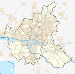
Krupunder station is on the Hamburg-Altona–Kiel line and is a railway station served by the city trains of the Hamburg S-Bahn.[2] The railway station is located in the municipality Halstenbek in the district of Pinneberg, in Schleswig-Holstein, Germany, directly at the border to Hamburg.
Station layout
The station is an elevated island platform with 2 tracks and one exit. The station is fully accessible for handicapped persons, because since 2014 there is a lift and a special floor layout for blind persons.
Station services
Trains
The rapid transit trains of the line S3 of the Hamburg S-Bahn are calling the station. Direction of the trains on track 1 is Pinneberg. On track 2 the trains are traveling in the direction Stade via Hamburg central station.
Buses
Several bus lines are calling a bus stop in front.
Facilities at the station
A small shop in the station sells fast food and newspapers. There are no lockerboxes. No personnel is attending the station, but there are SOS and information telephones, ticket machines, 30 bicycle stands and 56 park and ride parking lots.
See also
References
- ^ "Tarifplan" (PDF). Hamburger Verkehrsverbund. 9 December 2018. Retrieved 18 October 2019.
- ^ Liste Bahnhofskategorie 2008 (pdf)[permanent dead link], DB Station&Service AG, Köthener Straße 2, 10963 Berlin (2008) (in German)
External links
- DB station information (in German)
- "Network plan HVV" (PDF) (in German). Archived from the original (PDF) on 2009-01-17.
53°36′55″N 9°52′6″E / 53.61528°N 9.86833°E


