Sinop Airport
Appearance
Sinop Airport Sinop Havalimanı | |||||||||||
|---|---|---|---|---|---|---|---|---|---|---|---|
 | |||||||||||
| Summary | |||||||||||
| Airport type | Public | ||||||||||
| Operator | General Directorate of State Airports Authority | ||||||||||
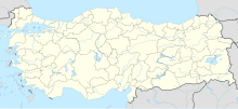
| Serves | Sinop, Black Sea Region, Turkey | ||||||||||
| Coordinates | 42°00′57″N 035°03′59″E / 42.01583°N 35.06639°E | ||||||||||
| Website | www.sinop.dhmi.gov.tr | ||||||||||
| Map | |||||||||||
| Runways | |||||||||||
| |||||||||||
Sinop Airport (IATA: NOP, ICAO: LTCM) is an airport in Sinop, in the Black Sea Region of Turkey. Turkish Airlines has daily flights from Istanbul. Tower and approach frequency is 126.300 MHz. The old runway of the airport was previously used by the US military base in Sinop. The IATA code has changed from SIC to NOP.
Airlines and destinations
| Airlines | Destinations |
|---|---|
| Pegasus Airlines | Istanbul–Sabiha Gökçen |
| Turkish Airlines | Istanbul[4] |
References
- ^ Airport information for LTCM at Great Circle Mapper.
- ^ Airport information for Sinop Airport at Transport Search website.
- ^ http://www.sinop.dhmi.gov.tr/havaalanlari/page.aspx?hv=34&mnu=633#.U2D7p8eXuL8
- ^ "Istanbul New Airport Transition Delayed Until April 5, 2019 (At The Earliest)".
External links

