
Situbondo Regency
This article needs additional citations for verification. (November 2014) |
Situbondo Regency
Kabupaten Situbondo | |
|---|---|
 Seal | |
 Location within East Java | |
| Coordinates: 7°42′S 114°00′E / 7.700°S 114.000°E | |
| Country | |
| Province | East Java |
| Capital | Situbondo |
| Government | |
| • Regent | Dadang Wigiarto |
| • Vice Regent | Yoyok Mulyadi |
| Area | |
| • Total | 1,669.87 km2 (644.74 sq mi) |
| Population (2014) | |
| • Total | 665,818 |
| • Density | 400/km2 (1,000/sq mi) |
| Time zone | UTC+7 (IWST) |
| Area code | (+62) 338 |
| Website | situbondokab |


Situbondo Regency is a regency (kabupaten) of East Java province, Indonesia. It covers an area of 1,669.87 km2, and had a population of 647,619 at the 2010 Census;[1] the latest official estimate (as at January 2014) is 665,818. It is located in east end of Java before Banyuwangi. The administrative centre is Situbondo, a small town within the regency. One of the famous tourist sites is Baluran National Park.
Administrative Division
Situbondo has seventeen (17) districts, which are:
- Banyuglugur
- Besuki
- Jatibanteng
- Sumbermalang
- Suboh
- Mlandingan
- Bungatan
- Kendit
- Panarukan
- Situbondo
- Kendit
- Panji
- Mangaran
- Kapongan
- Arjasa
- Asembagus
- Banyuputih
History
This section is empty. You can help by adding to it. (June 2020) |
Demographic Information
This section is empty. You can help by adding to it. (June 2020) |
Future Projects
This section is empty. You can help by adding to it. (June 2020) |
Gallery
-

-
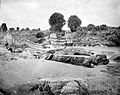
 Two groups of men under a large banyan tree in Situbondo
 -
 River and washed away bridge in the area of Situbondo
 -


References
- ^ Biro Pusat Statistik, Jakarta, 2011.

| International | |
|---|---|
| National | |
This East Java location article is a stub. You can help Wikipedia by expanding it. |